Category:Germany photographs taken on 2010-09-04
Jump to navigation
Jump to search
| ← | Saturday 4 September 2010 | → | ||
| ← | September 2010 | → | ||

Germany photographs taken on 4 September 2010.
Image files should be categorized here automatically using {{taken on}} template. Direct categorisation is also possible, if automatic is impossible.
Subcategories
This category has the following 4 subcategories, out of 4 total.
Media in category "Germany photographs taken on 2010-09-04"
The following 97 files are in this category, out of 97 total.
-
 A1 (E22), Kreuz 25 - Reinfeld - geo.hlipp.de - 14090.jpg 640 × 436; 43 KB
-
 A1, Kreuz 25 - Reinfeld (1000m) - geo.hlipp.de - 14091.jpg 640 × 397; 43 KB
-
 A2 (E30) bei Bernser Landwehr - geo.hlipp.de - 16067.jpg 640 × 426; 48 KB
-
 A2 - Kreuz (25), Bielefeld (2500m) - geo.hlipp.de - 15240.jpg 640 × 438; 35 KB
-

-

-
 A2 - Kreuz 35, Bad Eilsen (500m) - geo.hlipp.de - 16328.jpg 640 × 418; 50 KB
-
 A2 - Kreuz 36, Rehren (500m) - geo.hlipp.de - 15717.jpg 640 × 480; 52 KB
-
 A2 - Kreuz 41, Garbsen (500m) - geo.hlipp.de - 20769.jpg 640 × 404; 41 KB
-
 A2 - Kruez 19 , Hamm-Uentrop (1200m) - geo.hlipp.de - 14312.jpg 640 × 412; 44 KB
-
 A2 - Rasthof Garbsen Nord (500m) - geo.hlipp.de - 20770.jpg 640 × 421; 45 KB
-
 A2 - Rastplatz Herford Nord - geo.hlipp.de - 20772.jpg 640 × 480; 77 KB
-
 A2 - Verkehrskontrolle - geo.hlipp.de - 15982.jpg 640 × 462; 43 KB
-
 A2 bei Garbsen - geo.hlipp.de - 16013.jpg 640 × 467; 43 KB
-
 A2 bei Garbsen - geo.hlipp.de - 20768.jpg 640 × 399; 38 KB
-
 A2 bei Herford - geo.hlipp.de - 20771.jpg 640 × 415; 70 KB
-
 A2 bei Suderwich - geo.hlipp.de - 15343.jpg 640 × 427; 35 KB
-
 A2 bei Werse - geo.hlipp.de - 20764.jpg 640 × 381; 31 KB
-
 A2 westlich von Beckum - geo.hlipp.de - 20765.jpg 640 × 413; 38 KB
-
 A20 - Auf dem Karkfeld (500m) - geo.hlipp.de - 14129.jpg 640 × 431; 46 KB
-
 A20 bei Niendorf - geo.hlipp.de - 14148.jpg 640 × 382; 50 KB
-
 A20 westlich von Vorrade - geo.hlipp.de - 14119.jpg 640 × 425; 42 KB
-
 A3 - Kreuz 12, Oberhausen-West (1500m) - geo.hlipp.de - 15342.jpg 640 × 443; 35 KB
-
 A3 - Kreuz 12, Oberhausen-West (600m) - geo.hlipp.de - 15341.jpg 640 × 480; 42 KB
-
 A3 - Kreuz 13, Oberhausen-Lirich (1000m) - geo.hlipp.de - 15337.jpg 640 × 480; 36 KB
-
 A3 - Kreuz 13, Oberhausen-Lirich, 600m - geo.hlipp.de - 15336.jpg 640 × 408; 40 KB
-
 A3 - Kruez 11, Oberhausen-Holten - geo.hlipp.de - 15344.jpg 640 × 413; 42 KB
-
 A3-A40 - Kreuz 13, Kaiserberg - geo.hlipp.de - 15338.jpg 640 × 480; 48 KB
-
 A40 - Kreuz 6, Kerken (1000m) - geo.hlipp.de - 15340.jpg 640 × 401; 33 KB
-
 A40 bei Duisburg Innenhafen - geo.hlipp.de - 15339.jpg 640 × 480; 40 KB
-
 A7 - Kreuz 38 Seevetal-Ramelsloh (500m) - geo.hlipp.de - 14270.jpg 640 × 403; 34 KB
-
 A7 - Kreuz 41 - Egestorf (500m) - geo.hlipp.de - 14296.jpg 640 × 450; 42 KB
-
 A7 - Kreuz 41 Egestorf (1000m) - geo.hlipp.de - 14285.jpg 640 × 435; 41 KB
-
 A7 - Kreuz 43 - Bispingen (380m) - geo.hlipp.de - 14306.jpg 640 × 405; 40 KB
-
 A7 - Kreuz 43 - Bispingen (650m) - geo.hlipp.de - 14305.jpg 640 × 446; 42 KB
-
 A7 - Kreuz 48, Dreieck Walsrode (2000m) - geo.hlipp.de - 20766.jpg 640 × 394; 38 KB
-
 A7 - Kreuz 48, Walsrode (500m) - geo.hlipp.de - 20767.jpg 640 × 426; 44 KB
-
 A7 - Kreuz 49, Westenholz (1200m) - geo.hlipp.de - 16182.jpg 640 × 433; 45 KB
-
 A7 - Kreuz 50, Schwarmstedt (1000m) - geo.hlipp.de - 16011.jpg 640 × 431; 40 KB
-
 A7 - Kreuz 50, Schwarmstedt (500m) - geo.hlipp.de - 16012.jpg 640 × 419; 39 KB
-
 A7 - Rasthof Brunautal, (1000m) - geo.hlipp.de - 14297.jpg 640 × 409; 37 KB
-
 A7 - Rastplatz zwischen Kreuz 44 und Kreuz 43 - geo.hlipp.de - 14307.jpg 640 × 480; 108 KB
-
 A7 - Rastplatz zwischen Kreuz 44 und Kreuz 43 - geo.hlipp.de - 14309.jpg 640 × 480; 111 KB
-
 A7 - Wolfsgrund Rastplatz (500m) - geo.hlipp.de - 14005.jpg 640 × 446; 50 KB
-
 A7 bei Parkplatz Seevetal - geo.hlipp.de - 14271.jpg 640 × 391; 39 KB
-
 A7 zwischen Ohlendorf und Thieshope - geo.hlipp.de - 14283.jpg 640 × 480; 48 KB
-
 Agkistrodon contortrix qtl1.jpg 3,856 × 2,728; 5.42 MB
-
 Alex - panoramio (1).jpg 1,468 × 1,349; 287 KB
-
 Alligator mississippiensis qtl1.jpg 4,188 × 2,848; 5.06 MB
-
 Anableps anableps qtl1.jpg 4,288 × 2,848; 7.23 MB
-
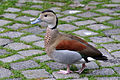
 Anas bahamensis qtl1.jpg 4,036 × 2,696; 3.67 MB
-
 Borkumer Meilenlauf Nordic Walking.jpg 600 × 450; 297 KB
-
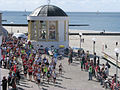 Start Borkumer Meilenlauf.jpg 600 × 450; 359 KB
-
 Callonetta leucophrys qtl1.jpg 3,852 × 2,604; 4.18 MB
-
 Callonetta leucophrys qtl2.jpg 4,168 × 2,772; 5.31 MB
-
 Campingplatz in Wangen am Untersee - panoramio.jpg 3,072 × 2,304; 3.32 MB
-
 Church - panoramio - michiel1972 (10).jpg 2,448 × 3,264; 2.15 MB
-
 Church - panoramio - michiel1972 (9).jpg 2,448 × 3,264; 2.62 MB
-
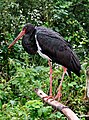
 Ciconia nigra qtl1.jpg 4,288 × 2,848; 5.32 MB
-
 Ciconia nigra qtl2.jpg 2,787 × 3,751; 6.25 MB
-
 Combined Endeavor 2010 DVIDS321690.jpg 3,600 × 2,400; 3.05 MB
-
 Combined Endeavor 2010 DVIDS321696.jpg 3,990 × 2,514; 4.54 MB
-
 Cyclura cornuta qtl1.jpg 3,768 × 2,708; 5.27 MB
-
 Cyclura cornuta qtl2.jpg 3,896 × 2,848; 5.68 MB
-
 Dendrocygna viduata qtl2.jpg 3,640 × 2,480; 4.04 MB
-
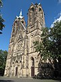
 Dom - panoramio - michiel1972 (1).jpg 2,448 × 3,264; 1.69 MB
-
 Englisch Kirche - panoramio.jpg 2,848 × 2,134; 2.63 MB
-
 Gewerbeschule am Zeughausmarkt in Hamburg-Neustadt.jpg 2,848 × 2,134; 3.09 MB
-
 Giraffa camelopardalis reticulata qtl1.jpg 3,070 × 2,063; 3.67 MB
-
 Gleis 22 - panoramio.jpg 2,448 × 3,264; 2.8 MB
-
 Hallenbad - panoramio.jpg 3,264 × 2,448; 1.66 MB
-
 Hamburg-Neustadt, Hamburg, Germany - panoramio.jpg 2,848 × 2,134; 3.05 MB
-
 Heideland - geo.hlipp.de - 16009.jpg 640 × 480; 108 KB
-
 Heideland - geo.hlipp.de - 16010.jpg 480 × 640; 141 KB
-
 Hotel One - panoramio.jpg 2,437 × 1,861; 2.84 MB
-
 Houses - panoramio - michiel1972.jpg 3,264 × 2,448; 2.3 MB
-
 Igeler Saeule BW 1.jpg 2,272 × 3,849; 4.24 MB
-
 Into The Great Wide Open - panoramio.jpg 4,899 × 2,831; 10.61 MB
-

-
 Kiek in - panoramio.jpg 2,634 × 1,785; 2.43 MB
-
 Main street - panoramio - michiel1972.jpg 3,264 × 2,448; 1.8 MB
-
 Maisfeld - geo.hlipp.de - 14308.jpg 640 × 480; 103 KB
-
 Maisfeld bei A7 - geo.hlipp.de - 16008.jpg 640 × 480; 121 KB
-
 Musikschule - panoramio (1).jpg 1,654 × 1,624; 383 KB
-
 ND-382-MZG-MET - Hohle Eiche.jpg 3,512 × 5,268; 16.64 MB
-
 Park - panoramio - michiel1972 (1).jpg 3,264 × 2,448; 2.07 MB
-

-
 Saguinus oedipus qtl1.jpg 3,244 × 2,480; 4.28 MB
-
 Schafe auf dem Dach - panoramio.jpg 2,848 × 2,134; 2.88 MB
-
 Shikara Restaurant - panoramio.jpg 2,612 × 1,676; 2.07 MB
-
 Speicher im Hafen - panoramio.jpg 3,072 × 2,304; 1.18 MB
-
 Speyerer Strasse, Heidelberg - geo.hlipp.de - 13818.jpg 640 × 480; 55 KB
-
 St Lambertikirche - panoramio.jpg 2,448 × 3,264; 1.5 MB
-
 Station - panoramio - michiel1972 (1).jpg 3,264 × 2,448; 1.88 MB
-
 Treppe zur Hochstraße - panoramio.jpg 1,862 × 1,822; 242 KB
-
 Tönnig Hafen - panoramio.jpg 2,848 × 2,134; 3.05 MB
-
 Unser Oma ihr kleins Häuschen - panoramio.jpg 1,822 × 1,795; 564 KB
,_Kreuz_25_-_Reinfeld_-_geo.hlipp.de_-_14090.jpg)
_-_geo.hlipp.de_-_14091.jpg)
_bei_Bernser_Landwehr_-_geo.hlipp.de_-_16067.jpg)
,_Bielefeld_(2500m)_-_geo.hlipp.de_-_15240.jpg)
,_Bielefeld_Zentrum_(1000m)_-_geo.hlipp.de_-_15239.jpg)
,_Bielefeld_Zentrum_(1600m)_-_geo.hlipp.de_-_15238.jpg)
_-_geo.hlipp.de_-_16328.jpg)
_-_geo.hlipp.de_-_15717.jpg)
_-_geo.hlipp.de_-_20769.jpg)
_-_geo.hlipp.de_-_14312.jpg)
_-_geo.hlipp.de_-_20770.jpg)


_-_geo.hlipp.de_-_14129.jpg)


_-_geo.hlipp.de_-_15342.jpg)
_-_geo.hlipp.de_-_15341.jpg)
_-_geo.hlipp.de_-_15337.jpg)


_-_geo.hlipp.de_-_15340.jpg)

_-_geo.hlipp.de_-_14270.jpg)
_-_geo.hlipp.de_-_14296.jpg)
_-_geo.hlipp.de_-_14285.jpg)
_-_geo.hlipp.de_-_14306.jpg)
_-_geo.hlipp.de_-_14305.jpg)
_-_geo.hlipp.de_-_20766.jpg)
_-_geo.hlipp.de_-_20767.jpg)
_-_geo.hlipp.de_-_16182.jpg)
_-_geo.hlipp.de_-_16011.jpg)
_-_geo.hlipp.de_-_16012.jpg)
_-_geo.hlipp.de_-_14297.jpg)


_-_geo.hlipp.de_-_14005.jpg)


.jpg)


.jpg)
.jpg)


.jpg)


.jpg)

.jpg)
_-_geo.hlipp.de_-_20763.jpg)


.jpg)


