Category:Germany photographs taken on 2010-08-28
Jump to navigation
Jump to search
| ← | Saturday 28 August 2010 | → | ||
| ← | August 2010 | → | ||

Germany photographs taken on 28 August 2010.
Image files should be categorized here automatically using {{taken on}} template. Direct categorisation is also possible, if automatic is impossible.
Subcategories
This category has the following 6 subcategories, out of 6 total.
B
N
S
Media in category "Germany photographs taken on 2010-08-28"
The following 72 files are in this category, out of 72 total.
-
 "Heiliger Sand", jüdischer Friedhof in Worms.jpg 3,072 × 2,304; 2.34 MB
-
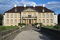 2010-08-28 Schloss Oranienbaum (Parkseite), Oranienbaum-Wörlitz (Sachsen).jpg 3,898 × 2,594; 10.11 MB
-
 Am Abend - panoramio - Rembert Satow.jpg 4,000 × 3,000; 1,006 KB
-
 An der Diemel - panoramio.jpg 2,560 × 1,920; 2.23 MB
-
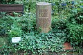 Eduard Bernstein Grab 28.8.2010.JPG 3,008 × 2,000; 3.06 MB
-
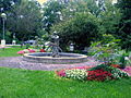 Brunnen in Oberschleißheim zwischen Feierabendst. und Mittenheimer Str..JPG 1,632 × 1,224; 433 KB
-
 Burg Wassenberg, Wassenberg, Denkmalliste Nr. 49.jpg 1,920 × 1,440; 3.3 MB
-
 DDR highrise on Mollstrasse - panoramio.jpg 1,600 × 900; 714 KB
-
 Diemel - panoramio - Eugen Kalloch (2).jpg 2,560 × 1,920; 2.39 MB
-
 Diemel - panoramio - Eugen Kalloch (3).jpg 2,560 × 1,920; 2.39 MB
-
 Diemel - panoramio - Eugen Kalloch (5).jpg 2,560 × 1,920; 2.24 MB
-
 Diemel - panoramio.jpg 2,560 × 1,920; 2.45 MB
-
 Dunkle Wolken - geo.hlipp.de - 13093.jpg 640 × 480; 75 KB
-
 Ehemalige Eisenerzgrube, Rottorf - geo.hlipp.de - 13857.jpg 640 × 480; 93 KB
-
 Friedrichshain, Berlin, Germany - panoramio - Jan Hazevoet.jpg 1,600 × 900; 531 KB
-
 Friseur - panoramio.jpg 2,848 × 2,134; 3.14 MB
-
 Geopunkt mit Findling - geo.hlipp.de - 13819.jpg 640 × 480; 97 KB
-
 Halbtrockenrasen, Heesesberg - geo.hlipp.de - 13755.jpg 640 × 480; 96 KB
-
 Hippopotamus - panoramio - DARIUSzpre.jpg 640 × 480; 76 KB
-
 Hippopotamus - panoramio.jpg 640 × 480; 69 KB
-
 Hümme - panoramio.jpg 2,560 × 1,920; 1.81 MB
-
 Krankenhaus Nördlingen August 2010 - panoramio.jpg 3,008 × 2,000; 2.64 MB
-
 Lichtung im Kieferwald - geo.hlipp.de - 13807.jpg 640 × 480; 90 KB
-
 Miltitzer Teich - panoramio.jpg 1,600 × 1,200; 769 KB
-
 Miltitzer Teich 2 - panoramio.jpg 1,600 × 1,200; 847 KB
-
 Naturschutzgebiet - geo.hlipp.de - 13149.jpg 640 × 480; 77 KB
-
 Naturschutzgebiet - geo.hlipp.de - 13151.jpg 640 × 480; 77 KB
-
 Naturschutzgebiet - geo.hlipp.de - 13155.jpg 640 × 480; 84 KB
-
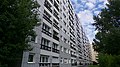
 Neugereut, 70378 Stuttgart, Germany - panoramio - Immanuel Giel (1).jpg 1,871 × 1,856; 588 KB
-
 Neugereut, 70378 Stuttgart, Germany - panoramio - Immanuel Giel (2).jpg 2,039 × 1,874; 565 KB
-
 Neugereut, 70378 Stuttgart, Germany - panoramio - Immanuel Giel (3).jpg 1,954 × 1,889; 471 KB
-
 Neugereut, 70378 Stuttgart, Germany - panoramio - Immanuel Giel.jpg 1,813 × 1,825; 602 KB
-
 Neugereut, 70378 Stuttgart, Germany - panoramio.jpg 1,984 × 1,889; 612 KB
-
 Panorama Hochwasser Schüttorf Nordring 2010.jpg 7,796 × 1,764; 3.17 MB
-
 Panorama Hochwasser Schüttorf Vechtebrücken 2010.jpg 5,249 × 1,955; 2.76 MB
-
 Panorama-Sonnenuntergang-Soleil Couchant-Steinen - panoramio.jpg 1,600 × 591; 77 KB
-
 Panoramaaussicht auf der Walhalla - panoramio.jpg 15,309 × 2,771; 6.94 MB
-
 Ratgeber-Schule - panoramio - Immanuel Giel (1).jpg 2,057 × 1,893; 657 KB
-
 Ratgeber-Schule - panoramio - Immanuel Giel (2).jpg 1,929 × 1,880; 451 KB
-
 Ratgeber-Schule - panoramio - Immanuel Giel (3).jpg 2,081 × 1,908; 537 KB
-
 Ratgeber-Schule - panoramio - Immanuel Giel.jpg 1,822 × 1,755; 562 KB
-
 Ratgeber-Schule - panoramio.jpg 1,859 × 1,865; 621 KB
-
 Regenbogen by Niederkasseler - panoramio (1).jpg 3,888 × 2,592; 4.26 MB
-
 Rosenhagen Strand - geo.hlipp.de - 13066.jpg 640 × 480; 97 KB
-
 Rosenhagen Strand - geo.hlipp.de - 13104.jpg 640 × 480; 114 KB
-
 Rosenhagen Strand - geo.hlipp.de - 13105.jpg 640 × 480; 94 KB
-
 Rosenhagen Strand - geo.hlipp.de - 13176.jpg 640 × 480; 85 KB
-
 Rosenhagen Strand - geo.hlipp.de - 13177.jpg 640 × 480; 69 KB
-
 Rosenhagen Strand - geo.hlipp.de - 13178.jpg 640 × 480; 104 KB
-
 Rosenhagen Strand - geo.hlipp.de - 13179.jpg 480 × 640; 71 KB
-
 Rutsche - panoramio - Immanuel Giel.jpg 2,091 × 1,914; 894 KB
-
 Sandgrube Uhry 1 - geo.hlipp.de - 13813.jpg 640 × 480; 100 KB
-
 Sandgrube Uhry 2 - geo.hlipp.de - 13816.jpg 640 × 480; 104 KB
-
 Saray Dügün Salonu - panoramio.jpg 2,848 × 2,134; 2.89 MB
-
 Schick der 70er Jahre - panoramio.jpg 1,865 × 1,761; 620 KB
-
 Nachbau Jaegerhaus Schernsdorf.jpg 3,611 × 2,681; 6.23 MB
-
 Sonnenuntergang -Steinen - panoramio.jpg 1,600 × 901; 113 KB
-
 Spirillo - panoramio.jpg 1,911 × 1,807; 642 KB
-
 Steinbruch Hexengeld - geo.hlipp.de - 13803.jpg 640 × 480; 103 KB
-
 Steinbruch mit Stromatolithen - geo.hlipp.de - 13756.jpg 640 × 480; 89 KB
-
 Stendal-Borstel - Fahne der IG Fallschirmjäger Flugplatz Stendal Borstel - panoramio.jpg 5,184 × 3,456; 3.88 MB
-
 Stendal-Borstel - Junkers JU-52 Flugplatz Stendal-Borstel im Jahre 2010 - panoramio.jpg 5,184 × 3,456; 6.14 MB
-
 Stendal-Borstel - Junkers JU-52 im Jahre 2010 Flugplatz Stendal-Borstel - panoramio.jpg 5,184 × 3,456; 5.51 MB
-
 Strandzugang 1 - geo.hlipp.de - 13063.jpg 480 × 640; 94 KB
-
 Strandzugang 1 - geo.hlipp.de - 13092.jpg 640 × 442; 62 KB
-
 Strandzugang 2 - geo.hlipp.de - 13161.jpg 640 × 480; 116 KB
-
 Strandzugang 3 - geo.hlipp.de - 13065.jpg 640 × 480; 131 KB
-
 Strandzugang 3 - geo.hlipp.de - 13169.jpg 640 × 480; 122 KB
-
 Strandzugang 3 - geo.hlipp.de - 13181.jpg 640 × 480; 82 KB
-
 Strandzugang 3 - Rosenhagen Strand - geo.hlipp.de - 13180.jpg 640 × 480; 76 KB
-
 Strandzugang 3 - Rosenhagen Strand - geo.hlipp.de - 13182.jpg 640 × 480; 118 KB
-
 Vechte flood 2010 schüttorf weir.jpg 2,816 × 2,112; 3.19 MB

,_Oranienbaum-W%C3%B6rlitz_(Sachsen).jpg)


.jpg)
.jpg)
.jpg)


.jpg)
.jpg)
.jpg)


.jpg)
.jpg)
.jpg)


.jpg)


