Category:Germany photographs taken on 2010-08-31
Jump to navigation
Jump to search
| ← | Tuesday 31 August 2010 | → | ||
| ← | August 2010 | → | ||

Germany photographs taken on 31 August 2010.
Image files should be categorized here automatically using {{taken on}} template. Direct categorisation is also possible, if automatic is impossible.
Subcategories
This category has the following 6 subcategories, out of 6 total.
Media in category "Germany photographs taken on 2010-08-31"
The following 90 files are in this category, out of 90 total.
-
 2010-08 ND Eiche in Klasdorf (Brandenburg).jpg 2,500 × 2,067; 6.23 MB
-
 2010-08-31 Burgruine Wredenhagen 01.jpg 3,898 × 2,594; 9 MB
-
 2010-08-31 Burgruine Wredenhagen 02.jpg 3,898 × 2,114; 12.45 MB
-
 2010-08-31 Glashütte Baruth (Mark), Brandenburg 01.jpg 2,334 × 3,501; 8.17 MB
-
 2010-08-31 Glashütte Baruth (Mark), Brandenburg 02.jpg 3,898 × 2,594; 10.68 MB
-
 2010-08-31 Glashütte Baruth (Mark), Brandenburg 03.jpg 3,261 × 2,594; 7.75 MB
-
 Abgeerntetes Feld bei Steinbeck - geo.hlipp.de - 15355.jpg 640 × 480; 87 KB
-
 Abgeerntetes Feld bei Steinbeck - geo.hlipp.de - 15789.jpg 640 × 480; 92 KB
-
 Abgeerntetes Feld bei Steinbeck - geo.hlipp.de - 15790.jpg 640 × 480; 100 KB
-
 Ackerland und Mecklenburger Bucht - geo.hlipp.de - 15788.jpg 640 × 480; 66 KB
-
 Am Park - Harkensee, 4km - geo.hlipp.de - 13262.jpg 640 × 428; 52 KB
-
 Am Park - Kaltenhof - geo.hlipp.de - 13263.jpg 640 × 456; 51 KB
-
 Bauernhof - Kalkhorst - geo.hlipp.de - 26750.jpg 640 × 400; 54 KB
-
 Blick auf Mecklenburger Bucht - geo.hlipp.de - 15787.jpg 640 × 480; 71 KB
-
 Blick auf SwinGolf Boltenhagen - geo.hlipp.de - 15786.jpg 640 × 480; 84 KB
-
 Boltenhagen Bucht - geo.hlipp.de - 15784.jpg 640 × 448; 46 KB
-
 Boltenhagen Strand - geo.hlipp.de - 13941.jpg 640 × 480; 72 KB
-
 Boltenhagen Strand - geo.hlipp.de - 13942.jpg 640 × 480; 64 KB
-
 Boltenhagen Strand - geo.hlipp.de - 15781.jpg 480 × 640; 64 KB
-
 Butenfeld Neubausiedlung - panoramio.jpg 2,848 × 2,134; 3.41 MB
-
 Campus-Forschung UKE - panoramio.jpg 2,848 × 2,134; 3.15 MB
-

-
 Combined Endeavor 2010 DVIDS318906.jpg 864 × 576; 375 KB
-
 Combined Endeavor 2010 DVIDS321379.jpg 4,256 × 2,832; 906 KB
-
 Combined Endeavor 2010 DVIDS321380.jpg 4,256 × 2,832; 1.6 MB
-
 Combined Endeavor 2010 DVIDS321386.jpg 3,600 × 2,400; 2.29 MB
-
 Combined Endeavor 2010 DVIDS321390.jpg 3,600 × 2,400; 1.75 MB
-
 Felder bei Kalkhorst - geo.hlipp.de - 14039.jpg 640 × 464; 62 KB
-
 Felder bei Kalkhorst - geo.hlipp.de - 15368.jpg 640 × 484; 67 KB
-

-

-
-
-

-

-

-

-
 Bad Urach 0001.jpg 701 × 1,200; 314 KB
-
 Bad Urach 0003.jpg 1,200 × 859; 396 KB
-
 Bad Urach 0004.jpg 803 × 1,200; 365 KB
-
 Bad Urach 0007.jpg 1,200 × 803; 392 KB
-
 Bad Urach 0009.jpg 616 × 1,200; 253 KB
-
 Bad Urach 0011.jpg 1,200 × 801; 361 KB
-
 Bad Urach 0012.jpg 1,200 × 745; 298 KB
-
 Bad Urach 0013.jpg 803 × 1,200; 373 KB
-
 Bad Urach 0015.jpg 803 × 1,200; 322 KB
-
 Bad Urach 0017.jpg 812 × 1,200; 331 KB
-
 Bad Urach 0019.jpg 1,200 × 803; 409 KB
-
 Bad Urach 0020.jpg 803 × 1,200; 591 KB
-
 Bad Urach 0021.jpg 803 × 1,200; 377 KB
-
 Dettingen 0001.jpg 831 × 1,200; 306 KB
-
 Dettingen 0002.jpg 1,200 × 740; 339 KB
-
 Dettingen 0003.jpg 744 × 1,200; 278 KB
-
 Dettingen 0004.jpg 749 × 1,200; 296 KB
-
 Dettingen 0005.jpg 1,200 × 934; 376 KB
-
 Dettingen 0006.jpg 665 × 1,200; 392 KB
-
 Dettingen 0007.jpg 870 × 1,200; 455 KB
-
 Metzingen 0001.jpg 738 × 1,200; 402 KB
-
 Metzingen 0002.jpg 748 × 1,200; 363 KB
-
 Herne, Germany - panoramio - handorange (1).jpg 2,816 × 2,112; 1.02 MB
-
 Herne, Germany - panoramio - handorange (2).jpg 2,816 × 2,112; 479 KB
-
 Herne, Germany - panoramio - handorange (3).jpg 2,816 × 2,112; 678 KB
-
 Herne, Germany - panoramio - handorange (4).jpg 2,816 × 2,112; 613 KB
-
 Herne, Germany - panoramio - handorange.jpg 2,816 × 2,112; 1.28 MB
-
 Herne, Germany - panoramio.jpg 2,816 × 2,112; 1.06 MB
-
 Laubwald bei Kalkhorst - geo.hlipp.de - 15369.jpg 640 × 437; 46 KB
-
 Ostseeallee - Boltenhagen - geo.hlipp.de - 13943.jpg 640 × 480; 83 KB
-
 Ostseeallee - Boltenhagen - geo.hlipp.de - 13944.jpg 640 × 480; 102 KB
-
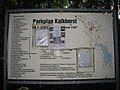 Parkplan Kalkhorst - geo.hlipp.de - 26749.jpg 640 × 480; 79 KB
-

-

-

-

-

-
 Redewisch Ausbau - geo.hlipp.de - 15351.jpg 640 × 480; 98 KB
-

-
 Strand bei Redewisch - geo.hlipp.de - 15348.jpg 640 × 480; 67 KB
-
 U-Bahn Alsterdorf - panoramio.jpg 2,848 × 2,134; 2.65 MB
-

-
 UKE- Blutspendedienst - panoramio.jpg 2,848 × 2,134; 3.17 MB
-
 UKE-Hautklinik - panoramio.jpg 2,848 × 2,134; 3.29 MB
-
 UKE-Herzcentrum - panoramio.jpg 2,848 × 2,134; 3.04 MB
-
 UKE-Rechtsmedizin - panoramio.jpg 2,848 × 2,134; 3.76 MB
-
 University Medical - panoramio.jpg 2,848 × 2,134; 3.01 MB
-
 Wald bei Kalkhorst - geo.hlipp.de - 15371.jpg 640 × 480; 132 KB
-
 Wald bei Steinbeck - geo.hlipp.de - 15785.jpg 640 × 480; 83 KB
-
 Waldweg bei Kalkhorst - geo.hlipp.de - 15370.jpg 640 × 480; 125 KB
-
 Waldweg bei Rankendorf - geo.hlipp.de - 13982.jpg 640 × 484; 110 KB
-
 Warnkenhagener Weg - geo.hlipp.de - 14041.jpg 640 × 480; 57 KB
-
 Wohnblock - Dorfplatz, Elmenhorst - geo.hlipp.de - 15792.jpg 640 × 442; 62 KB
.jpg)


,_Brandenburg_01.jpg)
,_Brandenburg_02.jpg)
,_Brandenburg_03.jpg)


.jpg)
.jpg)
.jpg)
.jpg)


