Category:Fyvie (civil parish)
Jump to navigation
Jump to search
Scottish parish in Aberdeenshire, Scotland, UK | |||||
| Upload media | |||||
| Instance of | |||||
|---|---|---|---|---|---|
| Named after | |||||
| Location |
| ||||
| Population |
| ||||
| Area |
| ||||
 | |||||
Subcategories
This category has the following 3 subcategories, out of 3 total.
Media in category "Fyvie (civil parish)"
The following 200 files are in this category, out of 386 total.
(previous page) (next page)-

-
 A920 towards Oldmeldrum - geograph.org.uk - 3796806.jpg 640 × 480; 62 KB
-
 A947 towards Turriff - geograph.org.uk - 2101713.jpg 640 × 480; 57 KB
-
 Aberdeenshire vista... - geograph.org.uk - 5576451.jpg 3,008 × 2,000; 2.73 MB
-
 Aberdeenshire wind turbines - geograph.org.uk - 5812197.jpg 4,509 × 3,384; 4.03 MB
-
 Above the Braes - geograph.org.uk - 5479139.jpg 3,251 × 2,167; 929 KB
-
 All Saints - geograph.org.uk - 5479130.jpg 4,272 × 2,848; 3.18 MB
-
 All Saints Episcopal Church, Woodhead - geograph.org.uk - 5811222.jpg 6,000 × 4,000; 6.64 MB
-
 Altons - geograph.org.uk - 1303448.jpg 640 × 427; 241 KB
-
 Approaching Lethenty - geograph.org.uk - 6214099.jpg 2,592 × 1,944; 1.41 MB
-
 Approaching Tifty - geograph.org.uk - 4366848.jpg 640 × 427; 413 KB
-
 Ardlogie Farmland - geograph.org.uk - 5147116.jpg 4,203 × 2,801; 1.5 MB
-
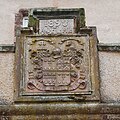 Arms of Forbes-Leith of Fyvie - geograph.org.uk - 5008382.jpg 1,513 × 1,513; 1.31 MB
-
 B9001 heading north - geograph.org.uk - 3741371.jpg 640 × 480; 68 KB
-
 B9001 heading north - geograph.org.uk - 3741704.jpg 640 × 451; 77 KB
-
 B9001 heading north near Burnside - geograph.org.uk - 3741398.jpg 640 × 480; 73 KB
-
 B9001 heading north west - geograph.org.uk - 3741368.jpg 640 × 480; 48 KB
-
 B9001 heading south - geograph.org.uk - 3741705.jpg 640 × 480; 78 KB
-
 B9001 towards Rothienorman - geograph.org.uk - 2085304.jpg 640 × 480; 46 KB
-
 B9005 towards Methlick - geograph.org.uk - 2101660.jpg 640 × 480; 61 KB
-
 Backhill of Gourdas Steading - geograph.org.uk - 2101547.jpg 640 × 480; 81 KB
-
 Bairnsdale Steading - geograph.org.uk - 5479124.jpg 4,272 × 2,848; 2.66 MB
-
 Bales by Bankhead - geograph.org.uk - 5147727.jpg 4,272 × 2,848; 3.67 MB
-
 Banks Farm - geograph.org.uk - 1293161.jpg 640 × 427; 241 KB
-
 Banks Farm - geograph.org.uk - 5147215.jpg 4,110 × 2,740; 1.35 MB
-
 Barn, Burnside - geograph.org.uk - 3741383.jpg 640 × 480; 65 KB
-
 Bench in the Valley of the River Ythan, Aberdeenshire - geograph.org.uk - 6264986.jpg 2,400 × 1,600; 2.06 MB
-
 Blachrie - geograph.org.uk - 2101555.jpg 640 × 480; 70 KB
-
 Blackpool Farm - geograph.org.uk - 1304422.jpg 640 × 427; 269 KB
-
 Blossom by the wall - geograph.org.uk - 5133656.jpg 3,660 × 2,614; 2.42 MB
-
 Boathouse, Loch of Fyvie - geograph.org.uk - 5008978.jpg 2,328 × 1,930; 2.11 MB
-
 Bogdavie Road - geograph.org.uk - 5477704.jpg 4,272 × 2,848; 2.48 MB
-
 Braes of Minnonie - geograph.org.uk - 1292309.jpg 640 × 427; 245 KB
-
 Braes of Minnonie - geograph.org.uk - 1292311.jpg 640 × 427; 236 KB
-
 Bridge at Burnside of Folla - geograph.org.uk - 1106306.jpg 640 × 480; 75 KB
-
 Bridge at Mill of Easterton - geograph.org.uk - 1132026.jpg 640 × 480; 129 KB
-
 Bridge over Skeugh Burn - geograph.org.uk - 2101707.jpg 640 × 480; 117 KB
-
 Broken Down Dyke at Sunnyside of Folla - geograph.org.uk - 1126497.jpg 640 × 480; 104 KB
-
 Brown Hill Wood - geograph.org.uk - 2095991.jpg 640 × 480; 85 KB
-
 Brownhill - geograph.org.uk - 2085316.jpg 640 × 480; 71 KB
-
 Bruckleseat - geograph.org.uk - 1303442.jpg 640 × 427; 227 KB
-
 Burn of Asleid, Swanford Bridge - geograph.org.uk - 2092252.jpg 640 × 480; 112 KB
-
 Burnside - geograph.org.uk - 1303365.jpg 640 × 388; 216 KB
-
 Burnside of Gight - geograph.org.uk - 1303432.jpg 640 × 427; 269 KB
-
 Burnside of Gight Farm - geograph.org.uk - 1106843.jpg 640 × 480; 109 KB
-
 Burnside of Gight Farm Buildings - geograph.org.uk - 1106848.jpg 640 × 480; 65 KB
-
 Burnside of Gourdas - geograph.org.uk - 4366863.jpg 640 × 427; 351 KB
-
 Cardenwell - geograph.org.uk - 4366830.jpg 640 × 427; 403 KB
-
 Castle Dale - geograph.org.uk - 5301255.jpg 4,272 × 2,848; 3.86 MB
-
 Cattle Feeder at Blackford - geograph.org.uk - 1126521.jpg 640 × 480; 81 KB
-
 Cattle Feeder near Hill of Blackford - geograph.org.uk - 1126506.jpg 640 × 480; 94 KB
-
 Cattle Grazing - geograph.org.uk - 5147193.jpg 4,272 × 2,848; 3.24 MB
-
 Cemetery beside Fyvie Golf Course - geograph.org.uk - 5300900.jpg 1,024 × 682; 228 KB
-

-
 Chrichneyled Cattle - geograph.org.uk - 5477741.jpg 4,272 × 2,848; 2.81 MB
-
 Closed garage, Inverythan - geograph.org.uk - 2101722.jpg 640 × 480; 50 KB
-
 Clovery Croft - geograph.org.uk - 5477718.jpg 4,272 × 2,848; 2.13 MB
-
 Clovery Woods of Rest - geograph.org.uk - 911456.jpg 640 × 480; 111 KB
-
 Converted church, Cross Of Jackston - geograph.org.uk - 3741753.jpg 480 × 640; 131 KB
-
 Corn field on Easterton farm - geograph.org.uk - 968785.jpg 640 × 425; 135 KB
-
 Cornfield at the side of Hill of Meadaple - geograph.org.uk - 990655.jpg 640 × 534; 187 KB
-
 Cowiehillock - geograph.org.uk - 2101587.jpg 640 × 480; 63 KB
-
 Cranna from Waulkmill - geograph.org.uk - 1292157.jpg 640 × 427; 258 KB
-
 Crichie Burn - geograph.org.uk - 5147147.jpg 4,071 × 2,715; 2.38 MB
-
 Crichneyled - geograph.org.uk - 1292251.jpg 640 × 427; 269 KB
-
 Crichneyled and Crichnelyled Croft - geograph.org.uk - 1292281.jpg 640 × 427; 233 KB
-
 Crichneyled Croft - geograph.org.uk - 1292277.jpg 640 × 427; 215 KB
-
 Crichneyled Croft - geograph.org.uk - 5477759.jpg 3,986 × 2,656; 3.73 MB
-
 Crichneyled Farmland - geograph.org.uk - 5477768.jpg 4,272 × 2,848; 2.38 MB
-
 Crichneyled Steading - geograph.org.uk - 5477749.jpg 4,272 × 2,848; 2.76 MB
-
 Crop field, Toddley Hill - geograph.org.uk - 3741732.jpg 640 × 401; 78 KB
-
 Crops by the Den - geograph.org.uk - 5147104.jpg 3,967 × 2,645; 2.38 MB
-
 Crops under cover - geograph.org.uk - 3741769.jpg 640 × 480; 95 KB
-
 Crow Trap in Waulkmill Wood - geograph.org.uk - 1133804.jpg 640 × 480; 130 KB
-
 Curious Sheep at Sunnyside of Folla - geograph.org.uk - 1126502.jpg 640 × 480; 101 KB
-
 Daffodils at Fyvie - geograph.org.uk - 5133640.jpg 4,272 × 2,848; 2.87 MB
-
 Darnabo Farm - geograph.org.uk - 2101688.jpg 640 × 480; 50 KB
-
 Deer Running near Middlehill - geograph.org.uk - 1343850.jpg 640 × 506; 33 KB
-
 Den of Burngarnie - geograph.org.uk - 1077009.jpg 640 × 480; 81 KB
-
 Den of Crichie - geograph.org.uk - 5147132.jpg 2,816 × 4,224; 2.82 MB
-
 Den of Slateheugh - geograph.org.uk - 5147087.jpg 3,953 × 2,635; 4.97 MB
-
 Denhill Farm - geograph.org.uk - 1292302.jpg 640 × 427; 288 KB
-
 Denhill Farm - geograph.org.uk - 5147197.jpg 4,215 × 2,811; 1.71 MB
-
 Denhill Turbine - geograph.org.uk - 5147203.jpg 640 × 427; 58 KB
-
 Derelict building at Stoneyfield - geograph.org.uk - 1292259.jpg 640 × 427; 265 KB
-
 Dismantled railway bridge over a road near Haddo - geograph.org.uk - 3848526.jpg 1,600 × 1,200; 420 KB
-
 Disused Railway Bridge - geograph.org.uk - 841504.jpg 640 × 427; 55 KB
-

-
 Drain beside the A920 - geograph.org.uk - 3796805.jpg 480 × 640; 69 KB
-
 East Backhill of Lethenty - geograph.org.uk - 1303413.jpg 640 × 427; 266 KB
-

-
 Entrance to Westertown farm - geograph.org.uk - 968783.jpg 640 × 425; 153 KB
-
 Family memorials... - geograph.org.uk - 5009065.jpg 2,279 × 1,819; 1.91 MB
-
 Farm buildings, Gight - geograph.org.uk - 2101667.jpg 640 × 480; 82 KB
-
 Farm track near Rothiebrisbane - geograph.org.uk - 3848547.jpg 1,600 × 1,200; 351 KB
-
 Farmland and woodland - geograph.org.uk - 3741755.jpg 640 × 480; 51 KB
-
 Farmland and woodland, Gight - geograph.org.uk - 2101645.jpg 640 × 480; 118 KB
-
 Farmland near Badiebath Wood - geograph.org.uk - 2101663.jpg 640 × 480; 53 KB
-
 Farmland near Blachrie - geograph.org.uk - 2101557.jpg 640 × 480; 82 KB
-
 Farmland near Briggs Farm - geograph.org.uk - 2101597.jpg 640 × 480; 71 KB
-
 Farmland near Brownhill - geograph.org.uk - 2085319.jpg 640 × 480; 75 KB
-
 Farmland near Burnside - geograph.org.uk - 2101612.jpg 640 × 480; 71 KB
-
 Farmland near communications masts - geograph.org.uk - 3741761.jpg 640 × 480; 35 KB
-
 Farmland near Cowiehillock - geograph.org.uk - 2101589.jpg 640 × 480; 85 KB
-
 Farmland near Darnabo Farm - geograph.org.uk - 2101690.jpg 640 × 480; 56 KB
-
 Farmland near Edgarsglen - geograph.org.uk - 2092260.jpg 640 × 480; 69 KB
-
 Farmland near Hill of Wells - geograph.org.uk - 2085300.jpg 640 × 480; 58 KB
-
 Farmland near Home Farm - geograph.org.uk - 2101711.jpg 640 × 480; 55 KB
-
 Farmland near Milton of Gight - geograph.org.uk - 2101656.jpg 640 × 480; 77 KB
-
 Farmland near Netherton of Mounie - geograph.org.uk - 3796804.jpg 640 × 480; 89 KB
-
 Farmland near North Bodiechell - geograph.org.uk - 2101570.jpg 640 × 480; 66 KB
-
 Farmland near Red Burn - geograph.org.uk - 3741370.jpg 640 × 480; 87 KB
-
 Farmland near South Bodiechell - geograph.org.uk - 2101574.jpg 640 × 480; 88 KB
-
 Farmland near Tifty Farm - geograph.org.uk - 2101708.jpg 640 × 480; 53 KB
-
 Farmland near Upperton - geograph.org.uk - 2101593.jpg 640 × 480; 85 KB
-
 Farmland near Wells of Rothie - geograph.org.uk - 2085297.jpg 640 × 480; 76 KB
-
 Farmland north of Monkshill - geograph.org.uk - 6214109.jpg 2,592 × 1,944; 1.41 MB
-
 Farmland towards South Blachrie - geograph.org.uk - 2101578.jpg 640 × 480; 79 KB
-
 Farmland, Brown Hill - geograph.org.uk - 2085320.jpg 640 × 480; 57 KB
-
 Farmland, Cottown - geograph.org.uk - 2101672.jpg 640 × 480; 74 KB
-
 Farmland, Gight - geograph.org.uk - 2101669.jpg 640 × 480; 55 KB
-
 Farmland, Jackstown - geograph.org.uk - 3741765.jpg 640 × 480; 67 KB
-
 Farmland, Lendrum - geograph.org.uk - 2101550.jpg 640 × 480; 77 KB
-
 Farmland, Lethenty - geograph.org.uk - 2101679.jpg 640 × 480; 64 KB
-
 Farmland, Monkshill - geograph.org.uk - 2101685.jpg 1,600 × 1,200; 404 KB
-
 Fernybrae Farm - geograph.org.uk - 1132063.jpg 640 × 338; 63 KB
-
 Fetterletter Farm - geograph.org.uk - 5479149.jpg 4,272 × 2,848; 2.3 MB
-
 Fetterletter Farmhouse - geograph.org.uk - 1106370.jpg 640 × 480; 77 KB
-
 Field by Corehill - geograph.org.uk - 5878217.jpg 5,184 × 3,888; 4.89 MB
-
 Flag Iris - geograph.org.uk - 2530889.jpg 3,456 × 2,304; 2.57 MB
-
 Folla Field - geograph.org.uk - 5878150.jpg 4,623 × 3,468; 3 MB
-
 Folla from the air - geograph.org.uk - 5300859.jpg 1,024 × 682; 209 KB
-
 Folla Rule Cemetery - geograph.org.uk - 3741722.jpg 640 × 480; 138 KB
-
 Forbes-Leith of Fyvie burial enclosure, Fyvie Kirk - geograph.org.uk - 5009039.jpg 3,008 × 2,000; 2.9 MB
-
 Fordoun Burn in spate - geograph.org.uk - 3848560.jpg 1,600 × 1,200; 667 KB
-
 Fordoun Burn, Fyvie - geograph.org.uk - 2162604.jpg 640 × 480; 105 KB
-
 Former Episcopal Church, Folla Rule - geograph.org.uk - 3741717.jpg 480 × 640; 101 KB
-
 Former Episcopal Church, Folla Rule - geograph.org.uk - 3741719.jpg 640 × 480; 122 KB
-
 Former St George's episcopal kirk, Folla Rule - geograph.org.uk - 5576490.jpg 3,008 × 2,000; 2.97 MB
-
 Fountainbridge - geograph.org.uk - 4366876.jpg 640 × 427; 469 KB
-
 Framed By Trees - geograph.org.uk - 5137142.jpg 4,263 × 2,841; 2.79 MB
-
 Front Entrance - geograph.org.uk - 5137160.jpg 2,699 × 4,049; 1.22 MB
-
-
 Fyvie Boathouse - geograph.org.uk - 952648.jpg 640 × 400; 86 KB
-
 Fyvie Castle (view from the south-west) - geograph.org.uk - 5008324.jpg 2,364 × 1,653; 1.42 MB
-
 Fyvie Castle - geograph.org.uk - 4281701.jpg 4,799 × 3,107; 6.17 MB
-
 Fyvie Castle - geograph.org.uk - 4281704.jpg 3,580 × 2,760; 7.02 MB
-
 Fyvie Castle - geograph.org.uk - 4293932.jpg 5,045 × 2,675; 7.28 MB
-
 Fyvie Castle - geograph.org.uk - 5008339.jpg 2,747 × 1,692; 1.86 MB
-
 Fyvie Castle - geograph.org.uk - 5132413.jpg 4,129 × 2,753; 2.12 MB
-
 Fyvie Castle - geograph.org.uk - 5137133.jpg 4,071 × 2,715; 1.39 MB
-
 Fyvie Castle - geograph.org.uk - 6275657.jpg 1,600 × 1,201; 403 KB
-
 Fyvie Castle - geograph.org.uk - 6363739.jpg 3,528 × 2,296; 1.28 MB
-
 Fyvie Kirk - geograph.org.uk - 5009030.jpg 2,331 × 1,834; 1.73 MB
-
 Fyvie Kirk - geograph.org.uk - 5479111.jpg 4,272 × 2,848; 3.1 MB
-
 Fyvie Loch - geograph.org.uk - 952665.jpg 640 × 406; 97 KB
-
 Fyvie Loch from the boathouse - geograph.org.uk - 963326.jpg 640 × 398; 41 KB
-
 Fyvie mercat cross, Cuminestown Road - geograph.org.uk - 3684513.jpg 475 × 640; 111 KB
-
 Fyvie Post Office - geograph.org.uk - 2162602.jpg 640 × 480; 98 KB
-
 Fyvie Primary School - geograph.org.uk - 5009011.jpg 2,344 × 1,777; 1.82 MB
-
 Fyvie Sawmill - geograph.org.uk - 5301243.jpg 4,272 × 2,848; 3.94 MB
-
 Gateway to All Saints Episcopal Church, Woodhead - geograph.org.uk - 5811212.jpg 6,000 × 4,000; 6.06 MB
-
 Giant Haystacks - geograph.org.uk - 990700.jpg 640 × 425; 129 KB
-
 Gight Castle, Aberdeenshire - geograph.org.uk - 6253227.jpg 2,400 × 1,590; 2.37 MB
-
 Give Way to the A947 - geograph.org.uk - 5147023.jpg 4,209 × 2,807; 2.52 MB
-
 Glacial Meltwater Channel - geograph.org.uk - 1293180.jpg 640 × 427; 249 KB
-
 Grazing, Burnside of Folla - geograph.org.uk - 3741388.jpg 640 × 480; 81 KB
-
 Grazing, Den of Smiddyburn - geograph.org.uk - 3741728.jpg 640 × 480; 132 KB
-
 Grazing, Folla Rule - geograph.org.uk - 3741720.jpg 640 × 480; 71 KB
-
 Grazing, Meikle Folla - geograph.org.uk - 3741373.jpg 640 × 480; 96 KB
-
 Greenbrae - geograph.org.uk - 2101542.jpg 640 × 480; 87 KB
-
 Harrow at Monkshill - geograph.org.uk - 4366865.jpg 640 × 427; 424 KB
-
 Heading downhill towards the A920 - geograph.org.uk - 3741771.jpg 640 × 480; 74 KB
-
 Highfields - geograph.org.uk - 2101680.jpg 640 × 480; 38 KB
-
 Hill of Blairfowl - geograph.org.uk - 1293124.jpg 427 × 640; 216 KB
-
 Hill of Blairfowl - geograph.org.uk - 1293130.jpg 640 × 427; 242 KB
-
 Hill of Blairfowl - geograph.org.uk - 1293136.jpg 640 × 427; 255 KB
-
 Hill of Blairfowl - geograph.org.uk - 1293141.jpg 640 × 427; 265 KB
-
 Hill of Cloverycrook - geograph.org.uk - 1292175.jpg 640 × 427; 254 KB
-
 Hill of Cloverycrook - geograph.org.uk - 1292181.jpg 640 × 427; 270 KB
-
 Hill of Cloverycrook - geograph.org.uk - 1292187.jpg 640 × 427; 257 KB
-
 Hill of Kinbroon - geograph.org.uk - 1292049.jpg 640 × 427; 226 KB
-
 Hill of Meadaple - geograph.org.uk - 990651.jpg 640 × 443; 122 KB
-
 Hill of Petty - geograph.org.uk - 1292166.jpg 640 × 427; 217 KB
-
 Hill of Petty - geograph.org.uk - 1292192.jpg 640 × 427; 219 KB
-
 Hillside farmland, Tigh na Sgoil - geograph.org.uk - 3741379.jpg 640 × 480; 62 KB
-
 Hillside grazing, Burnside - geograph.org.uk - 3741395.jpg 640 × 480; 81 KB
-
 Industrial Premises - geograph.org.uk - 1292199.jpg 640 × 427; 275 KB
-
 Itching to Know^ - geograph.org.uk - 1292248.jpg 640 × 427; 244 KB
-
 Ladyswell Farm - geograph.org.uk - 2101603.jpg 640 × 480; 50 KB
-
 Lake of Fyvie Castle - geograph.org.uk - 1342967.jpg 640 × 480; 98 KB
-
 Lakeside Memorial - geograph.org.uk - 2434684.jpg 3,456 × 2,304; 1.91 MB
-
 Lethen Farm - geograph.org.uk - 5878219.jpg 5,184 × 3,888; 3.59 MB
-
 Lethenty - geograph.org.uk - 1303426.jpg 640 × 427; 233 KB
-
 Lethenty Smiddy - geograph.org.uk - 2101682.jpg 640 × 480; 94 KB
-

-
 Little Millbrex - geograph.org.uk - 2101601.jpg 640 × 480; 60 KB
-
 Littlehillie - geograph.org.uk - 1292237.jpg 640 × 427; 229 KB
-
 Littlehillie Farm - geograph.org.uk - 5477729.jpg 4,272 × 2,848; 2.54 MB
-
 Loch of Fyvie - geograph.org.uk - 2617587.jpg 3,648 × 2,736; 6.17 MB


_-_geograph.org.uk_-_5008324.jpg)


&filefrom=Looking+Towards+Burnside+-+geograph.org.uk+-+1304396.jpg#mw-category-media)