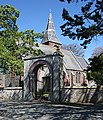
Category:Woodhead, Aberdeenshire
Jump to navigation
Jump to search
village in Aberdeenshire, Scotland, UK | |||||
| Upload media | |||||
| Instance of | |||||
|---|---|---|---|---|---|
| Location |
| ||||
 | |||||
English: Woodhead of Fyvie, often simply called "Woodhead", is an inland hamlet in Formartine, Aberdeenshire, Scotland that lies to the east of Fyvie near the upper River Ythan.
Media in category "Woodhead, Aberdeenshire"
The following 53 files are in this category, out of 53 total.
-
'Native American Studio' - geograph.org.uk - 1384402.jpg 640 × 480; 76 KB
-
All Saints Episcopal Church - geograph.org.uk - 1293238.jpg 551 × 640; 371 KB
-
All Saints Episcopal Church - geograph.org.uk - 1293244.jpg 427 × 640; 246 KB
-
Cemetery at Barthol Chapel. - geograph.org.uk - 308755.jpg 640 × 426; 134 KB
-
Cottage at Cottown Ardlogie - geograph.org.uk - 1106314.jpg 640 × 480; 40 KB
-
Lane to Townhead and Altons Farms. - geograph.org.uk - 309411.jpg 640 × 426; 119 KB
-
Millbrex Kirk and Kirkyard - geograph.org.uk - 1303405.jpg 640 × 427; 262 KB
-
Phone box at Woodhead - geograph.org.uk - 774285.jpg 640 × 480; 57 KB
-
Pig farming by Banks Farm. - geograph.org.uk - 308827.jpg 640 × 426; 110 KB
-
Sign for Beechcroft Farm - geograph.org.uk - 1215670.jpg 640 × 480; 59 KB
-
The church at South Millbrex. - geograph.org.uk - 309359.jpg 640 × 460; 188 KB
-
Woodhead Chapel.jpg 640 × 480; 119 KB
-
WoodheadChapel.jpg 1,786 × 1,296; 2.53 MB
-
Aberdeen-Angus Cattle - geograph.org.uk - 563174.jpg 640 × 427; 259 KB
-
Airborne vermin assault the pig farmer. - geograph.org.uk - 308830.jpg 640 × 436; 109 KB
-
Births, Marriages, and Deaths. - geograph.org.uk - 308635.jpg 640 × 426; 117 KB
-
Blackmill Farm. - geograph.org.uk - 307144.jpg 640 × 426; 92 KB
-
Blacksmiddy Farmhouse. - geograph.org.uk - 307184.jpg 640 × 464; 126 KB
-
Braes of Gight Wood. - geograph.org.uk - 308962.jpg 640 × 471; 149 KB
-
Eastwards from South Crichie Lane. - geograph.org.uk - 308783.jpg 640 × 426; 82 KB
-
Gowhies Pot on the River Ythan. - geograph.org.uk - 308957.jpg 640 × 426; 115 KB
-
Macterry - geograph.org.uk - 563166.jpg 640 × 427; 280 KB
-
Memorial to Chalmers' of Monkshill. - geograph.org.uk - 309461.jpg 640 × 426; 133 KB
-
Millbrex Public Hall. - geograph.org.uk - 309406.jpg 640 × 426; 104 KB
-
North Flobbets Farm. - geograph.org.uk - 308768.jpg 640 × 426; 80 KB
-
Petty Farm - geograph.org.uk - 666204.jpg 640 × 426; 63 KB
-
Road near Brownhill - geograph.org.uk - 349259.jpg 640 × 480; 65 KB
-
South Blachrie - geograph.org.uk - 563100.jpg 640 × 427; 266 KB
-
South Crichie Farm straight ahead. - geograph.org.uk - 308776.jpg 640 × 426; 86 KB
-
Stonehouse Farm to the west. - geograph.org.uk - 309421.jpg 640 × 426; 83 KB
-
Tattie Lifting - geograph.org.uk - 563056.jpg 640 × 427; 200 KB
-
The Church of Scotland at Barthol Chapel. - geograph.org.uk - 308613.jpg 640 × 426; 155 KB
-
The lane to Blackburn Croft. - geograph.org.uk - 308824.jpg 640 × 416; 85 KB
-
The lane to Nether Kirkton. - geograph.org.uk - 308759.jpg 640 × 426; 76 KB
-
The lane to South Flobbets. - geograph.org.uk - 308763.jpg 640 × 426; 125 KB
-
Towards Gourdas - geograph.org.uk - 669938.jpg 640 × 480; 49 KB
-
Western approach to Darnabo Farm - geograph.org.uk - 688273.jpg 640 × 426; 97 KB


