Category:French-language maps of Turkey
Jump to navigation
Jump to search
Subcategories
This category has the following 3 subcategories, out of 3 total.
Media in category "French-language maps of Turkey"
The following 40 files are in this category, out of 40 total.
-
 1731 manuscript map - Canal de Constantinople de mer de Marmara et canal de la mer noire.jpg 12,024 × 7,160; 8.16 MB
-

-
 1785 - Carte de la partie occidentale de la Mer Marmara et des Dardanelles.jpg 20,814 × 11,431; 28.79 MB
-

-

-

-
 1804 map - Carte de la Mer de Marmora (cropped).jpg 2,542 × 1,237; 677 KB
-

-

-
 1854 nautical chart - Carte de la partie septentrionale de l'Archipel.jpg 12,840 × 8,936; 12.02 MB
-

-
 1889 map of the Sea of Marmara.jpg 7,530 × 4,118; 5.94 MB
-

-
 1915 bird's eye view map of the Dardanelles.jpg 6,704 × 5,464; 5.63 MB
-
 1915 French map of the Turkish Straits and the Sea of Marmara.jpg 5,000 × 3,753; 11.78 MB
-
 Anastasian Wall path-fr.svg 695 × 650; 564 KB
-
 Anatolia ethnic map 1914 french 1.jpg 3,584 × 3,290; 1,022 KB
-
 Ca. 1799 French map of Turkey in Asia.jpg 1,647 × 1,350; 459 KB
-
 Ca. 1805 map of the Sea of Marmara - Carte De La Mer de Marmara.png 6,615 × 4,111; 59.19 MB
-
 Carte de Constantinople en 1786, Levée par F. Kauffer et J.B. Lechevalier.jpg 8,180 × 5,867; 18.33 MB
-
 Carte de l'Asie Minevre ou de la Natolie et du Pont Euxin 02.jpg 7,744 × 6,400; 16.96 MB
-
 Carte de la mer de Marmara - btv1b59642163.jpg 4,592 × 2,984; 1.89 MB
-
 Carte de la Mer de Marmara 1861.jpg 12,360 × 8,376; 8.82 MB
-
 Carte de la partie occidentale de la Mer Marmara et des Dardanelles - Truguet - btv1b53100976g.jpg 20,814 × 11,431; 27.73 MB
-
 Carte de la partie septentrionale de l'Archipel.jpg 14,393 × 10,036; 22.55 MB
-
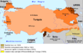
 Carte de la Turquie FR.png 737 × 375; 144 KB
-
 Carte des nouvelles limites de la Russie (33745437194).jpg 2,699 × 4,282; 6.51 MB
-
 Carte Fr Hittites.png 1,920 × 1,213; 485 KB
-
 Carte Reduite de la Mer de Marmara et du Canal Des Dardanelles.jpg 21,921 × 14,676; 57.94 MB
-
 Carte réduite de la Mer de Marmara et du Canal des Dardanelle.tif 7,699 × 5,519; 86.12 MB
-
 Geol Anatolia-fr.jpg 2,909 × 876; 2.08 MB
-
 Kapidag (cropped).tif 956 × 549; 1.17 MB
-
 Les Dardanelles - Le Bosphore - btv1b85935206.jpg 11,232 × 9,067; 14.25 MB
-
 Patrie Bleue.jpg 1,600 × 1,254; 145 KB
-

-

-
 Sea of Marmara map--01.png 1,336 × 748; 598 KB
-
 Turquia - Tractat de Laussana (1923).png 1,406 × 908; 278 KB
-
 Turquia - Tractat de Sèvres (1920).png 736 × 532; 141 KB
-
 Turquie 1919-1921 d'après Luisao Araujo.png 14,583 × 8,733; 1.8 MB


.jpg)


.jpg)


.jpg)


.png)
.png)
