Category:French-language maps of Europe
Jump to navigation
Jump to search
Subcategories
This category has the following 15 subcategories, out of 15 total.
*
F
G
I
P
R
S
T
U
Media in category "French-language maps of Europe"
The following 112 files are in this category, out of 112 total.
-
11 of 'La France et les Colonies. (Illustrated.)' (11187857163).jpg 2,044 × 1,486; 755 KB
-
1770 map of the Mediterranean Sea by Tobias Conrad Lotter.jpg 20,904 × 8,607; 28.3 MB
-
1837 Malte-Brun Map of Europe in the Middle Ages - Geographicus - MiddleAges-mb-1837.jpg 2,223 × 1,656; 650 KB
-
1844 Logerot Postal Pocket Map of Europe - Geographicus - Europe-logerot-1844.jpg 6,000 × 4,455; 8.34 MB
-
1855 map - Carte du Théâtre de la Guerre.jpg 10,800 × 7,500; 24.31 MB
-
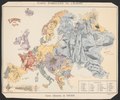
1872 satirical map - L'Europe en Ce Moment - Fantaise Politico-Géographique.jpg 5,500 × 3,577; 6.38 MB
-
1872 satirical map - L'Europe en Ce Moment - Fantaise Politico-Géographique.png 5,500 × 3,577; 54.23 MB
-
1882 satirical map - L'Europe animale - physiologie comique.jpg 9,883 × 7,135; 19.62 MB
-
1899 detail map of Vienna.jpg 1,443 × 1,540; 520 KB
-
1899 ethnographic map of Austria-Hungary.jpg 7,712 × 6,417; 9.51 MB
-
1915 bird's eye view map - Carte panoramique à vol d'oiseau du front russe.jpg 10,712 × 2,560; 3.96 MB
-
876 fr.png 6,824 × 6,584; 2.63 MB
-
Allemagne carte générale.png 1,979 × 2,521; 7.05 MB
-
AtlBalk680 hu.png 680 × 699; 389 KB
-
AtlBalk680.jpg 318 × 327; 155 KB
-
AtlBalkrelig.jpg 318 × 327; 173 KB
-
Austrian-Empire map fr.png 640 × 474; 214 KB
-
Austrian-Hungarian dissolution (fr).png 1,187 × 881; 1.04 MB
-
Autriche-Hongrie en 1887.jpg 4,408 × 3,361; 10.72 MB
-
Azerbaijan Democratic Republic Map2.jpg 945 × 700; 1.09 MB
-
Balkans-Vaugondy-Robert 1752.jpg 4,000 × 4,224; 4.78 MB
-
Banja luka location.png 330 × 355; 21 KB
-
Biełarusy. Беларусы (1885).jpg 735 × 544; 414 KB
-
Bretagne-broiou3-fr.png 293 × 219; 12 KB
-
Canton of Geneva empty map-fr small.png 960 × 647; 199 KB
-
Canton of Geneva empty map-fr.png 1,033 × 1,012; 285 KB
-
Canton of Geneva Municipalities map-fr.png 1,033 × 1,012; 336 KB
-
Carte abstention élection européennes 2009.png 1,140 × 1,200; 191 KB
-
Carte climatique de l'Espagne-fr.png 503 × 393; 71 KB
-
Carte climatique de l'Espagne.png 503 × 393; 51 KB
-
Carte d'Europe de 1819.JPG 795 × 724; 156 KB
-
Carte d'Europe-Musée Oberlin.jpg 2,250 × 1,845; 566 KB
-
Carte de Croatie.png 330 × 355; 11 KB
-
Carte de Hongrie.png 635 × 324; 48 KB
-
Carte de la Manche.png 832 × 465; 107 KB
-
Carte de Tallinn.jpg 328 × 351; 25 KB
-
Carte des districts de Chypre.png 600 × 365; 37 KB
-
Carte du Portugal.png 340 × 733; 19 KB
-
Carte du théâtre de la Guerre (34382295026).jpg 1,000 × 803; 168 KB
-
Carte du voyage de Nicolas Bouvier dans L'Usage du monde.jpg 3,507 × 1,688; 811 KB
-
Carte Encyprotype de L'Europe reduite de celle sur 4 feuilles du meme Auteur.jpg 20,223 × 15,018; 50.7 MB
-
Carte Europe Cannabis Medical.png 2,192 × 1,957; 719 KB
-
Carte Grece antique 02.jpg 1,802 × 1,439; 1.86 MB
-
Carte PM10 Europe 20140314.JPG 593 × 586; 90 KB
-
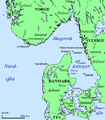
Carte Skagerrak-Kattegat-kvarstad1.png 445 × 508; 58 KB
-
Carte Skagerrak-Kattegat-sv.png 445 × 508; 38 KB
-
Carte Skagerrak-Kattegat.png 445 × 508; 16 KB
-
Carte symbolique de l'Europe Guerre libératrice de 1914-1915 - - B. Crétée, 1914. LCCN2016647864.tif 9,248 × 7,712; 204.11 MB
-
Carteestonieregion.gif 908 × 589; 41 KB
-
CarteregionBasseNormandie.jpg 500 × 500; 112 KB
-
CarteregionBretagne.jpg 500 × 500; 89 KB
-
CarteregionCentre.jpg 500 × 500; 190 KB
-
CarteRoulEurope.jpg 994 × 1,176; 196 KB
-
CAUCASIA~Vegetation Land Cover with ethnic borders~2.jpg 1,080 × 1,799; 1.14 MB
-
Composition ethnique de Bosnie-Herzégovine.png 1,205 × 1,144; 150 KB
-
Crete topographic map-fr.jpg 3,370 × 1,600; 1.2 MB
-
CrimeeXV-s.jpg 394 × 311; 147 KB
-
Czesław Miłosz.jpg 1,006 × 867; 365 KB
-
Désarmement actuel.jpg 3,719 × 3,553; 10.28 MB
-
Edward Stanford, L'EUROPE EN 1860, 245551 original.jpg 2,761 × 1,978; 5.92 MB
-
Empire carolingien 806.png 544 × 480; 234 KB
-
En-map.jpg 328 × 351; 39 KB
-
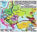
EurEstAlphabets.jpg 492 × 413; 259 KB
-
Euro2008 suisse autriche carte.png 640 × 265; 33 KB
-
1706 De La Feuille Map of Europe - Geographicus - Europe-lafeuille-1706.jpg 2,452 × 1,809; 889 KB
-
Europe - btv1b8459204k.jpg 4,954 × 3,924; 2.45 MB
-
Europe - Dressée et gravée par Blondel La Rougery - btv1b53121495x.jpg 10,940 × 7,658; 11.06 MB
-
Europe - zônes interdites à la navigation aérienne - btv1b8459327x.jpg 8,940 × 6,886; 9 MB
-
Europe countries map fr 2.png 1,475 × 1,200; 792 KB
-
Europe countries map fr.png 1,475 × 1,200; 612 KB
-
Europe en 01.pdf 1,752 × 1,239; 452 KB
-
Europe en 1547 par Mister Shek.jpg 786 × 675; 280 KB
-
Europe Moyen-âge.jpg 3,543 × 2,577; 2.25 MB
-
Europe physique, hydrographique (Cours d'eau, canaux) orographique.jpg 15,805 × 12,205; 32.15 MB
-
Europe religion map situation 1950 fr.png 1,473 × 1,198; 1.09 MB
-
Europe states de facto fr.png 1,475 × 1,200; 679 KB
-
Europe time zones map fr.png 1,475 × 1,200; 982 KB
-
Expansion-Russie-et-URSS.png 1,851 × 1,261; 161 KB
-
FederAutriche.jpg 800 × 446; 82 KB
-
Guillaume Delisle, L'Espagne (FL37099326 2588942).jpg 17,268 × 12,505; 313.38 MB
-
Jean-Claude Dezauche - Map of Europe - Google Art Project.jpg 4,001 × 3,296; 5.31 MB
-
Karte Murtensee fr.png 1,003 × 880; 226 KB
-
L'Europe comique par A. Bellogue.jpg 8,274 × 5,894; 16.73 MB
-
L'Europe en 1876 a la portée des grands esprits.jpg 7,160 × 5,078; 10.43 MB
-
L'Europe en 1939 - Dessinée par Jacques Mercier - btv1b531214931.jpg 11,586 × 7,890; 12.55 MB
-
Ligne de Benrath.PNG 328 × 352; 22 KB
-
Map of Europe, 1683.jpg 768 × 1,024; 119 KB
-
Marche du mouvement abolitioniste en Europe.jpg 3,784 × 3,606; 8.57 MB
-
Nom français des villes.png 1,152 × 843; 321 KB
-
Northern Range repères.png 658 × 532; 41 KB
-
NorthStream.png 788 × 605; 140 KB
-
PaysBaltes-Langues.jpg 269 × 362; 119 KB
-
Plan de Monaco - (Bellin) - btv1b53043160b.jpg 3,071 × 3,564; 1.52 MB
-
Problème ? Le Rhin, les Alpes, le Danube, l'Euphrate, les mers, les détroits.jpg 8,951 × 7,046; 10.57 MB
-
Revue du Pays de Caux n1 mars 1902 (page 31 crop).jpg 5,443 × 3,511; 1.97 MB
-
Template europe map fr.png 1,475 × 1,200; 571 KB
-
Ukraine villes-et-fleuves--fr.png 1,245 × 852; 99 KB
-
Mapa etnograficzna Europy = Carte etnographique de l'Europe (70647523).jpg 24,897 × 19,604; 87.25 MB
-
Карта Российской империи 1766г Европейская часть Париж 1766г основная копия.jpg 3,072 × 2,304; 2.26 MB
-
Карта Российской империи 1766г Европейская часть Париж 1766г основная часть.jpg 3,072 × 2,304; 2.21 MB
-
Карта Российской империи 1766г Европейская часть Париж 1766г.jpg 2,816 × 2,032; 2.28 MB


