Category:French-language maps of Asia
Jump to navigation
Jump to search
Subcategories
This category has the following 14 subcategories, out of 14 total.
Media in category "French-language maps of Asia"
The following 85 files are in this category, out of 85 total.
-
Mea du japon1704.jpg 2,328 × 1,701; 1.78 MB
-
L'Asie divisée en ses principales régions... - par le Sr Sanson... - btv1b55000424t.jpg 11,419 × 7,126; 11.62 MB
-
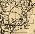
Mer Orientale 1700.jpg 626 × 608; 379 KB
-
1705 map - Carte des Indes et de la Chine.jpg 16,281 × 15,523; 49.69 MB
-
Carte huilée du royaume de Corée fournie aux jésuites par les chinois - btv1b59627255.jpg 6,648 × 9,592; 8.26 MB
-
Map of Japan, 1718.jpg 768 × 1,024; 110 KB
-
B26055931I - Carte des Indes, de la Chine des Iles de Sumatra, Java.jpg 5,860 × 6,124; 11.21 MB
-
Royaume de Corée - d'Anville - btv1b5963117v.jpg 4,424 × 6,448; 4.65 MB
-
Royaume de Corée - (d'Anville) ; Delahaye fils sculpsit - btv1b530274374.jpg 5,159 × 6,767; 5.26 MB
-
Map Japan 1746.JPG 409 × 295; 20 KB
-
Carte de la Corée - Dheulan Sculp. - btv1b5963114m.jpg 2,928 × 4,392; 1.92 MB
-
Carte de la Corée - par J.-B. d'Anville - btv1b8468520p.jpg 3,168 × 5,088; 2.63 MB
-
프랑스의 독도지도1 copy.gif 361 × 461; 164 KB
-
Carte-des-isles-du-japon-terre-de-jesso-et-pays-voisoins-d-bellin.jpg 1,799 × 1,300; 2.61 MB
-
1771 Bonne Map of Central Asia - Geographicus - Tartarie-bonne-1770.jpg 4,000 × 2,808; 3.34 MB
-
1770 Janvier Map of Asia - Geographicus - Asia-janvier-1770.jpg 4,000 × 2,800; 3.24 MB
-
Carte des Isles du Japon - OTM- HB-KZL I 2 A 9 (31a).jpg 3,436 × 2,612; 3.2 MB
-
Carte de la Corée - d'après l'original envoyé par André Kim en 1846 - btv1b531029174.jpg 8,221 × 14,884; 13.73 MB
-
1852 Levasseur Map of Asia - Geographicus - Asia-levasseur-1852.jpg 4,000 × 2,780; 3.92 MB
-
CUINET(1896) LA SYRIE.jpg 3,459 × 6,075; 8.83 MB
-
Carte de la Russie, Japon, Corée, Mandchourie - publié par A. Taride - btv1b8443668r.jpg 10,992 × 8,641; 9.84 MB
-
1904 French map of the Russo-Japanese War by Librairie Universelle.jpg 10,248 × 14,311; 26.27 MB
-
1904 French map of the Russo-Japanese War.jpg 19,801 × 14,663; 77.16 MB
-
1915 bird's eye view map of the Middle Eastern theatre of World War I.jpg 6,440 × 5,240; 5.28 MB
-
Archives des missions scientifiques et littéraires (1885) (19727892916).jpg 2,928 × 2,028; 1.29 MB
-
Asie.jpg 8,103 × 6,974; 13.67 MB
-
Plattegrond Lands Plantentuin Buitenzorg 1901.jpg 1,390 × 1,676; 415 KB
-
Ca. 1799 French map of Turkey in Asia.jpg 1,647 × 1,350; 459 KB
-
Ca. 1904 map - Carte de l'Extreme-Orient et du Theatre De La Guerre Russo-Japonaise.jpg 14,756 × 19,337; 38.4 MB
-
Ca. 1904 map - Carte de la Guerre Russo-Japonaise.jpg 19,377 × 14,280; 50.51 MB
-
Carte de L'Asie divisée en ses principaux Etats.jpg 9,000 × 6,400; 13.87 MB
-
Carte des districts de Chypre.png 600 × 365; 37 KB
-
Carte des royaumes de Siam, de Tunquin, Pegu, Ava Aracan, etc. LOC 2008621653.tif 7,114 × 5,002; 101.81 MB
-
Carte du Royaume de Siam et de la Cochinchine Française (34427017492).jpg 1,200 × 1,709; 800 KB
-
Carte du voyage de Nicolas Bouvier dans L'Usage du monde.jpg 3,507 × 1,688; 811 KB
-
Carte-Asie-MP-MGPauthier-1865-détail.jpg 2,972 × 2,068; 1.79 MB
-
Carte-Asie-MP-MGPauthier-1865.jpg 1,024 × 1,183; 364 KB
-
CarteCanaanAuBronzeRécent.jpg 2,901 × 3,930; 1.58 MB
-
Detroit Malacca OHI.png 432 × 360; 17 KB
-
Detroit Malacca.png 432 × 360; 17 KB
-
Du Val's more detailed route map of the Deccan, 1690, from Surat westward.jpg 1,600 × 1,236; 564 KB
-
Expansion-Russie-et-URSS.png 1,851 × 1,261; 161 KB
-
Hooghly River 1749.jpg 436 × 658; 114 KB
-
Indochine - btv1b53065045p.jpg 10,836 × 14,173; 22.36 MB
-
Indochine - btv1b530650803.jpg 7,616 × 9,976; 10.25 MB
-
L'Arabie(cropped).jpg 3,617 × 2,012; 5.76 MB
-
L'Asie selon les mémoires les (...)Coronelli Vincenzo btv1b530890106.jpg 1,152 × 868; 485 KB
-
Langues Ienisseïennes.png 1,467 × 816; 72 KB
-
Le Turkestan et les pays limitrophes tracé des frontières de la Russie d'Asie.jpg 12,250 × 7,968; 15.45 MB
-
Louis-Joseph Mondhare - Map of Jerusalem - 1770.jpg 3,080 × 1,967; 2.18 MB
-
Missions catholiques au Kansu.png 1,560 × 2,130; 9.38 MB
-
Missions catholiques au Kweichow.png 1,710 × 1,344; 6.75 MB
-
Missions catholiques au Ningsia.png 1,560 × 2,006; 8.58 MB
-
Missions catholiques au Sikang et au Szechwan.png 2,456 × 1,590; 10.6 MB
-
Missions catholiques au Szechwan.png 1,754 × 1,590; 7.65 MB
-
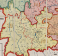
Missions catholiques au Yunnan.png 1,664 × 1,600; 6.85 MB
-
Missions catholiques en Chine occidentale.png 1,266 × 2,078; 6.29 MB
-
Nepal bouddhisme 2011.png 7,593 × 5,560; 2.57 MB
-
Ottoman Empire 1696 by Jaillot cropped the Middle East A.jpg 371 × 411; 57 KB
-
Pierre M. Lapie, Asie (FL27961801 2487477).jpg 18,652 × 13,056; 362.1 MB
-
Plan d'une partie des côtes de la Cochinchine 1787 - Le Floch de La Carrière.jpg 5,353 × 3,626; 2.6 MB
-
Sunda Strait Map.png 669 × 798; 1.34 MB
-
Travels of Pietro della Valle-1.png 1,752 × 1,231; 857 KB


