Category:French-language maps showing history of Europe
Jump to navigation
Jump to search
Media in category "French-language maps showing history of Europe"
The following 200 files are in this category, out of 232 total.
(previous page) (next page)-
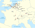
 Première croisade - routes.jpg 1,254 × 936; 865 KB
-
 Première croisade - Route de Baudouin de Boulogne.jpg 1,254 × 936; 846 KB
-
 Première croisade - Route de Bohémond de Tarente.jpg 1,254 × 936; 908 KB
-
 Première croisade - Route de Godefroy de Bouillon.jpg 1,254 × 936; 915 KB
-
 Première croisade - Route de Hugues de Vermandois.jpg 1,254 × 936; 842 KB
-
 Première croisade - Route de Raymond de Saint-Gilles.jpg 1,254 × 936; 844 KB
-
 Première croisade - Route de Robert Courteheuse.jpg 1,254 × 936; 918 KB
-
 527Europe.PNG 750 × 600; 251 KB
-
 Ancient greek dialects-fr-400.jpg 2,000 × 1,682; 804 KB
-
 AtHistEur250.jpg 1,912 × 2,200; 936 KB
-
 AtHistEur500.jpg 1,912 × 2,200; 737 KB
-
 AtHistEur560.jpg 1,912 × 2,200; 667 KB
-
 AtHistEur810.jpg 1,875 × 2,073; 751 KB
-
 AtHistEur850.jpg 1,265 × 1,180; 260 KB
-
 AtHistEur900.jpg 1,267 × 1,182; 277 KB
-
 AtHistEur1180.jpg 1,890 × 2,070; 694 KB
-
 AtHistEur1250.jpg 1,299 × 1,440; 233 KB
-
 AtHistEur1360.jpg 1,317 × 1,445; 274 KB
-
 AtHistEur1500.jpg 1,317 × 1,445; 369 KB
-
 AtHistEur1648.jpg 1,263 × 1,395; 397 KB
-
 AtHistEur1750.jpg 1,306 × 1,434; 397 KB
-
 AtHistEur1811.jpg 1,284 × 1,402; 223 KB
-
 AtHistEur1840.jpg 1,290 × 1,434; 222 KB
-
 AtHistEur1885.jpg 1,301 × 1,440; 215 KB
-
 AtHistEur1914.jpg 1,301 × 1,440; 192 KB
-
 AtHistEur1924.jpg 1,311 × 1,445; 221 KB
-
 AtHistEur1940.jpg 1,295 × 1,424; 229 KB
-
 AtHistEur1942.jpg 1,295 × 1,424; 217 KB
-
 AtHistEur1961.jpg 1,260 × 1,412; 241 KB
-
 AtHistEur1991.jpg 1,266 × 1,413; 216 KB
-
 AtHistEur1996.jpg 1,269 × 1,416; 217 KB
-
 AtHistEurEU09.jpg 1,269 × 1,416; 235 KB
-
 AtHistEurEU13.jpg 1,269 × 1,416; 248 KB
-
 AtHistEurEU15.jpg 1,269 × 1,416; 230 KB
-
 Balkans-ethnic (1861).jpg 6,280 × 5,072; 3.98 MB
-
 Balkans-ethnic (1877).jpg 2,020 × 2,084; 1.14 MB
-
 Balkans-ethnique.JPG 1,258 × 1,266; 457 KB
-
 Bastides - 1 - carte comtale avec limtes comté.jpg 864 × 587; 85 KB
-
 Bastides - 2 - carte alphonsine 1249 à 1259.jpg 861 × 911; 197 KB
-
 Bastides - 3 - situation en 1271.jpg 1,137 × 808; 224 KB
-
 Battle of Berezina map-fr.svg 512 × 385; 26 KB
-
 Bloc de l'Est.png 909 × 856; 348 KB
-
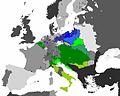
 Bulgaria Samuil (997-1014) es fr.svg 728 × 594; 208 KB
-
 Carte de la guerre du Péloponnèse 431a.C.svg 476 × 531; 151 KB
-
 Carte des peuples francs.png 583 × 599; 114 KB
-
 Carte Guerre de Sept Ans Europe.PNG 884 × 643; 77 KB
-
 Carte religieuse - Europe centrale - 1901.svg 1,977 × 1,709; 2.35 MB
-
 Carte-territoires-vosges.jpg 1,095 × 1,203; 438 KB
-
 Conséquences territoriales du traité de Vienne (1738).png 2,012 × 1,761; 222 KB
-
 D285- Répartition des Chrétiens vers l’An 180 -liv3-ch1.png 1,448 × 1,018; 129 KB
-
 D306- Europe de 375 à 400 -liv3-ch1.png 1,451 × 1,352; 196 KB
-
 D307- Europe de 400 à 425 -liv3-ch1.png 1,458 × 1,332; 206 KB
-
 D347- Europe de 425 à 450. -liv3-ch2.png 1,447 × 1,320; 188 KB
-
 D349- Europe de 450 à 475. -liv3-ch2.png 1,454 × 1,342; 364 KB
-
 D359- N° 375. Charles Quint et François Ier. - liv3-ch12.png 1,437 × 1,626; 374 KB
-
 D361- Europe de 476 à 493. -liv3-ch2.png 1,450 × 1,337; 173 KB
-
 D363- Europe de 493 à 526. -liv3-ch2.png 1,450 × 1,344; 179 KB
-
 D391- N° 275. Europe de 526 à 552. -liv3-ch2.png 1,449 × 1,322; 174 KB
-
 D393- N° 276. Europe de 552 à 590. -liv3-ch2.png 1,444 × 1,321; 165 KB
-
 D503-Migrations et Incursions gauloises.-Liv2-ch10.png 1,446 × 1,190; 158 KB
-
 D505-Incursions des Cimbres et des Teutons.-Liv2-ch10.png 1,442 × 1,280; 171 KB
-
 DespotatMorée-fr.PNG 643 × 599; 100 KB
-
 Distribution géographique premiers sceaux armoriés (1110-1160).svg 730 × 585; 265 KB
-
 Empire carolingien 768-811.jpg 1,400 × 1,180; 713 KB
-
 Empire Carolingien en 880.png 588 × 600; 79 KB
-
 Empires voies commerciales.jpg 663 × 500; 169 KB
-
 Eur.ope en -400.pdf 1,752 × 1,239; 410 KB
-
 Europe 1096-1254 - Religions - Arnaud de Vachon.png 1,254 × 936; 903 KB
-
 Europe en -100.pdf 1,752 × 1,239; 444 KB
-
 Europe en -1000.pdf 1,752 × 1,239; 402 KB
-
 Europe en -200.pdf 1,752 × 1,239; 441 KB
-
 Europe en -2500.pdf 1,752 × 1,239; 310 KB
-
 Europe en -300.pdf 1,752 × 1,239; 452 KB
-
 Europe en -500.pdf 1,752 × 1,239; 412 KB
-
 Europe en -5000.pdf 1,752 × 1,239; 343 KB
-
 Europe en -600.pdf 1,752 × 1,239; 379 KB
-
 Europe en -700.pdf 1,752 × 1,239; 387 KB
-
 Europe en 0.pdf 1,752 × 1,239; 453 KB
-
 Europe en 100.pdf 1,752 × 1,239; 563 KB
-
 Europe en 1000.pdf 1,752 × 1,239; 501 KB
-
 Europe en 1050.pdf 1,752 × 1,239; 497 KB
-
 Europe en 1100.pdf 1,752 × 1,239; 500 KB
-
 Europe en 1150.pdf 1,752 × 1,239; 496 KB
-
 Europe en 1250.pdf 1,752 × 1,239; 512 KB
-
 Europe en 1300.pdf 1,752 × 1,239; 517 KB
-
 Europe en 1350.pdf 1,752 × 1,239; 500 KB
-
 Europe en 1400.pdf 1,752 × 1,239; 513 KB
-
 Europe en 1500.pdf 1,752 × 1,239; 506 KB
-
 Europe en 1550.pdf 1,752 × 1,239; 505 KB
-
 Europe en 1600.pdf 1,752 × 1,239; 586 KB
-
 Europe en 1650.pdf 1,752 × 1,239; 484 KB
-
 Europe en 1700.pdf 1,752 × 1,239; 475 KB
-
 Europe en 1750.pdf 1,752 × 1,239; 464 KB
-
 Europe en 1800.pdf 1,752 × 1,239; 445 KB
-
 Europe en 1850.pdf 1,752 × 1,239; 435 KB
-
 Europe en 1900.pdf 1,752 × 1,239; 421 KB
-
 Europe en 1933.pdf 1,752 × 1,239; 417 KB
-
 Europe en 1966.pdf 1,752 × 1,239; 415 KB
-
 Europe en 200.pdf 1,752 × 1,239; 434 KB
-
 Europe en 2000.pdf 1,752 × 1,239; 421 KB
-
 Europe en 300.pdf 1,752 × 1,239; 445 KB
-
 Europe en 301.pdf 1,752 × 1,239; 445 KB
-
 Europe en 400.pdf 1,752 × 1,239; 444 KB
-
 Europe en 401.pdf 1,752 × 1,239; 444 KB
-
 Europe en 450.pdf 1,752 × 1,239; 457 KB
-
 Europe en 500.pdf 1,752 × 1,239; 455 KB
-
 Europe en 550.pdf 1,752 × 1,239; 458 KB
-
 Europe en 551.pdf 1,752 × 1,239; 457 KB
-
 Europe en 600.pdf 1,752 × 1,239; 600 KB
-
 Europe en 601.pdf 1,752 × 1,239; 599 KB
-
 Europe en 650.pdf 1,752 × 1,239; 605 KB
-
 Europe en 651.pdf 1,752 × 1,239; 603 KB
-
 Europe en 700.pdf 1,752 × 1,239; 586 KB
-
 Europe en 750.pdf 1,752 × 1,239; 588 KB
-
 Europe en 800.pdf 1,752 × 1,239; 496 KB
-
 Europe en 850.pdf 1,752 × 1,239; 490 KB
-
 Europe en 900.pdf 1,752 × 1,239; 496 KB
-
 Europe en 950.pdf 1,752 × 1,239; 484 KB
-
 Europe VII-e VIII-e siècles.jpg 10,902 × 7,080; 6.84 MB
-
 Europe13eSiecle.jpg 800 × 600; 187 KB
-
 Europee en 501.pdf 1,752 × 1,239; 454 KB
-
 France1860cheminsdefer.png 783 × 800; 32 KB
-
 Fédération balkanique.png 613 × 850; 42 KB
-
 Gauleromaine.png 569 × 524; 110 KB
-
 Holy Roman Empire 1648 fr.svg 2,283 × 1,810; 4.15 MB
-
 Indre-et-Loire-ligne demarcation.png 340 × 293; 69 KB
-
 Italie 1812.png 556 × 642; 71 KB
-
 Italie byzantine et lombarde.jpg 1,000 × 1,159; 422 KB
-
 Italie du sud vers 1000.png 1,508 × 1,544; 2.31 MB
-
 La France en 1180 (section).png 3,449 × 3,376; 6.88 MB
-
 La Méditerranée en -146.jpg 800 × 600; 241 KB
-
 La méditerranée en -168 après Pydna.jpg 800 × 600; 291 KB
-
 La Méditerranée en -188.jpg 800 × 600; 254 KB
-
 La Méditerranée en -220.jpg 800 × 600; 291 KB
-
 La Méditerranée en -280.jpg 800 × 600; 263 KB
-
 La Pologne-Lituanie face à la Russie, la Prusse & l'Autriche.png 1,962 × 1,631; 98 KB
-
 LangCeltes.jpg 447 × 301; 84 KB
-
 LangEur-300.jpg 815 × 571; 402 KB
-

-
 Les possessions normandes vers 1130 en Italie.png 558 × 519; 185 KB
-
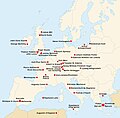
 Lieux de traduction et d'enseignement.jpg 728 × 925; 101 KB
-
 Map Europe regimes 1914.png 998 × 593; 155 KB
-
 Mercie (730-745).png 959 × 777; 80 KB
-
 Meule à grains enquête 1808-9 departement-77.jpg 530 × 523; 123 KB
-
 Meule à grains enquête 1808-9 departements-24-27-37-51.jpg 530 × 523; 183 KB
-
 Meule à grains enquête 1808-9 departements-78-86.jpg 530 × 523; 174 KB
-
 Monde2.jpg 4,200 × 3,453; 4.76 MB
-
 Mozart family Grand Tour Map-fr.svg 1,947 × 1,533; 122 KB
-
 Normans possessions 12century-fr.png 1,394 × 1,012; 1.02 MB
-
 Normans possessions in 1130-fr.png 1,400 × 1,018; 5.45 MB
-
 Partage de l'Empire carolingien au Traité de Verdun en 843.JPG 3,597 × 3,308; 3.66 MB
-
 Politically divided Gaul, 481.jpg 1,242 × 1,144; 335 KB
-
 Preview Europe philosophes fr.jpg 400 × 392; 139 KB
-
 Pruse Autriche XVIIIème siècle.jpg 776 × 432; 158 KB
-
 Prusse Autriche XVIII.jpg 540 × 432; 107 KB
-
 Pyrrhic War map-fr.svg 1,922 × 1,522; 1.09 MB
-
 PéloponnèseBlouet.jpg 1,984 × 1,296; 840 KB
-
 Péninsule Ibérique en 1002.png 2,000 × 1,500; 841 KB
-
 Péninsule ibérique en 1037.png 2,000 × 1,500; 1,014 KB
-
 Péninsule ibérique en 1065.png 2,000 × 1,500; 1,014 KB
-
 Péninsule ibérique en 1085.png 2,000 × 1,500; 1,008 KB
-
 Péninsule ibérique en 1115.png 2,000 × 1,500; 1.1 MB
-
 Péninsule ibérique en 1144.png 2,000 × 1,500; 990 KB
-
 Péninsule ibérique en 1148.png 2,000 × 1,500; 1.03 MB
-
 Péninsule ibérique en 1157.png 2,000 × 1,500; 1 MB
-
 Péninsule ibérique en 1195.png 2,000 × 1,500; 948 KB
-
 Péninsule ibérique en 1224.png 2,000 × 1,500; 935 KB
-
 Péninsule ibérique en 1230.png 2,000 × 1,500; 839 KB
-
 Péninsule ibérique en 1240.png 2,000 × 1,500; 875 KB
-
 Péninsule ibérique en 1250.png 2,000 × 1,500; 853 KB
-
 Péninsule ibérique en 1275.png 2,000 × 1,500; 820 KB
-
 Péninsule ibérique en 1314.png 2,000 × 1,500; 913 KB
-
 Péninsule ibérique en 1350.png 2,000 × 1,500; 849 KB
-
 Péninsule ibérique en 1369.png 2,000 × 1,500; 963 KB
-
 Péninsule ibérique en 1410.png 2,000 × 1,500; 897 KB
-
 Péninsule ibérique en 1450.png 2,000 × 1,500; 839 KB
-
 Péninsule ibérique en 1479.png 2,000 × 1,500; 1,012 KB
-
 Péninsule ibérique en 1516.png 2,000 × 1,500; 1.01 MB
-
 Péninsule ibérique en 1556.png 2,000 × 1,500; 974 KB
-
 Péninsule ibérique en 1598.png 2,000 × 1,500; 771 KB
-
 Péninsule ibérique en 1621.png 2,000 × 1,500; 722 KB
-
 Péninsule ibérique en 1665.png 2,000 × 1,500; 802 KB
-
 Péninsule ibérique en 1700.png 2,000 × 1,500; 693 KB
-
 Péninsule ibérique en 1705.png 2,000 × 1,500; 771 KB
-
 Péninsule ibérique en 1706.png 2,000 × 1,500; 713 KB
-
 Péninsule ibérique en 1709.png 2,000 × 1,500; 764 KB
-
 Péninsule ibérique en 1715.png 2,000 × 1,500; 694 KB
-
 Péninsule ibérique en 1750.png 2,000 × 1,500; 640 KB
-
 Péninsule ibérique en 1788.png 2,000 × 1,500; 638 KB
-
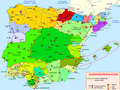
 Péninsule Ibérique en 711.png 2,000 × 1,557; 790 KB
-
 Péninsule Ibérique en 757.png 2,000 × 1,500; 722 KB
-
 Péninsule ibérique en 814.png 2,000 × 1,500; 867 KB
-
 Péninsule ibérique en 850.png 2,000 × 1,500; 826 KB
-
 Péninsule ibérique en 875.png 2,000 × 1,500; 859 KB
-
 Péninsule ibérique en 900.png 2,000 × 1,500; 858 KB
-
 Péninsule ibérique en 929.png 2,000 × 1,500; 921 KB
-
 Péninsule ibérique en 961.png 2,000 × 1,500; 853 KB
-
 Péninsule Italienne vers 750.png 1,000 × 1,159; 487 KB
-
 Revolutions of 1848 in Europe (trad fr).svg 512 × 325; 225 KB
-
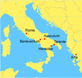 Rome against Taranto location-fr.png 253 × 240; 26 KB


.jpg)
.jpg)


_es_fr.svg)


.png)


.svg)


.png)


_grecques_des_cit%C3%A9s_de_Sicile_%26_dates_de_fondations.jpg)


.png)


.svg)
