Category:Drainage basin maps of Chile
Jump to navigation
Jump to search
English: Maps of drainage basins predominantly within the territory of Chile
Subcategories
This category has only the following subcategory.
Media in category "Drainage basin maps of Chile"
The following 10 files are in this category, out of 10 total.
-
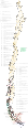
 Cuencas hidrograficas de Chile.png 2,036 × 9,108; 4.88 MB
-
 Cuencas-drenaje-ciudades de Chile(13MB).png 3,420 × 14,573; 12.52 MB
-
 Cuencas-drenaje-ciudades de Chile.png 2,201 × 9,403; 6.8 MB
-
 Cuencas-imagemap-full.png 2,515 × 426; 381 KB
-
 Cuencas-imagemap.png 2,556 × 423; 223 KB
-
 Cuencas-total.svg 1,909 × 8,539; 6.77 MB
-
 Cuencas-total2.svg 1,909 × 8,539; 7.34 MB
-
 Mapa-de-ubicacion-de-las-cuencas-hidrograficas-de-chile-horiz-full.svg 2,358 × 400; 4.36 MB
-
 Mapa-de-ubicacion-de-las-cuencas-hidrograficas-de-chile-horiz.svg 2,556 × 423; 488 KB
-
 Mapa-de-ubicacion-de-las-cuencas-hidrograficas-de-chile.svg 396 × 2,396; 2.58 MB
.png)