Category:Drainage basin maps of Canada
Jump to navigation
Jump to search
English: Maps of drainage basins predominantly within the territory of Canada
Subcategories
This category has the following 2 subcategories, out of 2 total.
S
Media in category "Drainage basin maps of Canada"
The following 82 files are in this category, out of 82 total.
-
 Adams River Watershed Map.jpg 1,102 × 1,363; 850 KB
-
 Al-Sa-Ma-rivers.png 500 × 500; 137 KB
-
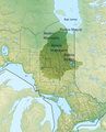
 Albany River basin map.png 1,724 × 993; 3 MB
-
 Ashuapmushuan River basin map.png 968 × 992; 2.06 MB
-
 Athabasca Watershed-WCanada.png 1,879 × 1,353; 2.54 MB
-
 Athabasca Watershed.png 808 × 1,019; 863 KB
-
 Bassin-de-la-Moose.png 1,338 × 1,656; 3.62 MB
-
 Betsiamites map.png 330 × 219; 16 KB
-
 Bowrivermap.jpg 657 × 531; 296 KB
-
 Broadback map.png 340 × 238; 16 KB
-
 Bvlassom.svg 765 × 990; 2.15 MB
-
 Becancourrivermap.png 500 × 500; 69 KB
-
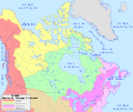
 Canada drainage map - en.svg 1,114 × 942; 429 KB
-
 Canada drainage map - fr.svg 1,114 × 942; 429 KB
-
 Canada-Drainage.png 860 × 691; 199 KB
-
 Chaudiererivermap.png 500 × 500; 73 KB
-
 Churchill river hudson basin map.png 1,200 × 788; 1.6 MB
-
 Churchill-bassin.png 280 × 230; 14 KB
-
 Eastmain map.png 396 × 254; 19 KB
-
 Riviere Eastmain carte.png 396 × 254; 22 KB
-
 English River (Ontario) basin map.png 1,251 × 990; 2.97 MB
-
 Finlay river basin map.png 1,000 × 1,111; 2.16 MB
-
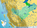
 Fraser River Watershed.png 1,763 × 1,353; 2.51 MB
-
 FraserRiverBritishColumbia Location.png 458 × 339; 14 KB
-
 Fraser River Basin Map.jpg 2,719 × 3,260; 8.29 MB
-
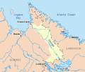 George map.png 444 × 372; 24 KB
-
 Riviere George carte.png 444 × 372; 27 KB
-
 Grande riviere de la Baleine carte.png 452 × 286; 24 KB
-
 Great Whale map.png 452 × 286; 21 KB
-
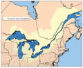
 Grlakes lawrence map.png 600 × 483; 54 KB
-
 Grlakes lawrence map2.png 640 × 520; 79 KB
-
 Harricana map.png 359 × 254; 19 KB
-
 Harricana-Moose rivers.png 300 × 290; 18 KB
-
 Hay River Watershed.png 1,763 × 1,353; 2.49 MB
-
 Hudson-bassin.PNG 280 × 230; 14 KB
-
 Koksoak map.png 531 × 413; 38 KB
-
 Riviere Koksoak carte.png 531 × 413; 41 KB
-
 La Grande map 2.png 522 × 390; 37 KB
-
 La Grande map.png 522 × 311; 30 KB
-
 La Grande Riviere carte 2.png 522 × 390; 43 KB
-
 La Grande Riviere carte.png 522 × 311; 35 KB
-
 Leaf River map.png 413 × 271; 22 KB
-
 Riviere aux Feuilles carte.png 413 × 271; 24 KB
-
 Liard river map with borders.png 448 × 500; 102 KB
-
 Liard river map.png 448 × 500; 89 KB
-
 Location of the Thames River in southern Ontario.png 1,240 × 984; 1.31 MB
-
 Mackenzierivermap cropped.jpg 490 × 498; 197 KB
-
 Manicouagan map.png 456 × 300; 24 KB
-
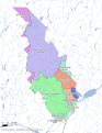
 Mattawa River basin map.png 1,132 × 944; 2.22 MB
-
 Mississagi River basin map.png 1,084 × 961; 2.14 MB
-
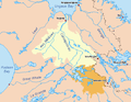
 Moose River basin map.png 1,134 × 993; 1.98 MB
-
 Moose-River-Basin.png 1,652 × 2,154; 4.32 MB
-
 Southnahannirivermap.jpg 856 × 637; 470 KB
-
 Natashquan map.png 457 × 276; 23 KB
-
 Nelson-bassin.png 280 × 230; 14 KB
-
 Nelsonrivermap.png 500 × 500; 139 KB
-
 Nipigon River basin map.png 1,273 × 994; 2.79 MB
-
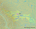
 NorthSaskMap.jpg 831 × 549; 393 KB
-
 Nottaway map.png 390 × 265; 20 KB
-
 Otoskwin River basin map.png 1,735 × 994; 3.67 MB
-
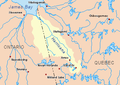
 Ottawarivermap.png 500 × 500; 146 KB
-
 Outardes map.png 334 × 222; 14 KB
-
 Riviere aux Outardes carte.png 334 × 222; 17 KB
-
 Peace River Watershed.png 1,763 × 1,353; 2.53 MB
-
 Redrivernorthmap.png 500 × 499; 137 KB
-
 Riviererougecarte.png 500 × 499; 133 KB
-
 Rupert map 2.png 412 × 273; 20 KB
-
 Rupert map.png 412 × 273; 19 KB
-
 Saguenaymap.png 300 × 300; 45 KB
-
 Stfrancoisrivermap.png 500 × 500; 83 KB
-
 Stmauricerivermap.png 500 × 500; 132 KB
-
 Bassin de la riviere Saint-Charles.JPG 542 × 484; 161 KB
-
 Saskatchewanrivermap.png 500 × 348; 90 KB
-
 Watershed of the Saskatchewan River.png 513 × 382; 33 KB
-
 Skeena Watershed.png 1,315 × 1,324; 1.89 MB
-
 Slave River Watershed.png 1,763 × 1,353; 2.57 MB
-
 Stcroixrivermapmaine-fr.png 400 × 400; 54 KB
-
 Stcroixrivermapmaine.png 400 × 400; 56 KB
-
 Thelon River basin map.svg 637 × 531; 1.54 MB
-
 ThompsonRiverBritishColumbia Location.png 453 × 340; 29 KB
-
 Yukon River Basin USGS.jpg 745 × 511; 47 KB
-
 Yukon watershed.png 500 × 500; 123 KB


_basin_map.png)


