Category:Drainage basin maps of South America
Jump to navigation
Jump to search
English: This category includes files about rivers (represented as watersheds/drainage basins/drainage divides) focused on geographic boundaries of the whole body of water.
See also:
- Category:Maps of rivers by country for files about rivers focusing on political national or subnational (states, counties and so on) boundaries.
- Category:Maps of rivers of South America for files about rivers (represented as paths) focused on geographic boundaries of the whole body of water.
Subcategories
This category has the following 7 subcategories, out of 7 total.
A
- Maps of Amazon Basin (71 F)
B
C
- Drainage basin maps of Colombia (14 F)
D
- Drainage basin maps of Peru (3 F)
O
- Maps of the Orinoco basin (12 F)
Media in category "Drainage basin maps of South America"
The following 29 files are in this category, out of 29 total.
-

-
 The Source of the Amazon River.jpg 540 × 717; 167 KB
-
 Bacia do Rio Canoas.jpg 677 × 481; 45 KB
-
 Rio Bogota plain map.png 965 × 833; 360 KB
-
 Cenepa river basin.jpg 965 × 1,216; 900 KB
-
 Colorado arg rivermap.png 1,000 × 1,000; 694 KB
-
 Comité Interjurisdiccional de la Cuenca del Río Carcarañá.jpg 3,040 × 2,149; 1.48 MB
-
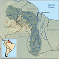 Essequiborivermap.png 1,000 × 1,000; 1.41 MB
-
 Guaviarerivermap.png 981 × 984; 164 KB
-
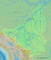 Madeirarivermap.jpg 1,217 × 1,429; 750 KB
-
 Magdalena watershed.png 300 × 248; 63 KB
-
 Rio Magdalena map.png 936 × 950; 1.25 MB
-
 Mapa de la Cuenca Matanza Riachuelo.png 426 × 415; 94 KB
-
 Mapa cuencas endorréicas meseta del collao.jpg 2,175 × 2,710; 386 KB
-
 Paranarivermap.png 1,000 × 1,000; 285 KB
-

-
 Mapa de riscos ambientais do Ribeirão das Pedras, Campinas, São Paulo.jpg 1,172 × 1,600; 442 KB
-
 Rio Negro Argentina map.png 1,200 × 949; 1.42 MB
-
 Esboço - Bacia do Rio Utinga.jpg 665 × 582; 73 KB
-
 Riodelaplatabasinmap-ar.png 1,500 × 1,510; 3.1 MB
-
 Riodelaplatabasinmap-fr.png 1,500 × 1,508; 3.1 MB
-
 Riodelaplatabasinmap.png 1,500 × 1,510; 3.14 MB
-
 Cuenca Río San Juan.png 927 × 588; 17 KB
-
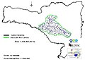
 Cuenca Hidrográfica San Juan de Micay.png 843 × 559; 616 KB
-
 Saofrancisco.png 500 × 500; 83 KB
-
 Tocantins watershed.png 498 × 500; 104 KB
-
 TriânguloMineiro.png 358 × 358; 283 KB
-
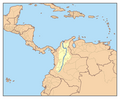
 Cuenca Rio Tachira.svg 800 × 1,260; 930 KB
-
 Uruguayrivermap.png 1,000 × 1,007; 217 KB
_Alunos_visitam_ao_Centro_Cultural_Rio_Tiet%C3%AA_e_fazem_plantio_de_mudas_(36536732593).jpg)


.svg)


