Category:Henry Mountains
Jump to navigation
Jump to search
mountain range in Utah, United States  | |||||
| Upload media | |||||
| Instance of | |||||
|---|---|---|---|---|---|
| Named after | |||||
| Location |
| ||||
| Length |
| ||||
| Mountain range | |||||
| Highest point | |||||
| Elevation above sea level |
| ||||
 | |||||
English: Media related to the Henry Mountains, a range in southeast Utah, United States, mostly in northeast Garfield County, extending slightly north into Wayne County.
Subcategories
This category has the following 3 subcategories, out of 3 total.
E
- Mount Ellen (Utah) (2 F)
- Mount Ellsworth (Utah) (6 F)
Media in category "Henry Mountains"
The following 38 files are in this category, out of 38 total.
-
 2008-0914-CapitolReef-WaterpocketFold1.jpg 3,412 × 1,976; 5.41 MB
-
 Aerial view of Mt. Ellsworth.jpg 3,600 × 2,400; 4.82 MB
-

-
 Bull Mountain south aspect. Henry Mountains, Utah.jpg 4,103 × 3,014; 3.51 MB
-
 Bull Mountain, Henry Mountains, Utah.jpg 3,133 × 1,818; 2.04 MB
-
 Bull Mountain, Utah.jpg 4,607 × 3,591; 6.55 MB
-
 Campground, Henry Mtns in back (3722868735).jpg 1,600 × 1,067; 549 KB
-
 Capital Reef satellite image.jpg 4,221 × 4,209; 8.29 MB
-
 Capitalreef.jpg 408 × 566; 76 KB
-
 Capitol-Reef-NP-TF.jpg 4,800 × 2,700; 3.87 MB
-
 Clay Canyon with Mt Hilliers in back (3685466922).jpg 667 × 1,000; 319 KB
-
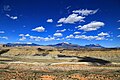
 Distant Henry Mountains - Flickr - pellaea.jpg 3,562 × 2,672; 3.31 MB
-
 Fremont river cainville.jpg 1,024 × 768; 100 KB
-
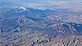 Henry Mountains aerial.jpg 4,564 × 2,568; 4.76 MB
-
 Henry Mountains Beyond the Strike Valley, Capitol Reef National Park, Utah.jpg 5,472 × 3,648; 5.33 MB
-
 Henry Mountains, North of Glen Canyon National Recreation Area, Utah (9181473482).jpg 4,000 × 3,000; 2.31 MB
-
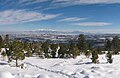
 Henry Mountains, Utah, 2005-06-01.jpg 768 × 512; 202 KB
-
 Henry Mtns, Mt Pennell (3684658339).jpg 1,000 × 750; 170 KB
-
 Henry-waterfold.jpg 1,024 × 666; 103 KB
-
 Henry Mountain grazing - draft environmental impact statement (IA henrymountaingra17unit).pdf 1,252 × 1,677, 170 pages; 36.99 MB
-
 HenryMtns NASA.jpg 1,291 × 1,600; 457 KB
-
 Horndio.jpg 4,000 × 3,000; 2.28 MB
-
 Long-term vegetation change in Utah's Henry Mountains - a study in repeat photography (IA longtermvegetati00kayc).pdf 1,275 × 1,650, 284 pages; 13.74 MB
-
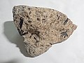
 Metamorphic Aureole in the Henry Mountains.JPG 3,648 × 2,736; 2.87 MB
-
 Mount Ellen, Henry Mountains.jpg 6,321 × 3,645; 7.26 MB
-
 Mount Hillers at the core of the Henry Mountains in Utah.jpg 6,595 × 2,673; 2.57 MB
-
 Mount Hillers from Halls Crossing.jpg 6,199 × 3,215; 5.96 MB
-
 Mount Holmes, Henry Mountains.jpg 7,264 × 4,602; 11.21 MB
-
 Mount Holmes, southwest aspect.jpg 1,170 × 1,194; 423 KB
-
 Mount Pennell, Henry Mountains.jpg 7,750 × 3,951; 7.19 MB
-
 Mount Pennell.jpg 6,233 × 2,740; 3.86 MB
-
 Mts. Pennell and Hillers.jpg 7,713 × 2,405; 4.73 MB
-
 Plateau laccoliths NASA.jpg 900 × 1,124; 324 KB
-

-
 Scenic Byway 12 - View of Henry Mountains - NARA - 7721974.jpg 745 × 485; 321 KB
-

-
 UTMap-doton-HenryMtns.png 153 × 200; 1 KB
-
 View of the Henry Mountains from Goblin Valley SP (4058950212).jpg 1,067 × 1,600; 388 KB


.jpg)


.jpg)


.jpg)
.jpg)


.jpg)