Category:CIA World Factbook maps of India
Jump to navigation
Jump to search
Media in category "CIA World Factbook maps of India"
The following 18 files are in this category, out of 18 total.
-
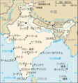
In-map-ja.png 329 × 352; 56 KB
-
India Calcutta-Kolkata 2001.png 653 × 350; 41 KB
-
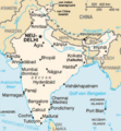
India map Deutsch.png 323 × 349; 18 KB
-
India map mod.png 324 × 351; 17 KB
-
India Map.gif 327 × 351; 17 KB
-
India mapa.png 330 × 355; 15 KB
-
India – U.S. area comparison.jpg 701 × 671; 512 KB
-
India-CIA WFB Map (2004).png 327 × 351; 16 KB
-
India-CIA WFB Map.png 329 × 353; 24 KB
-
Indiamap-mo.JPG 322 × 346; 29 KB
-
Indiamap.gif 329 × 353; 25 KB
-
Map India Ahmedabad.png 330 × 355; 21 KB
-
Map India Bhopal.png 330 × 355; 20 KB
-
Map India Mathura.jpg 330 × 355; 52 KB
-
Map of india position of Agartala highlighted.png 327 × 351; 45 KB
-
Map of india position of Allahabad highlighted.png 327 × 351; 53 KB
-
Map of india with mubai.jpg 330 × 355; 126 KB
-
World Factbook (1982) India.jpg 588 × 587; 92 KB


