Category:CIA World Factbook maps of Lebanon
Jump to navigation
Jump to search
Media in category "CIA World Factbook maps of Lebanon"
The following 21 files are in this category, out of 21 total.
-
 000 Libani harta.PNG 329 × 353; 11 KB
-
 Le-map-uk.gif 495 × 531; 14 KB
-
 Le-map.png 330 × 354; 10 KB
-
 Lebanon 2002 CIA map-ar.jpg 1,606 × 1,979; 1.04 MB
-
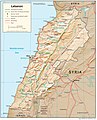
 Lebanon 2002 CIA map.jpg 1,623 × 2,000; 1.36 MB
-
 Lebanon governorates color.png 1,238 × 1,328; 65 KB
-
 Lebanon Physiography.jpg 1,986 × 2,458; 1.56 MB
-
 Lebanon Transportation.jpg 1,986 × 2,458; 1.23 MB
-
 Lebanon – U.S. area comparison.jpg 701 × 851; 348 KB
-
 Lebanon-CIA WFB Map (2004).png 330 × 354; 10 KB
-
 Lebanon-CIA WFB Map.png 329 × 353; 15 KB
-
 Libanon be mapa.png 330 × 354; 21 KB
-
 Libanon.png 330 × 354; 14 KB
-
 Map of Lebanon-ar.png 325 × 349; 42 KB
-
 Map of Lebanon-heb.png 330 × 354; 17 KB
-
 Map of Lebanon-sl.png 330 × 354; 13 KB
-
 Map of Lebanon.png 325 × 349; 10 KB
-
 Map of Lebanon1.PNG 330 × 354; 21 KB
-
 Mapa do Líbano.png 325 × 349; 15 KB
-
 Região do Líbano na cidade de Baskinta aldeia dos Khoury.jpg 217 × 233; 7 KB
-
 World Factbook (1990) Lebanon.jpg 516 × 552; 97 KB


.png)


_Lebanon.jpg)