Category:CIA World Factbook maps of the British Indian Ocean Territory
Jump to navigation
Jump to search
Media in category "CIA World Factbook maps of the British Indian Ocean Territory"
The following 8 files are in this category, out of 8 total.
-
 BIOG-kaart.png 400 × 431; 14 KB
-
 Biot-map-ar.png 328 × 353; 20 KB
-
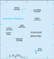
 Biot-map.png 328 × 353; 5 KB
-
 Biot-map.PNG 328 × 353; 7 KB
-
 British indian ocean map DG marked.png 329 × 355; 7 KB
-
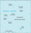
 British Indian Ocean Territory-CIA WFB Map (2004).png 329 × 355; 5 KB
-
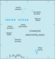
 British Indian Ocean Territory-CIA WFB Map.png 328 × 353; 6 KB
-
 World Factbook (1990) British Indian Ocean Territory.jpg 567 × 532; 28 KB


.png)

_British_Indian_Ocean_Territory.jpg)