Category:Ightenhill
Jump to navigation
Jump to search
English: Ightenhill is a civil parish, and a district of Burnley in Lancashire, England. It has a population of 1,512. (→Ightenhill)
Nederlands: Ightenhill is een plaats en civil parish in het bestuurlijke gebied Burnley, in het Engelse graafschap Lancashire met 1.512 inwoners. (→Ightenhill)

civil parish in Lancashire, UK .jpg) | |||||
| Upload media | |||||
| Instance of | |||||
|---|---|---|---|---|---|
| Location | Burnley, Lancashire, North West England, England | ||||
 | |||||
Subcategories
This category has the following 3 subcategories, out of 3 total.
A
G
- Great Barn, Ightenhill (2 F)
Media in category "Ightenhill"
The following 119 files are in this category, out of 119 total.
-
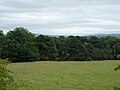
 A View towards Pendle Hill - geograph.org.uk - 5302005.jpg 5,184 × 3,456; 7.36 MB
-
 A6068 - geograph.org.uk - 2314657.jpg 640 × 480; 121 KB
-

-
 Access Lane to Top o' th' Close - geograph.org.uk - 5302001.jpg 5,184 × 3,456; 5.22 MB
-
 All Saints with St John the Baptist Church at Habergham - geograph.org.uk - 4595528.jpg 4,000 × 3,000; 2.52 MB
-
 Approaching Gawthorpe Hall - geograph.org.uk - 2896590.jpg 640 × 480; 691 KB
-
 Barrowford Road (A6068) - geograph.org.uk - 5039480.jpg 640 × 480; 53 KB
-
 Bridleway bridge over River Calder - geograph.org.uk - 1364637.jpg 640 × 480; 104 KB
-
 Bronté Way - geograph.org.uk - 4901434.jpg 3,666 × 2,845; 7.62 MB
-
 Brookfoot Farm on Burnley Way - geograph.org.uk - 3125362.jpg 1,600 × 1,198; 643 KB
-
 Burnley FC training ground - geograph.org.uk - 5337173.jpg 1,024 × 768; 187 KB
-
 Burnley Road, Habergham - geograph.org.uk - 2717955.jpg 3,872 × 2,592; 3.23 MB
-
 Burnley Way above Hunters Oak (geograph 4085512).jpg 4,320 × 3,240; 5.24 MB
-
 Burnley Way descending towards River Calder (geograph 4085488).jpg 4,320 × 3,240; 5.49 MB
-
 Burnley Way east of Hagg Wood - geograph.org.uk - 4527349.jpg 1,600 × 1,200; 834 KB
-
 Burnley Way leaving Ightenhill.jpg 4,011 × 3,008; 6.92 MB
-
 Burnley Way near Whittlefield - geograph.org.uk - 5302016.jpg 5,184 × 3,456; 4.39 MB
-
 Cornfield Grove - geograph.org.uk - 4901451.jpg 4,592 × 2,708; 7.72 MB
-
 Cornfield Grove, Burnley - geograph.org.uk - 762356.jpg 640 × 480; 227 KB
-
 Cornfield Grove, Habergham - geograph.org.uk - 2720966.jpg 3,872 × 2,592; 5.5 MB
-
 Entrance to Hunters Oak Farm on the Burnley Way (geograph 3125309).jpg 1,600 × 1,198; 480 KB
-
 Field entrance and footpath - geograph.org.uk - 5039476.jpg 640 × 480; 63 KB
-
 Footpath to Hag Wood - geograph.org.uk - 4950816.jpg 4,592 × 3,056; 6.6 MB
-
 Footpath, High Whittaker Farm - geograph.org.uk - 2326402.jpg 480 × 640; 74 KB
-
 Former route of the River Calder, Ightenhill.jpg 3,005 × 4,007; 5.17 MB
-
 Friendly Llamas at Top o th Close Farm (geograph 3125331).jpg 1,600 × 1,198; 609 KB
-
 Gate piers at Gawthorpe Hall - geograph.org.uk - 5337124.jpg 1,024 × 768; 276 KB
-
 Gawthorpe Estate, River Calder - geograph.org.uk - 2896860.jpg 640 × 480; 641 KB
-
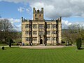
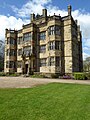
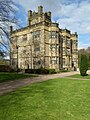
 Gawthorpe Hall - geograph.org.uk - 4900901.jpg 3,273 × 2,548; 7.07 MB
-
 Gawthorpe Hall - geograph.org.uk - 4900919.jpg 4,277 × 2,871; 7.08 MB
-
 Gawthorpe Hall - geograph.org.uk - 5337086.jpg 1,024 × 768; 201 KB
-
 Gawthorpe Hall - geograph.org.uk - 5337091.jpg 1,024 × 768; 200 KB
-
 Gawthorpe Hall - geograph.org.uk - 5337093.jpg 1,024 × 768; 226 KB
-
 Gawthorpe Hall - geograph.org.uk - 5337095.jpg 768 × 1,024; 260 KB
-
 Gawthorpe Hall - geograph.org.uk - 5337112.jpg 768 × 1,024; 276 KB
-
 Gawthorpe Hall - geograph.org.uk - 6362961.jpg 2,592 × 1,944; 1.15 MB
-
 Gawthorpe Hall Garden - geograph.org.uk - 2896841.jpg 640 × 480; 576 KB
-
 Gawthorpe Hall near Padiham - geograph.org.uk - 6482945.jpg 1,799 × 1,199; 339 KB
-
 Gawthorpe Hall Plantation - geograph.org.uk - 2896865.jpg 480 × 640; 623 KB
-
 Gawthorpe Hall, Lancs - geograph.org.uk - 5548845.jpg 2,592 × 1,944; 1.41 MB
-
-
 Grounds of Gawthorpe - geograph.org.uk - 5337119.jpg 1,024 × 768; 239 KB
-
 Grove Lane (geograph 4085491).jpg 4,320 × 3,240; 4.39 MB
-
 Grove Lane Plantation - geograph.org.uk - 2721821.jpg 3,872 × 2,592; 5.72 MB
-
 Habergham Lodge.jpg 640 × 480; 168 KB
-
 High Whitaker Farm - geograph.org.uk - 4083963.jpg 4,320 × 3,240; 2.58 MB
-
 High Whittaker Farm - geograph.org.uk - 136125.jpg 640 × 426; 110 KB
-
 High Whittaker Farm - geograph.org.uk - 2326400.jpg 640 × 480; 122 KB
-
 High Whittaker Farm - geograph.org.uk - 2326401.jpg 640 × 480; 120 KB
-
 High Whittaker Farm - geograph.org.uk - 2328030.jpg 640 × 480; 128 KB
-
 High Whittaker Farm - geograph.org.uk - 2328033.jpg 640 × 480; 121 KB
-
 High Whittaker Farmhouse.jpg 640 × 480; 115 KB
-
 Hollins Farm - geograph.org.uk - 2720952.jpg 3,709 × 2,457; 3.62 MB
-
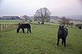 Horses above Top o'th' Close - geograph.org.uk - 2720935.jpg 3,872 × 2,592; 3.84 MB
-
 House near the entrance to Gawthorpe Hall - geograph.org.uk - 5337149.jpg 1,024 × 768; 236 KB
-
 Houses on Cornfield Grove, Burnley - geograph.org.uk - 6128182.jpg 800 × 600; 128 KB
-
 Ightenhill , Barnfield Training Centre - geograph.org.uk - 6360098.jpg 6,000 × 4,000; 6.93 MB
-
 Ightenhill , Footpath - geograph.org.uk - 6360100.jpg 6,000 × 4,000; 6.67 MB
-
 Ightenhill , Gawthorpe Hall - geograph.org.uk - 6360106.jpg 6,000 × 4,000; 6.08 MB
-
 Ightenhill , Gawthorpe Hall - geograph.org.uk - 6360108.jpg 6,000 × 4,000; 7.81 MB
-
 Ightenhill , Great Hall - geograph.org.uk - 6360103.jpg 6,000 × 4,000; 6.38 MB
-
 Ightenhill , Stockbridge Drive - geograph.org.uk - 6360089.jpg 6,000 × 4,000; 7.25 MB
-
 Ightenhill Manor 1.jpg 4,008 × 3,006; 3.42 MB
-
 Ightenhill Manor 2.jpg 4,008 × 3,006; 3.47 MB
-
 Ightenhill Manor 3.jpg 4,008 × 3,005; 4.71 MB
-
 Ightenhill Park Lane - geograph.org.uk - 4949887.jpg 4,589 × 2,201; 7.8 MB
-
 Looking over the garden at Gawthorpe Hall - geograph.org.uk - 6177644.jpg 2,700 × 2,323; 778 KB
-
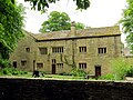
 Manor House Farm, Ightenhill NW.jpg 4,008 × 3,005; 4.94 MB
-
 Manor House Farm, Ightenhill SW.jpg 4,008 × 3,005; 4.84 MB
-
 Office building at Gawthorpe Hall - geograph.org.uk - 6177638.jpg 2,700 × 2,025; 714 KB
-
 Old tramway turning point, Grove Lane, Ightenhill.jpg 3,979 × 2,985; 5.32 MB
-
 One method of waste disposal - geograph.org.uk - 4951180.jpg 4,592 × 3,056; 7.9 MB
-
 Ornate gateposts on Habergham Drive on Gawthorpe Estate - geograph.org.uk - 3125345.jpg 1,600 × 1,198; 795 KB
-
 Padiham 1948 Old OS map - central part.jpg 685 × 471; 371 KB
-
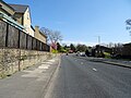 Padiham Road, Burnley - geograph.org.uk - 6128815.jpg 800 × 600; 125 KB
-
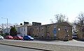 Palace House Care Home, Burnley - geograph.org.uk - 6128817.jpg 800 × 495; 78 KB
-
 Park Hill School, Padiham Road, Burnley.jpg 1,995 × 1,496; 1.33 MB
-
 Parkland at Gawthorpe Hall - geograph.org.uk - 5337176.jpg 1,024 × 768; 351 KB
-
 Path in Hagg Wood - geograph.org.uk - 1364629.jpg 480 × 640; 138 KB
-
 Path to Gawthorpe Hall - geograph.org.uk - 6177637.jpg 2,700 × 2,025; 708 KB
-
 Pendle View Garden Centre, Ightenhill (geograph 4527334).jpg 1,600 × 1,200; 442 KB
-
 Pigs in the mud near Habergham - geograph.org.uk - 2720915.jpg 3,872 × 2,592; 3.84 MB
-
 Public footpath to Habergham - geograph.org.uk - 4527340.jpg 1,600 × 1,200; 672 KB
-
 Puddly gateway near Top o'th' Close - geograph.org.uk - 2720923.jpg 3,872 × 2,592; 3.67 MB
-
 River Calder from Gawthorpe Hall - geograph.org.uk - 2896855.jpg 640 × 480; 608 KB
-
 River Calder, Gawthorpe Estate - geograph.org.uk - 2896858.jpg 640 × 480; 678 KB
-
 Road southeast of High Whittaker Farm - geograph.org.uk - 2326404.jpg 640 × 480; 138 KB
-
 Road to High Whittaker Farm - geograph.org.uk - 2314662.jpg 640 × 480; 117 KB
-
 Road to High Whittaker Farm - geograph.org.uk - 2328039.jpg 480 × 640; 106 KB
-
 Road to Top o'th' Close Farm - geograph.org.uk - 762366.jpg 640 × 480; 221 KB
-
 Sheep congregating in the corner of the field - geograph.org.uk - 2720947.jpg 3,732 × 2,435; 3.19 MB
-
 Slightly misty day in the Calder valley - geograph.org.uk - 2721773.jpg 3,872 × 2,592; 3.18 MB
-
 Stockbridge Drive - geograph.org.uk - 3067684.jpg 2,000 × 3,000; 5.27 MB
-
 Stockbridge Drive to Gawthorpe Hall - geograph.org.uk - 6177626.jpg 2,700 × 2,025; 528 KB
-
 Stockbridge Lane - geograph.org.uk - 2896569.jpg 640 × 480; 659 KB
-
 Stone Bridge, Gawthorpe Hall Plantation - geograph.org.uk - 2896862.jpg 640 × 480; 584 KB
-
 The Brontë Way - geograph.org.uk - 4950799.jpg 3,811 × 2,530; 7.59 MB
-
 The end of the lane - geograph.org.uk - 2721722.jpg 3,872 × 2,592; 4.98 MB
-
 The Great Barn at Gawthorpe Hall - geograph.org.uk - 6177634.jpg 2,700 × 2,025; 474 KB
-
 The River Calder - geograph.org.uk - 4950753.jpg 4,592 × 3,056; 7.72 MB
-
 The River Calder - geograph.org.uk - 4950775.jpg 4,592 × 3,056; 7.66 MB
-
-
 This one is in date - geograph.org.uk - 2328037.jpg 640 × 480; 142 KB
-

-
 Threatening clouds gather over the Bronte Way (geograph 3125323).jpg 1,600 × 1,161; 293 KB
-
 Track descending to Grove Lane (geograph 4083968).jpg 4,320 × 3,240; 2.7 MB
-
 Track leading down into the Calder Valley - geograph.org.uk - 4083972.jpg 4,320 × 3,240; 3.31 MB
-
 View east from High Whittaker Farm - geograph.org.uk - 2328028.jpg 640 × 480; 100 KB
-
 View northeast from High Whittaker Farm - geograph.org.uk - 2328034.jpg 640 × 480; 103 KB
-
 View Northwards from Top o' th' Close - geograph.org.uk - 5301995.jpg 5,184 × 3,456; 5.62 MB
-
 View over the Calder Valley - geograph.org.uk - 5302006.jpg 5,184 × 3,456; 7.35 MB
-
 Winter feed at Cornfield House, Burnley - geograph.org.uk - 762360.jpg 640 × 423; 135 KB
-
 Woodland near Northwood Farm - geograph.org.uk - 5039495.jpg 640 × 480; 93 KB
-
 Bronte Way (Footpath) - geograph.org.uk - 762371.jpg 640 × 480; 167 KB
-
 Cornfield Grove, Burnley - geograph.org.uk - 762355.jpg 640 × 457; 185 KB
-
 Cornfield Grove, Burnley - geograph.org.uk - 762368.jpg 640 × 480; 154 KB
-
 Entrance to Hunters Oak Barn - geograph.org.uk - 107667.jpg 640 × 426; 166 KB
-
 Hollins Farm - geograph.org.uk - 107659.jpg 640 × 426; 130 KB
-
 River Calder - geograph.org.uk - 381694.jpg 640 × 477; 59 KB


_-_geograph.org.uk_-_5039480.jpg)


.jpg)


.jpg)


.jpg)


.jpg)


.jpg)


.jpg)
.jpg)


_-_geograph.org.uk_-_762371.jpg)


