Category:August 2009 in Suffolk
Jump to navigation
Jump to search
Ceremonial counties of England: Bedfordshire · Berkshire · Buckinghamshire · Cambridgeshire · Cheshire · Cornwall · Cumbria · Derbyshire · Devon · Dorset · East Riding of Yorkshire · East Sussex · Essex · Gloucestershire · Greater London · Greater Manchester · Hampshire · Herefordshire · Hertfordshire · Isle of Wight · Kent · Lancashire · Leicestershire · Lincolnshire · Merseyside · Norfolk · North Yorkshire · Northamptonshire · Northumberland · Nottinghamshire · Oxfordshire · Shropshire · Somerset · South Yorkshire · Staffordshire · Suffolk · Surrey · Tyne and Wear · Warwickshire · West Midlands · West Sussex · West Yorkshire · Wiltshire · Worcestershire
City-counties: Bristol ·
Former historic counties:
Other former counties:
City-counties: Bristol ·
Former historic counties:
Other former counties:
Deutsch: Bilder, die im August 2009 in Suffolk aufgenommen worden sind. Bitte beachten Sie, dass dies weder das Datum des Uploads noch das Datum des Scannens eines Fotos ist.
English: Images/pictures taken in Suffolk during August 2009. Note this is not the date of the upload, nor the date a photo was scanned.
Español: Fotografías o imágenes tomadas en Suffolk durante agosto 2009. No es la fecha de subida ni escaneo, sino la fecha en que las fotografías o imágenes se crearon.
Esperanto: Bildoj faritaj en Suffolk en aŭgusto 2009. Tio ne estas la dato, kiam la bildoj estis alŝutitaj aŭ skanitaj.
Français : Photographies ou images prises en Suffolk durant août 2009. Ce n'est pas la date du téléchargement ou du scan.
Galego: Fotografías ou imaxes tomadas en Suffolk durante agosto 2009. Non é a data de subida nin escaneamento, senón a data na que se crearon as fotografías ou imaxes.
Italiano: Fotografie o immagini scattate a Suffolk nel agosto 2009. Nota bene: la data non si riferisce né a quella di upload né a quella in cui la foto è stata digitalizzata.
Norsk bokmål: Bilder tatt i Suffolk i løpet av august 2009. Merk at dette ikke er datoen for opplasting, eller når et bilde har blitt skannet.
Norsk nynorsk: Bilete teke i Suffolk i løpet av august 2009. Merk at dette ikkje er datoen for opplasting, eller når eit bilete har vorte skanna.
Русский: Изображения, сделанные в Suffolk в течение август 2009 (не дата загрузки изображения).
Українська: Зображення, зроблені в Suffolk протягом серпень 2009. Зауважте, що це не дата завантаження чи дата сканування фотографії.
| August 2008 | ← | August 2009 | → | August 2010 | |||||||
| Jan | Feb | Mar | Apr | May | Jun | Jul | Aug | Sep | Oct | Nov | Dec |
| 178 | 160 | 129 | 183 | 213 | 109 | 173 | 235 | 149 | 46 | 94 | 72 |
|---|---|---|---|---|---|---|---|---|---|---|---|
Media in category "August 2009 in Suffolk"
The following 200 files are in this category, out of 235 total.
(previous page) (next page)-

-
 A raft of cormorants - geograph.org.uk - 1428823.jpg 640 × 414; 102 KB
-
 A1120 and Swan Inn Postbox, Ashfield - geograph.org.uk - 1441206.jpg 3,072 × 2,304; 1.49 MB
-

-
 A12 London Road, Darsham and High Street Postbox - geograph.org.uk - 1440618.jpg 3,072 × 2,304; 1.44 MB
-
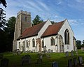 All Saints Church, Brandeston - geograph.org.uk - 1424549.jpg 640 × 510; 91 KB
-
 All Saints Church, Brandeston - geograph.org.uk - 1424553.jpg 640 × 473; 88 KB
-
 Allotments - geograph.org.uk - 1465310.jpg 640 × 480; 98 KB
-
 Asda 24 hour store - geograph.org.uk - 1461057.jpg 640 × 480; 62 KB
-
 B1122 Leiston Road,and Post Office, Theberton, Postbox - geograph.org.uk - 1440817.jpg 3,072 × 2,304; 1.42 MB
-
 Beccles Railway Station - Front - geograph.org.uk - 1460542.jpg 640 × 480; 55 KB
-
 Beccles station disused platforms - geograph.org.uk - 1460580.jpg 640 × 480; 76 KB
-
 Beccles Town Sign - geograph.org.uk - 1438286.jpg 3,072 × 2,304; 1.41 MB
-
 Beccles Town Sign - geograph.org.uk - 1438287.jpg 3,072 × 2,304; 1.32 MB
-

-
 Bruisyard Road and College Farm Postbox - geograph.org.uk - 1442037.jpg 3,072 × 2,304; 1.61 MB
-

-
 Business units at Charles Tye - geograph.org.uk - 1429270.jpg 640 × 453; 82 KB
-
 Butchers Arms Public House - geograph.org.uk - 1448331.jpg 3,072 × 2,304; 1.31 MB
-
 Butchers Arms Public House - geograph.org.uk - 1448335.jpg 3,072 × 2,304; 1.34 MB
-
 By Low Street, Brandeston - geograph.org.uk - 1424527.jpg 640 × 457; 128 KB
-
 By the carpark near Landguard Fort - geograph.org.uk - 1442095.jpg 640 × 480; 67 KB
-
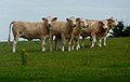
 Cattle in a meadow near woodland - geograph.org.uk - 1451763.jpg 640 × 401; 91 KB
-
 Central square at the arc - geograph.org.uk - 1460248.jpg 640 × 481; 95 KB
-
 Chapel House, Brandeston - geograph.org.uk - 1424573.jpg 640 × 480; 108 KB
-
 Church interior - geograph.org.uk - 1514800.jpg 640 × 457; 195 KB
-

-

-

-
 Coldfair Green Postbox - geograph.org.uk - 1448722.jpg 2,304 × 3,072; 1.75 MB
-
 College Farm Postbox - geograph.org.uk - 1442038.jpg 2,304 × 3,072; 3.11 MB
-
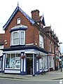 Corner Shop - geograph.org.uk - 1438478.jpg 480 × 640; 89 KB
-

-
 Cottages in Brandeston - geograph.org.uk - 1424538.jpg 640 × 549; 158 KB
-
 Country Footpath - geograph.org.uk - 1454946.jpg 480 × 640; 110 KB
-

-
 Crown Point Postbox, Main Road, Martlesham - geograph.org.uk - 1457846.jpg 2,304 × 3,072; 2.61 MB
-
 Curious young cattle - geograph.org.uk - 1424599.jpg 640 × 407; 59 KB
-
 Cycle shop on Hadleigh Road - geograph.org.uk - 1468457.jpg 640 × 480; 126 KB
-

-

-
 Doorcase, Ipswich - geograph.org.uk - 1462470.jpg 475 × 640; 106 KB
-
 Duke Street, Hadleigh - geograph.org.uk - 1439106.jpg 640 × 610; 104 KB
-
 Dunwich Beach, Looking South - geograph.org.uk - 1459470.jpg 640 × 480; 67 KB
-
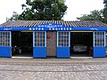
 East Anglia Transport Museum - geograph.org.uk - 1736668.jpg 3,072 × 2,304; 2.91 MB
-
 East Anglia Transport Museum - geograph.org.uk - 1736675.jpg 3,072 × 2,304; 2.32 MB
-
 East Anglian Transport Museum - geograph.org.uk - 1736655.jpg 3,072 × 2,304; 2.8 MB
-
 East Anglian Transport Museum - geograph.org.uk - 1736660.jpg 3,072 × 2,304; 3.03 MB
-
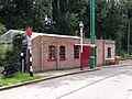
 East Suffolk Line - geograph.org.uk - 1735668.jpg 2,304 × 3,072; 2.65 MB
-
 East Suffolk Line - geograph.org.uk - 1735676.jpg 2,304 × 3,072; 2.95 MB
-
 East Suffolk Line - geograph.org.uk - 1735698.jpg 3,072 × 2,304; 2.7 MB
-
-
 Elliott Street, Ipswich - geograph.org.uk - 1468379.jpg 640 × 480; 104 KB
-

-
 Entrance to Garden Barn - geograph.org.uk - 1460179.jpg 640 × 480; 152 KB
-
 Evening Flight - geograph.org.uk - 1438652.jpg 640 × 480; 25 KB
-
 Ever Summit (ship, 2007) 001.jpg 1,582 × 660; 665 KB
-
 Falcon Street, Walton - geograph.org.uk - 1443346.jpg 640 × 480; 81 KB
-
 Felixstowe Police Station - geograph.org.uk - 1442309.jpg 640 × 447; 75 KB
-
 Field and trees, Smallwood Green - geograph.org.uk - 1451634.jpg 640 × 480; 91 KB
-
 Field near Capel Farm - geograph.org.uk - 1451853.jpg 640 × 480; 98 KB
-
 Field north of Hadleigh Road - geograph.org.uk - 1468493.jpg 640 × 443; 106 KB
-
 Field north of Kiln Wood - geograph.org.uk - 1424592.jpg 640 × 480; 99 KB
-
 Field of stubble and dead tree - geograph.org.uk - 1424335.jpg 442 × 640; 79 KB
-
 Fields by the Angles Way - geograph.org.uk - 1462707.jpg 480 × 640; 84 KB
-
 Fields towards Hill House Farm - geograph.org.uk - 1440905.jpg 640 × 466; 92 KB
-
 Footbridge across flooded gravel pits - geograph.org.uk - 1464350.jpg 640 × 480; 138 KB
-

-
 Footpath across the golf course - geograph.org.uk - 1424784.jpg 640 × 480; 97 KB
-
 Footpath by the churchyard - geograph.org.uk - 1442369.jpg 640 × 419; 88 KB
-
 Footpath into Wolves Wood RSPB Reserve - geograph.org.uk - 1464335.jpg 640 × 480; 150 KB
-
 Footpath of B1121 South Entrance - geograph.org.uk - 1457601.jpg 3,072 × 2,304; 1.36 MB
-
 Footpath off Judith Avenue - geograph.org.uk - 1448706.jpg 2,304 × 3,072; 2.42 MB
-
 Footpath to church - geograph.org.uk - 1457234.jpg 427 × 640; 101 KB
-
 Footpath To Shelland Wood - geograph.org.uk - 1460936.jpg 640 × 480; 94 KB
-
 Footpath towards Cretingham - geograph.org.uk - 1424589.jpg 640 × 480; 105 KB
-
 Four Crossways Victorian Postbox Box - geograph.org.uk - 1440765.jpg 2,304 × 3,072; 2.3 MB
-
 Framsden Post Mill - geograph.org.uk - 1455028.jpg 457 × 640; 98 KB
-
 Friar Street - geograph.org.uk - 1514639.jpg 640 × 457; 202 KB
-
 Gate by lane corner - geograph.org.uk - 1424224.jpg 640 × 501; 122 KB
-
 Gateway near lane junction - geograph.org.uk - 1424451.jpg 640 × 480; 141 KB
-
 Gateway to maize field - geograph.org.uk - 1427226.jpg 640 × 427; 118 KB
-
 George Street, Hadleigh - geograph.org.uk - 1438713.jpg 640 × 472; 79 KB
-
 George VI Postbox Bank Corner Yoxford - geograph.org.uk - 1448059.jpg 2,304 × 3,072; 2.09 MB
-
 Hadleigh High Street - geograph.org.uk - 1439126.jpg 640 × 480; 90 KB
-
 Hadleigh High Street - geograph.org.uk - 1439134.jpg 640 × 457; 77 KB
-
 Hadleigh Road, Ipswich - geograph.org.uk - 1468469.jpg 640 × 480; 90 KB
-
 Hargrave village sign - geograph.org.uk - 1461290.jpg 621 × 640; 260 KB
-
 Harvested field near Minsmere - geograph.org.uk - 1596709.jpg 640 × 428; 66 KB
-
 Harvested wheat field at Pitcher's Green - geograph.org.uk - 1457248.jpg 640 × 427; 105 KB
-
 Harvesting at Pitcher's Green - geograph.org.uk - 1457252.jpg 640 × 427; 77 KB
-
 Heron Road Postbox - geograph.org.uk - 1448266.jpg 2,304 × 3,072; 2.7 MB
-
 High Street Postbox - geograph.org.uk - 1440619.jpg 2,304 × 3,072; 2.22 MB
-
 Holy Trinity church - geograph.org.uk - 1514794.jpg 457 × 640; 194 KB
-
 Holy Trinity church - geograph.org.uk - 1514822.jpg 640 × 457; 176 KB
-
 House by Low Street - geograph.org.uk - 1424535.jpg 640 × 427; 93 KB
-
 House by Wattisham Road - geograph.org.uk - 1429275.jpg 640 × 480; 95 KB
-
 House in Chelmondiston - geograph.org.uk - 1432975.jpg 640 × 480; 89 KB
-
 Houseboat "The Potamus" - geograph.org.uk - 1443069.jpg 640 × 480; 100 KB
-
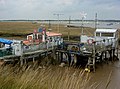 Houseboat by the Deben - geograph.org.uk - 1443060.jpg 640 × 473; 102 KB
-
 Houses by Gulpher Road - geograph.org.uk - 1443320.jpg 640 × 472; 84 KB
-
 Houses set back from Pinmill Road - geograph.org.uk - 1432804.jpg 640 × 480; 121 KB
-
 Inside Brandeston church - geograph.org.uk - 1424554.jpg 640 × 480; 70 KB
-
 Inside Cretingham church - geograph.org.uk - 1424809.jpg 480 × 640; 68 KB
-
 Inside of St.John the Baptist Church, Snape - geograph.org.uk - 1448926.jpg 2,304 × 3,072; 1.63 MB
-
 Inside Old Felixstowe church - geograph.org.uk - 1442356.jpg 640 × 480; 79 KB
-
 Inside St Mary's Church - geograph.org.uk - 1462721.jpg 480 × 640; 85 KB
-
 Isolated house - geograph.org.uk - 1424308.jpg 640 × 477; 80 KB
-
 Judith Avenue and Postbox - geograph.org.uk - 1448701.jpg 3,072 × 2,304; 1.39 MB
-
 Judith Avenue Postbox - geograph.org.uk - 1448705.jpg 2,304 × 3,072; 2.32 MB
-
 Kissing Gate on Deer Park Fence - geograph.org.uk - 1451439.jpg 640 × 480; 136 KB
-
 Knodishall Village Sign - geograph.org.uk - 1448276.jpg 2,304 × 3,072; 1.87 MB
-
 Knodishall Village Sign - geograph.org.uk - 1448280.jpg 2,304 × 3,072; 1.46 MB
-
 Lane junction at Charles Tye - geograph.org.uk - 1429263.jpg 640 × 445; 68 KB
-
 Lane towards Brandeston - geograph.org.uk - 1424518.jpg 480 × 640; 110 KB
-
 Large field near Crouch House - geograph.org.uk - 1432887.jpg 640 × 484; 75 KB
-
 Large field near Crouch House - geograph.org.uk - 1432906.jpg 640 × 448; 110 KB
-
 Large open fields - geograph.org.uk - 1439040.jpg 640 × 480; 88 KB
-
 Large patch of thistles - geograph.org.uk - 1429406.jpg 640 × 410; 99 KB
-
 St Margaret Leiston - geograph.org.uk - 1442589.jpg 640 × 480; 93 KB
-
 Looking across the Orwell - geograph.org.uk - 1432806.jpg 640 × 426; 90 KB
-
 Looking along Cliff Road - geograph.org.uk - 1442479.jpg 640 × 480; 60 KB
-
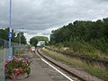
 Lowestoft Railway station - geograph.org.uk - 1460672.jpg 640 × 480; 67 KB
-
 Lowestoft Railway Station - geograph.org.uk - 1460689.jpg 480 × 640; 72 KB
-
 Martello tower, custom car - geograph.org.uk - 1467860.jpg 640 × 481; 66 KB
-
 Martello Tower, South Felixstowe - geograph.org.uk - 1467931.jpg 640 × 481; 65 KB
-
 Moot Hall Aldeburgh - geograph.org.uk - 1467295.jpg 640 × 480; 59 KB
-
 Napped flintwork - geograph.org.uk - 1514808.jpg 457 × 640; 251 KB
-
 New housing development by Boswell Lane - geograph.org.uk - 1439029.jpg 640 × 503; 103 KB
-
 New riverside flats on Ranelagh Road - geograph.org.uk - 1467688.jpg 640 × 450; 91 KB
-
 Old boat by the Gipping - geograph.org.uk - 1467760.jpg 640 × 480; 110 KB
-
 Old Garage - geograph.org.uk - 1438422.jpg 640 × 480; 71 KB
-
 Old level crossing on Ranelagh Road - geograph.org.uk - 1467671.jpg 640 × 474; 102 KB
-
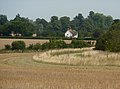
 Open fields - geograph.org.uk - 1424508.jpg 640 × 476; 99 KB
-
 Orford Road, Felixstowe - geograph.org.uk - 1442161.jpg 640 × 461; 85 KB
-
 Path between wheat fields - geograph.org.uk - 1424208.jpg 640 × 483; 107 KB
-
 Path in Cliff Plantation - geograph.org.uk - 1432828.jpg 640 × 464; 110 KB
-
 Path through Bradfield Woods - geograph.org.uk - 1451867.jpg 640 × 480; 179 KB
-
 Path through the clover - geograph.org.uk - 1451833.jpg 640 × 379; 78 KB
-
 Path to Church Lane - geograph.org.uk - 1424429.jpg 640 × 460; 105 KB
-
 Path towards the corner of New Covert - geograph.org.uk - 1432889.jpg 640 × 480; 108 KB
-
 Pig farming - geograph.org.uk - 1432892.jpg 640 × 446; 84 KB
-
 Ploughed Field - geograph.org.uk - 1470415.jpg 640 × 480; 93 KB
-
 Pond by the golf course - geograph.org.uk - 1424786.jpg 640 × 408; 133 KB
-
 Pond by the lane to Battsiford - geograph.org.uk - 1429560.jpg 640 × 451; 92 KB
-
 Pond in the village gardens - geograph.org.uk - 1424477.jpg 640 × 450; 143 KB
-
 Poppies and mayweed - geograph.org.uk - 1424317.jpg 640 × 378; 132 KB
-
 Post Office Postbox - geograph.org.uk - 1442028.jpg 2,304 × 3,072; 2.75 MB
-
 Post Office Road and Postbox - geograph.org.uk - 1448297.jpg 3,072 × 2,304; 1.53 MB
-
 Post Office Road Postbox - geograph.org.uk - 1448300.jpg 2,304 × 3,072; 2.98 MB
-
 Postbox, Brussels Green - geograph.org.uk - 1440668.jpg 2,304 × 3,072; 3.03 MB
-
 Potter's Reach of the Orwell estuary - geograph.org.uk - 1432814.jpg 640 × 424; 81 KB
-
 Railway line by Gippeswyk Park - geograph.org.uk - 1467584.jpg 640 × 480; 112 KB
-

-
 Ransomes Roller - geograph.org.uk - 1446604.jpg 480 × 640; 121 KB
-

-
 Reflections in the River Lark - geograph.org.uk - 1439424.jpg 640 × 427; 90 KB
-
 River Blyth opposite Southwold - geograph.org.uk - 1597547.jpg 640 × 428; 57 KB
-
 River Lark east of Barton Mills - geograph.org.uk - 1439419.jpg 640 × 427; 101 KB
-
 River Stour - geograph.org.uk - 1514649.jpg 640 × 457; 190 KB
-
 River Stour - geograph.org.uk - 1514668.jpg 640 × 457; 223 KB
-
 Robin's pincushion - Rose bedeguar gall - geograph.org.uk - 1424160.jpg 640 × 536; 101 KB
-
 Row of houses in Chelmondiston - geograph.org.uk - 1432803.jpg 640 × 468; 101 KB
-
 School Lane and Postbox - geograph.org.uk - 1457824.jpg 3,072 × 2,304; 1.52 MB
-
 School Lane and Postbox No. IP13 6214 - geograph.org.uk - 1457817.jpg 3,072 × 2,304; 1.65 MB
-
 School Lane Postbox - geograph.org.uk - 1457823.jpg 2,304 × 3,072; 2.74 MB
-
 School Road and Postbox - geograph.org.uk - 1448727.jpg 3,072 × 2,304; 1.43 MB
-
 School Road Postbox - geograph.org.uk - 1448735.jpg 2,304 × 3,072; 2.66 MB
-

-
 Seaside amusement park at Felixstowe - geograph.org.uk - 1442155.jpg 640 × 480; 96 KB
-
 Seed heads agains a blue sky - geograph.org.uk - 1440932.jpg 640 × 531; 136 KB
-
 Shopping centre car park - geograph.org.uk - 1468305.jpg 640 × 480; 95 KB
-
 Shore near Landguard Point - geograph.org.uk - 1442116.jpg 640 × 480; 69 KB
-

-
 Signal gantry - geograph.org.uk - 1467570.jpg 640 × 480; 119 KB
-
 Signpost at Little Saxham - geograph.org.uk - 1468776.jpg 640 × 427; 81 KB
-
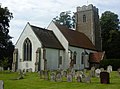
 St Andrew's Church, Chelmondiston - geograph.org.uk - 1432798.jpg 640 × 501; 70 KB
-
 St Andrew's Great Saxham - geograph.org.uk - 1445028.jpg 640 × 480; 82 KB
-
 St Mary And Old Roller - geograph.org.uk - 1446598.jpg 480 × 640; 91 KB
-
 St Mary Creeting St Mary - geograph.org.uk - 1445103.jpg 640 × 480; 74 KB
-
 St Mary Little Blakenham - geograph.org.uk - 1467525.jpg 480 × 640; 116 KB
-
 St Mary Little Blakenham - geograph.org.uk - 1469529.jpg 640 × 480; 140 KB
-
 Stained glass, Chelmondiston church - geograph.org.uk - 1432801.jpg 419 × 640; 124 KB
-
 Stained glass, Old Felixstowe Church - geograph.org.uk - 1442363.jpg 480 × 640; 116 KB
-
 Stubble field - geograph.org.uk - 1460970.jpg 640 × 480; 151 KB
-
-
 Swan Inn Postbox, Ashfield - geograph.org.uk - 1441215.jpg 2,304 × 3,072; 3.07 MB
-
 Thatched house with ladders - geograph.org.uk - 1424569.jpg 640 × 448; 95 KB
-
 The Guildhall Hadleigh - geograph.org.uk - 1438455.jpg 640 × 480; 82 KB
-

-
 The King's Head, Southwold - geograph.org.uk - 1597717.jpg 640 × 428; 61 KB
-
 The Pier, Felixstowe - geograph.org.uk - 1467954.jpg 640 × 473; 96 KB
-
 The Ship Inn Sign, St.James Street, Dunwich - geograph.org.uk - 1448814.jpg 2,304 × 3,072; 2.02 MB
-
 The Ship Inn, St.James Street, Dunwich - geograph.org.uk - 1448812.jpg 3,072 × 2,304; 1.37 MB
-
 The White Horse - geograph.org.uk - 1467672.jpg 640 × 480; 70 KB
-
 The White Lion Hotel and town sign - geograph.org.uk - 1495715.jpg 640 × 462; 55 KB
-
 Three Mariners - geograph.org.uk - 1431966.jpg 640 × 480; 99 KB
-
 Towards the tip of Landguard Point - geograph.org.uk - 1442139.jpg 640 × 480; 58 KB
-
 Tower and flowers - geograph.org.uk - 1424490.jpg 429 × 640; 100 KB
-
 Town House Postbox - geograph.org.uk - 1441258.jpg 2,304 × 3,072; 2.51 MB


_-_geograph.org.uk_-_1428822.jpg)


_001.jpg)


