Category:Arun District
Appearance
local government district in West Sussex, England | |||||
| Upload media | |||||
| Instance of | |||||
|---|---|---|---|---|---|
| Location | West Sussex, South East England, England | ||||
| Capital | |||||
| Legislative body |
| ||||
| Population |
| ||||
| Area |
| ||||
| official website | |||||
 | |||||
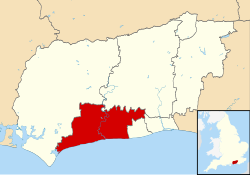
English: Arun is a local government district of the county of West Sussex in England.
Subcategories
This category has the following 32 subcategories, out of 32 total.
Media in category "Arun District"
The following 39 files are in this category, out of 39 total.
-
Arun Civic Centre - geograph.org.uk - 608161.jpg 640 × 480; 94 KB
-
Arun District Council Blue Plaque (not Historic England)..jpg 4,039 × 4,039; 2.83 MB
-
Arun District Council election 2011 map.svg 1,425 × 925; 384 KB
-
Arun UK ward map 2015.svg 635 × 380; 199 KB
-
Arun UK ward map 2019.svg 635 × 380; 199 KB
-
Arun UK ward map 2023.svg 635 × 380; 199 KB
-
Arundel Castle aerial view cropped.jpg 955 × 1,647; 1.14 MB
-
B2132 junction with A259 - geograph.org.uk - 3624717.jpg 3,264 × 2,448; 4.06 MB
-
Barrier on Worms Lane - geograph.org.uk - 3624897.jpg 3,264 × 2,448; 4.88 MB
-
Flag of Arun.jpg 1,200 × 800; 56 KB
-
Footpath 3052 at Middleton-on-Sea - geograph.org.uk - 3624858.jpg 3,264 × 2,448; 4.6 MB
-
Footpath 829 to the beach at Elmer - geograph.org.uk - 3624755.jpg 3,264 × 2,448; 3.95 MB
-
Garden - panoramio.jpg 1,024 × 768; 295 KB
-
Gateway - panoramio.jpg 1,024 × 768; 380 KB
-
Grounds of the Bailiff's Court Hotel - panoramio.jpg 1,667 × 846; 1.34 MB
-
Map of Arun (Region).png 1,068 × 1,285; 489 KB
-
Map of Arun (region).png 1,068 × 1,285; 502 KB
-
Mine's A Pint^ - geograph.org.uk - 891230.jpg 479 × 640; 112 KB
-
Motte - panoramio - Alistair Cunningham (1).jpg 1,024 × 768; 366 KB
-
Motte - panoramio.jpg 1,024 × 768; 313 KB
-
Not the Footpath to Decoy Wood - geograph.org.uk - 1254993.jpg 640 × 480; 79 KB
-
Oak tree by the north end of Footpath 161 - geograph.org.uk - 3624732.jpg 3,264 × 2,448; 5.21 MB
-
Outside the castle - panoramio.jpg 1,024 × 768; 316 KB
-
Parasols at The Cabin on Elmer Road - geograph.org.uk - 3624769.jpg 3,264 × 2,448; 3.63 MB
-
Please Drive Slowly - geograph.org.uk - 1443770.jpg 640 × 427; 103 KB
-
River Arun - panoramio.jpg 1,024 × 768; 283 KB
-
River Arun Colorful Sunset - panoramio.jpg 2,048 × 1,536; 1.39 MB
-
Sea defences and private gardens along Middleton beach - geograph.org.uk - 3624866.jpg 3,264 × 2,448; 2.92 MB
-
Sticky little buds (4578515146).jpg 640 × 480; 171 KB
-
Stop Look Listen - geograph.org.uk - 891283.jpg 479 × 640; 88 KB
-
Strange cactus flower ... (3424258095).jpg 2,832 × 2,128; 961 KB
-
Sunset Looking up the River Arun - panoramio.jpg 2,048 × 1,536; 470 KB
-
The cactus collection at Manor Nurseries (3425123086).jpg 2,832 × 2,128; 2.04 MB
-
The Loop - geograph.org.uk - 849946.jpg 640 × 480; 49 KB
-
The Manor Nursery cactus collection (3425123080).jpg 2,832 × 2,128; 1.46 MB
-
Thomas Walder (5472894507).jpg 1,920 × 2,560; 1.95 MB
-
UK Arun Council 2019.svg 360 × 185; 3 KB
-
UK ARUN District Council 2023 2023.svg 360 × 185; 4 KB
-
View from the castle - panoramio.jpg 1,024 × 768; 278 KB


