Category:Rustington
Jump to navigation
Jump to search
village in West Sussex, England  | |||||
| Upload media | |||||
| Instance of | |||||
|---|---|---|---|---|---|
| Location | Arun, West Sussex, South East England, England | ||||
| Area |
| ||||
| Said to be the same as | Rustington (Wikimedia duplicated page, civil parish) | ||||
| official website | |||||
 | |||||
Subcategories
This category has the following 6 subcategories, out of 6 total.
K
- Kingdom Hall, Rustington (5 F)
R
- Rustington House (2 F)
- Rustington Methodist Church (5 F)
Media in category "Rustington"
The following 200 files are in this category, out of 326 total.
(previous page) (next page)-

-
 1899-08-08-Porthos.jpg 513 × 516; 72 KB
-
 1st Rustington Scout HQ - geograph.org.uk - 4843951.jpg 640 × 480; 74 KB
-
 A bleak scene on Broadmark Beach - geograph.org.uk - 1671409.jpg 640 × 455; 44 KB
-
 A dull January day in Hawthorn Close - geograph.org.uk - 1670173.jpg 640 × 480; 71 KB
-
 A dull January day in Sea Lane - geograph.org.uk - 1670101.jpg 640 × 480; 53 KB
-
-
-
 A gloomy day on Broadmark Beach - geograph.org.uk - 1671371.jpg 640 × 480; 73 KB
-
 A soggy scene on Broadmark Beach - geograph.org.uk - 1671395.jpg 640 × 480; 47 KB
-
 A wet and windy day in Dolphin Way - geograph.org.uk - 1671189.jpg 640 × 480; 62 KB
-
 A wet day in Mallon Deane (1) - geograph.org.uk - 1671279.jpg 640 × 480; 50 KB
-
 A wet day in Mallon Deane (10) - geograph.org.uk - 1671307.jpg 640 × 480; 66 KB
-
 A wet day in Mallon Deane (11) - geograph.org.uk - 1671310.jpg 640 × 480; 51 KB
-
 A wet day in Mallon Deane (12) - geograph.org.uk - 1671313.jpg 640 × 480; 46 KB
-
 A wet day in Mallon Deane (13) - geograph.org.uk - 1671316.jpg 640 × 480; 51 KB
-
 A wet day in Mallon Deane (14) - geograph.org.uk - 1671330.jpg 640 × 480; 53 KB
-
 A wet day in Mallon Deane (15) - geograph.org.uk - 1671328.jpg 640 × 480; 56 KB
-
 A wet day in Mallon Deane (15) - geograph.org.uk - 1671331.jpg 640 × 480; 69 KB
-
 A wet day in Mallon Deane (16) - geograph.org.uk - 1671336.jpg 640 × 480; 64 KB
-
 A wet day in Mallon Deane (2) - geograph.org.uk - 1671280.jpg 640 × 480; 55 KB
-
 A wet day in Mallon Deane (3) - geograph.org.uk - 1671274.jpg 640 × 480; 43 KB
-
 A wet day in Mallon Deane (4) - geograph.org.uk - 1671281.jpg 480 × 640; 44 KB
-
 A wet day in Mallon Deane (5) - geograph.org.uk - 1671292.jpg 640 × 480; 49 KB
-
 A wet day in Mallon Deane (6) - geograph.org.uk - 1671295.jpg 640 × 480; 63 KB
-
 A wet day in Mallon Deane (7) - geograph.org.uk - 1671297.jpg 640 × 480; 88 KB
-
 A wet day in Mallon Deane (8) - geograph.org.uk - 1671296.jpg 640 × 480; 50 KB
-
 A wet day in Mallon Deane (9) - geograph.org.uk - 1671298.jpg 640 × 480; 56 KB
-
 Angmering, Level Crossing - geograph.org.uk - 2487768.jpg 640 × 480; 89 KB
-
 Approaching a bend in Seafield Road - geograph.org.uk - 1670166.jpg 640 × 480; 58 KB
-
 Approaching a postbox in Sea Lane - geograph.org.uk - 1670111.jpg 640 × 480; 58 KB
-

-

-

-

-

-

-

-

-

-

-

-
 Ash Lane, Rustington - geograph.org.uk - 5823401.jpg 2,004 × 1,478; 1.17 MB
-
 Beach at Rustington - geograph.org.uk - 3685949.jpg 1,600 × 1,200; 458 KB
-
 Beach huts at Littlehampton - geograph.org.uk - 3685996.jpg 1,600 × 1,200; 557 KB
-

-
 Beach huts on Broadmark Beach - geograph.org.uk - 1671369.jpg 640 × 480; 76 KB
-
 Beach huts, Rustington - geograph.org.uk - 5699347.jpg 640 × 428; 117 KB
-
 Beach, Rustington - geograph.org.uk - 5699324.jpg 640 × 428; 112 KB
-
 Bend at the top of Evelyn Avenue - geograph.org.uk - 1671168.jpg 640 × 480; 84 KB
-
 Bottom end of Broadmark Lane - geograph.org.uk - 1671259.jpg 640 × 480; 48 KB
-

-
 Broadmark Way - geograph.org.uk - 1671035.jpg 640 × 480; 48 KB
-
 Broadstrand - geograph.org.uk - 1671380.jpg 640 × 480; 73 KB
-
 Brookfield Park - geograph.org.uk - 616233.jpg 640 × 480; 76 KB
-

-
 Bungalows in Dolphin Way - geograph.org.uk - 1671177.jpg 640 × 480; 57 KB
-
 Bungalows in Evelyn Avenue - geograph.org.uk - 1671167.jpg 640 × 480; 56 KB
-
 Bungalows in Mariners Walk - geograph.org.uk - 1671200.jpg 640 × 480; 67 KB
-
 Bungalows in Seafield Road - geograph.org.uk - 1670202.jpg 640 × 392; 58 KB
-
 Bungalows in Sutton Avenue - geograph.org.uk - 1671214.jpg 640 × 480; 58 KB
-
 Bungalows near Summers Close - geograph.org.uk - 1671020.jpg 640 × 480; 57 KB
-
 Bus in Ash Lane - geograph.org.uk - 1667086.jpg 640 × 480; 78 KB
-
 Bus shelter in Sea Lane - geograph.org.uk - 1670200.jpg 640 × 480; 52 KB
-
 Bus stops on Sea Road - geograph.org.uk - 4970682.jpg 800 × 600; 104 KB
-
 Corbetts Tyres in Sea Lane - geograph.org.uk - 1670125.jpg 640 × 480; 55 KB
-

-
 Crane over Elm Place - geograph.org.uk - 1943747.jpg 428 × 640; 78 KB
-

-
 Datestone on the old school - geograph.org.uk - 4843958.jpg 640 × 480; 86 KB
-
 Delivery van in Broadmark Lane - geograph.org.uk - 1671037.jpg 640 × 480; 56 KB
-
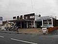
 Dentists in The Street - geograph.org.uk - 4843960.jpg 640 × 480; 112 KB
-
 Dragon in Sea Lane - geograph.org.uk - 1670108.jpg 640 × 480; 51 KB
-
 East Preston, shopping parade - geograph.org.uk - 6118835.jpg 1,024 × 756; 100 KB
-
 East Preston, Willowhayne - geograph.org.uk - 5884421.jpg 1,024 × 768; 184 KB
-
 Empty seat on Broadmark Beach - geograph.org.uk - 1671414.jpg 640 × 480; 72 KB
-

-
 Flats in Mallon Deane - geograph.org.uk - 1671343.jpg 640 × 480; 60 KB
-
 Flats in Overstrand Avenue - geograph.org.uk - 1670030.jpg 640 × 480; 78 KB
-
 Flats on Broadmark Beach - geograph.org.uk - 1671337.jpg 640 × 480; 62 KB
-
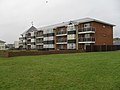
 Flats on Sea Road - geograph.org.uk - 4970688.jpg 800 × 600; 103 KB
-
 Flats on Sea Road, Rustington - geograph.org.uk - 3132844.jpg 1,600 × 1,200; 490 KB
-
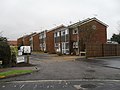
 Flats on Station Road, Rustington - geograph.org.uk - 5823397.jpg 2,024 × 1,502; 1.15 MB
-
 Flats overlooking Rustington Beach - geograph.org.uk - 3320085.jpg 1,600 × 1,200; 697 KB
-
 Glenville Road - geograph.org.uk - 1671113.jpg 640 × 480; 67 KB
-
 Green and beach at Rustington - geograph.org.uk - 3133231.jpg 1,600 × 1,200; 577 KB
-
 Green by Mallon Dene, Rustington - geograph.org.uk - 3685965.jpg 1,600 × 1,200; 330 KB
-
 Green near Botany Close - geograph.org.uk - 3686008.jpg 1,600 × 1,200; 324 KB
-
 Hardham Close - geograph.org.uk - 1670222.jpg 640 × 480; 51 KB
-
 Heavy rain in Evelyn Avenue - geograph.org.uk - 1671166.jpg 640 × 480; 51 KB
-
 Horse by the West Coastway Line - geograph.org.uk - 2607534.jpg 640 × 430; 53 KB
-
 House in Sea Lane, Rustington - geograph.org.uk - 3132866.jpg 1,600 × 1,472; 714 KB
-
 House on Angmering Way - geograph.org.uk - 2607540.jpg 640 × 354; 49 KB
-
 House on Station Road, Rustington - geograph.org.uk - 5823398.jpg 2,048 × 1,536; 1.5 MB
-
 Houses in Hawthorn Close - geograph.org.uk - 1670178.jpg 640 × 480; 65 KB
-
 Houses in Seafield Road - geograph.org.uk - 1670175.jpg 640 × 480; 56 KB
-
 Houses on Worthing Road, Toddington - geograph.org.uk - 5828928.jpg 1,982 × 1,444; 1.34 MB
-
 Housing by the beach at Rustington - geograph.org.uk - 3358342.jpg 3,264 × 2,448; 4.91 MB
-
 Industrial unit on Artex Avenue - geograph.org.uk - 3101750.jpg 3,264 × 2,448; 3.75 MB
-
 J. M. Barrie playing Neverland with Michael Llewelyn Davies.jpg 620 × 353; 58 KB
-

-

-

-
-
-

-

-
 Knightscroft House Sign - geograph.org.uk - 3320071.jpg 1,600 × 1,200; 1.09 MB
-
 Knightscroft House, Sea Lane, Rustington (geograph 3320061).jpg 1,600 × 1,200; 829 KB
-
 Lamppost in Broadmark Lane - geograph.org.uk - 1671032.jpg 480 × 640; 44 KB
-
 Lamppost in Glenville Road - geograph.org.uk - 1671085.jpg 480 × 640; 50 KB
-
 Lamppost in Overstrand Avenue - geograph.org.uk - 1670084.jpg 640 × 480; 39 KB
-
 Lamppost in Sutton Avenue - geograph.org.uk - 1671188.jpg 640 × 480; 56 KB
-
 Late Ice-age Erratic Boulder, Rustington - geograph.org.uk - 3144105.jpg 4,000 × 3,000; 3.55 MB
-

-

-

-

-

-

-

-

-
-

-

-

-

-

-

-

-

-

-

-

-

-

-

-

-

-

-

-
-

-

-

-

-

-

-

-
-
-

-

-

-

-

-

-

-

-

-

-

-

-

-

-

-
 Littlehampton welcome sign on Henry Avenue - geograph.org.uk - 3591082.jpg 3,264 × 2,448; 4.34 MB
-

-

-

-

-

-

-

-

-

-

-
-

-
-

-
-

-

-

-

-

-
-
-

-

-

-

-

-

-

-

-
-

-


_-_geograph.org.uk_-_1671279.jpg)
_-_geograph.org.uk_-_1671307.jpg)
_-_geograph.org.uk_-_1671310.jpg)
_-_geograph.org.uk_-_1671313.jpg)
_-_geograph.org.uk_-_1671316.jpg)
_-_geograph.org.uk_-_1671330.jpg)
_-_geograph.org.uk_-_1671328.jpg)
_-_geograph.org.uk_-_1671331.jpg)
_-_geograph.org.uk_-_1671336.jpg)
_-_geograph.org.uk_-_1671280.jpg)
_-_geograph.org.uk_-_1671274.jpg)
_-_geograph.org.uk_-_1671281.jpg)
_-_geograph.org.uk_-_1671292.jpg)
_-_geograph.org.uk_-_1671295.jpg)
_-_geograph.org.uk_-_1671297.jpg)
_-_geograph.org.uk_-_1671296.jpg)
_-_geograph.org.uk_-_1671298.jpg)


.jpg)


_-_geograph.org.uk_-_2316084.jpg)
_-_geograph.org.uk_-_2316097.jpg)
_-_geograph.org.uk_-_2316841.jpg)
_-_geograph.org.uk_-_2316842.jpg)
_-_geograph.org.uk_-_2316844.jpg)
_-_geograph.org.uk_-_2316846.jpg)
_-_geograph.org.uk_-_2316848.jpg)
_-_geograph.org.uk_-_2316851.jpg)
_-_geograph.org.uk_-_2316852.jpg)
_-_geograph.org.uk_-_2316857.jpg)
_-_geograph.org.uk_-_2317377.jpg)
_-_geograph.org.uk_-_2317399.jpg)
_-_geograph.org.uk_-_2314193.jpg)
_-_geograph.org.uk_-_2314203.jpg)
_-_geograph.org.uk_-_2314230.jpg)
_-_geograph.org.uk_-_2314255.jpg)
_-_geograph.org.uk_-_2314270.jpg)
_-_geograph.org.uk_-_2314281.jpg)
_-_geograph.org.uk_-_2314291.jpg)
_-_geograph.org.uk_-_2314297.jpg)
_-_geograph.org.uk_-_2314323.jpg)
_-_geograph.org.uk_-_2314331.jpg)
_-_geograph.org.uk_-_2314338.jpg)
_-_geograph.org.uk_-_2314346.jpg)
_-_geograph.org.uk_-_2314351.jpg)
_-_geograph.org.uk_-_2314353.jpg)
_-_geograph.org.uk_-_2314358.jpg)
_-_geograph.org.uk_-_2314370.jpg)
_-_geograph.org.uk_-_2314379.jpg)
_-_geograph.org.uk_-_2314380.jpg)
_-_geograph.org.uk_-_2314388.jpg)
_-_geograph.org.uk_-_2314391.jpg)
_-_geograph.org.uk_-_2314399.jpg)
_-_geograph.org.uk_-_2314411.jpg)
_-_geograph.org.uk_-_2314809.jpg)
_-_geograph.org.uk_-_2314808.jpg)
_-_geograph.org.uk_-_2314811.jpg)
_-_geograph.org.uk_-_2315977.jpg)
_-_geograph.org.uk_-_2315983.jpg)
_-_geograph.org.uk_-_2315987.jpg)
_-_geograph.org.uk_-_2315991.jpg)
_-_geograph.org.uk_-_2315998.jpg)
_-_geograph.org.uk_-_2316001.jpg)
_-_geograph.org.uk_-_2316012.jpg)
_-_geograph.org.uk_-_2316017.jpg)
_-_geograph.org.uk_-_2316023.jpg)
_-_geograph.org.uk_-_2316029.jpg)
_-_geograph.org.uk_-_2316049.jpg)
_-_geograph.org.uk_-_2316063.jpg)
_-_geograph.org.uk_-_2316073.jpg)
_-_geograph.org.uk_-_2316078.jpg)
_-_geograph.org.uk_-_2316080.jpg)


