Category:Aerial photographs of airports in South Dakota
Jump to navigation
Jump to search
States of the United States: Alabama · Alaska · Arizona · Arkansas · California · Colorado · Connecticut · Delaware · Florida · Georgia · Hawaii · Idaho · Illinois · Indiana · Iowa · Kansas · Kentucky · Louisiana · Maine · Maryland · Massachusetts · Michigan · Minnesota · Mississippi · Missouri · Montana · Nebraska · Nevada · New Hampshire · New Jersey · New Mexico · New York · North Carolina · North Dakota · Ohio · Oklahoma · Oregon · Pennsylvania · Rhode Island · South Carolina · South Dakota · Tennessee · Texas · Utah · Vermont · Virginia · Washington · West Virginia · Wisconsin · Wyoming
Puerto Rico
Puerto Rico
English: Aerial photographs of airports in the state of South Dakota, United States
Subcategories
This category has only the following subcategory.
Media in category "Aerial photographs of airports in South Dakota"
The following 8 files are in this category, out of 8 total.
-
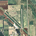
Aberdeen Regional Airport - South Dakota.jpg 752 × 749; 197 KB
-
ISS034-E-62525 - View of Earth.jpg 4,288 × 2,848; 1.35 MB
-
Mitchell Municipal Airport - South Dakota.jpg 750 × 751; 177 KB
-
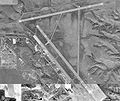
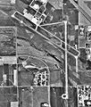
Mitchell Municipal Airportt-04-Oct-1997-USGS.jpg 675 × 652; 135 KB
-
Pierre Regional Airport - South Dakota.jpg 748 × 751; 178 KB
-
Pierre Regional Airport-SD-22 October 1996-USGS.jpg 732 × 618; 117 KB
-
Watertown Regional Airport - South Dakota.jpg 744 × 740; 144 KB
-
Watertown Regional Airport-SD-31 August 1991-USGS.jpg 611 × 721; 124 KB


