Category:Aerial photographs of airports in Illinois
Jump to navigation
Jump to search
States of the United States: Alabama · Alaska · Arizona · Arkansas · California · Colorado · Connecticut · Delaware · Florida · Georgia · Hawaii · Idaho · Illinois · Indiana · Iowa · Kansas · Kentucky · Louisiana · Maine · Maryland · Massachusetts · Michigan · Minnesota · Mississippi · Missouri · Montana · Nebraska · Nevada · New Hampshire · New Jersey · New Mexico · New York · North Carolina · North Dakota · Ohio · Oklahoma · Oregon · Pennsylvania · Rhode Island · South Carolina · South Dakota · Tennessee · Texas · Utah · Vermont · Virginia · Washington · West Virginia · Wisconsin · Wyoming
Puerto Rico
Puerto Rico
English: Aerial photographs of airports in the state of Illinois, United States
Subcategories
This category has the following 2 subcategories, out of 2 total.
Media in category "Aerial photographs of airports in Illinois"
The following 31 files are in this category, out of 31 total.
-
 Benton Municipal Airport - USGS 6 April 1998.jpg 1,200 × 1,600; 299 KB
-
 Chanute AFB-12apr1998.jpg 780 × 736; 169 KB
-
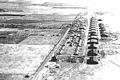
 Chanute Field - 1939.jpg 600 × 479; 91 KB
-
 Chanute Field IL - 1918.jpg 600 × 400; 55 KB
-
 CMI-Airport.jpg 240 × 180; 7 KB
-
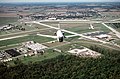
 F-GLZI Chicago Executive (PWK) (7154453294).jpg 1,952 × 1,208; 854 KB
-
 George Army Airfield IL 1953.jpg 669 × 774; 120 KB
-
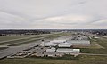
 Joliet Regional Airport, Joliet, Illinois (11004361593).jpg 4,000 × 3,000; 2.32 MB
-
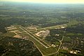 KTrimble-KPIA Aerial 2017-08-12 7500msl.jpg 4,312 × 2,860; 4.28 MB
-
 Lawrenceville-Vincennes International Airport IL 2006 USGS.jpg 690 × 664; 124 KB
-

-
 Meigs field USGS 2002.jpg 7,000 × 7,000; 44.74 MB
-
 Midway Airport (USGS).png 1,680 × 1,050; 3.42 MB
-
 Midwayhigh.jpg 320 × 240; 51 KB
-
 MWA airport seen from a departing plane 2.jpg 3,413 × 2,694; 1.3 MB
-
 MWA airport seen from a departing plane.jpg 3,104 × 1,854; 549 KB
-
 N916DN De Kalb Taylor DKB ILLINOIS (7160195416).jpg 1,308 × 908; 437 KB
-
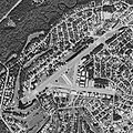
 Palwaukee Municipal Airport (USGS).png 1,680 × 1,050; 3.05 MB
-
 QuadCityIntlAirport Aerial.jpg 875 × 400; 63 KB
-
 Quincy Regional Airport-Baldwin Field.png 385 × 521; 257 KB
-
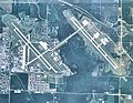 Scott AFB - 2008.jpg 753 × 586; 177 KB
-
 Scott AFB Aircraft.jpg 2,840 × 1,870; 2.37 MB
-
 Scott AFB airship hangar.jpg 653 × 435; 86 KB
-
 Scott afb IL - 2 April 1998.jpg 910 × 546; 163 KB
-
 Scott AFB, TC-6 over Hangar in the 1920s (cropped).jpg 2,672 × 2,005; 612 KB
-
 Scott AFB, TC-6 over Hangar in the 1920s.jpg 4,000 × 2,776; 1.17 MB
-
 Scott Field - 1930.jpg 701 × 497; 76 KB
-
 Scott Field - 1943.jpg 699 × 489; 70 KB
-
 Scott field LTA hangar.jpg 300 × 183; 24 KB
-
 SpruceCreekFlyInAerial.jpg 800 × 800; 202 KB
-
 Waukegan Regional Airport - USGS 17 April 1998.jpg 1,800 × 1,800; 542 KB


_(7154453294).jpg)

.jpg)


.png)


.jpg)
.png)


.jpg)


