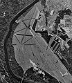
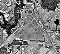
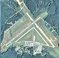
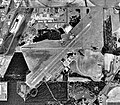
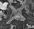
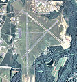
Category:Aerial photographs of airports in Georgia (U.S. state)
Jump to navigation
Jump to search
States of the United States: Alabama · Alaska · Arizona · Arkansas · California · Colorado · Connecticut · Delaware · Florida · Georgia · Hawaii · Idaho · Illinois · Indiana · Iowa · Kansas · Kentucky · Louisiana · Maine · Maryland · Massachusetts · Michigan · Minnesota · Mississippi · Missouri · Montana · Nebraska · Nevada · New Hampshire · New Jersey · New Mexico · New York · North Carolina · North Dakota · Ohio · Oklahoma · Oregon · Pennsylvania · Rhode Island · South Carolina · South Dakota · Tennessee · Texas · Utah · Vermont · Virginia · Washington · West Virginia · Wisconsin · Wyoming
Puerto Rico
Puerto Rico
English: Aerial photographs of airports in Georgia (U.S. state).
Subcategories
This category has only the following subcategory.
Media in category "Aerial photographs of airports in Georgia (U.S. state)"
The following 79 files are in this category, out of 79 total.
-
Souther Field - World War I Vertical Airphoto Mosaic of Airfield.jpg 2,700 × 1,962; 1.2 MB
-
20100119 0588DublinGaAirport.JPG 1,600 × 1,200; 540 KB
-
Atlanta South Regional Airport (27138999031).jpg 2,272 × 1,708; 1.04 MB
-
Atlanta South Regional Airport.jpg 1,488 × 1,117; 475 KB
-
Aug-reg-apt-16mar1999.jpg 969 × 1,031; 268 KB
-
Augusta Regional Airport - Georgia.jpg 750 × 757; 199 KB
-
Bainbridge Army Airfield - Oblique Airphoto.jpg 1,819 × 1,370; 530 KB
-
Charlie Brown Fulton County Airport GA 20100113 0226.JPG 1,200 × 1,600; 507 KB
-
Cobb County Airport (8991062302).jpg 4,000 × 3,000; 2.3 MB
-
Commodore Decatur Airport - Georgia.jpg 486 × 484; 96 KB
-
Cordeleapt-31jan1993.jpg 616 × 518; 116 KB
-
Crisp County-Cordele Airport - Georgia.jpg 497 × 498; 104 KB
-
Daniel Field - Georgia.jpg 499 × 494; 137 KB
-
Danielfield-apt-13feb1999.jpg 906 × 641; 191 KB
-
Decatur County Industrial Air Park 2006 USGS.jpg 768 × 768; 185 KB
-
Dekalbindustrialairpark-26jan1999.jpg 824 × 463; 148 KB
-
Dobbins-4apr2004.jpg 948 × 688; 264 KB
-
Donalsonville Municipal Airport - Georgia.jpg 495 × 496; 83 KB
-
Douglas Municipal Airport - Georgia.jpg 497 × 502; 109 KB
-
Douglas-apt-ga-14feb1993.jpg 750 × 756; 123 KB
-
EZM1.jpg 3,963 × 2,641; 3.21 MB
-
Habersham County Airport 20100115 0353.JPG 1,600 × 1,200; 471 KB
-
Habersham County Airport.jpg 4,000 × 3,000; 2.84 MB
-
Harris Neck Army Airfield 2006 USGS.jpg 985 × 899; 1.11 MB
-
Hartsfield-Jackson Airport overview.jpg 1,024 × 682; 685 KB
-
View of Atlanta Airport.jpg 3,072 × 2,304; 1.25 MB
-
Hartsfield-Jackson overview.jpg 1,024 × 767; 391 KB
-
Henry Tift Myers Airport - Georgia.jpg 664 × 703; 186 KB
-
Hnaaf-22feb1999.jpg 632 × 577; 169 KB
-
Hunter Army Airfield - Georgia.jpg 680 × 532; 161 KB
-
Jimmy Carter Regional Airport - Georgia.jpg 494 × 492; 96 KB
-
KCSG aerial view from northwest.jpg 3,837 × 2,210; 1.11 MB
-
KSSI 001.JPG 3,476 × 2,318; 7.49 MB
-
Lawson Army Airfield - Georgia.jpg 638 × 707; 191 KB
-
Lee Gilmer Memorial Airport (6284803266).jpg 4,000 × 3,000; 2.87 MB
-
Liberty County Airport (Georgia) - USGS 7 March 1999.jpg 1,400 × 1,400; 367 KB
-
Lower Chattachoochee Airport aerial.png 1,692 × 1,788; 2.38 MB
-
Lsf-aa-5feb1999.jpg 804 × 924; 221 KB
-
Macon Downtown Airport - Georgia.jpg 496 × 500; 106 KB
-
Macon-middlegeorgiaregionalairport-5feb1999.jpg 431 × 393; 73 KB
-
Macondowntownairport-8feb1999.jpg 593 × 477; 125 KB
-
Mckinnon airport.jpg 1,000 × 669; 235 KB
-
MidCoast Regional Airport at Wright Army Airfield - Georgia.jpg 507 × 500; 109 KB
-
Middle Georgia Regional Airport 2006 USGS.jpg 768 × 768; 179 KB
-
Moodyaaf-1943.jpg 906 × 621; 142 KB
-
Moultrie Municipal Airport - Georgia.jpg 505 × 492; 101 KB
-
Moultrieapt-31jan1993.jpg 601 × 520; 92 KB
-
Newnan Coweta County Airport20100113 0214.JPG 1,200 × 1,600; 414 KB
-
Perry-Houston County Airport - Georgia.jpg 495 × 491; 90 KB
-
Richard B. Russell Airport - USGS 8 February 1999.jpg 1,000 × 1,400; 279 KB
-
Robinsaaf-1-1944.jpg 700 × 527; 137 KB
-
Robinsaaf-1944.jpg 1,001 × 758; 205 KB
-
Robinsaaf-2-1944.jpg 700 × 512; 114 KB
-
Robinsafb-8feb1999.jpg 301 × 393; 43 KB
-
Savairprot-14jan1999.jpg 605 × 567; 156 KB
-
Souther Field - 1918.jpg 1,962 × 2,700; 1.2 MB
-
Souther Field - Oblique Aireal showing Airfield and Station.jpg 1,820 × 1,402; 366 KB
-
Souther Field - Oblique Overview Airphoto.jpg 1,050 × 444; 114 KB
-
Souther Field - USGS Airphoto 6 Feb 1999.jpg 576 × 503; 110 KB
-
Southwest Georgia Regional Airport - Georgia.jpg 493 × 498; 103 KB
-
Spence Airport GA 2006 USGS.jpg 768 × 768; 182 KB
-
Spence Army Airfield - Vertical Aireal Photograph.jpg 1,801 × 1,394; 662 KB
-
Spenceapt-31jan1993.jpg 741 × 881; 202 KB
-
Statesboro-Bulloch County Airport - Georgia.jpg 611 × 634; 162 KB
-
StoneMtnAirport1993.jpg 314 × 770; 51 KB
-
Swgeorgiaregionalapt-29dec1999.jpg 729 × 630; 180 KB
-
Tbr-ga-30dec1999.jpg 958 × 612; 180 KB
-
Thomasville Regional Airport - Georgia.jpg 622 × 631; 157 KB
-
Thomasvilleapt-5feb00.jpg 452 × 384; 67 KB
-
TiftonAirport-GA-2-16-99.jpg 518 × 503; 107 KB
-
Toccoa 20100115 0351.JPG 1,600 × 1,200; 461 KB
-
Turnerafb-3jan1964.jpg 539 × 559; 96 KB
-
Valdosta Regional Airport - Georgia.jpg 754 × 751; 214 KB
-
Vidalia Airport-6Feb1999.jpg 678 × 575; 167 KB
-
Vidalia Regional Airport - Georgia.jpg 497 × 500; 111 KB
-
Waycross-Ware County Airport - Georgia.jpg 557 × 598; 133 KB
-
Waycrossapt-5feb1999.jpg 604 × 567; 136 KB
-
Wr-aaf-ga-1944.jpg 906 × 689; 195 KB
-
Wr-aaf-ga-7mar1999.jpg 789 × 508; 173 KB


