Category:Aerial photographs of Everglades National Park
Jump to navigation
Jump to search
Media in category "Aerial photographs of Everglades National Park"
The following 51 files are in this category, out of 51 total.
-
-
 AER Shark Slough looking S to ENP across Hwy41, NPSPhoto (9247369749).jpg 3,300 × 2,200; 2.61 MB
-
 Aerial view of Shark River, Everglades National Park, 2007-08-14.jpg 1,024 × 768; 453 KB
-
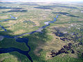
 Everglades Backcountry (1), NPSPhoto (9247500923).jpg 2,048 × 1,536; 1.2 MB
-
 Everglades Backcountry (2), NPSPhoto (9250283274).jpg 2,048 × 1,536; 1.16 MB
-
 Everglades FH020005.jpg 1,800 × 1,346; 632 KB
-
 Everglades in Eastern Broward County Aerial.jpg 2,400 × 3,600; 3.23 MB
-
 Everglades National Park EVER1492.jpg 3,072 × 2,048; 3.92 MB
-
 Everglades National Park EVER1497.jpg 3,072 × 2,048; 3.49 MB
-
 Everglades National Park EVER1523.jpg 3,072 × 2,048; 4.15 MB
-
 Everglades National Park EVER1538.jpg 3,072 × 2,048; 3.87 MB
-
 Everglades National Park EVER1551.jpg 3,072 × 2,048; 4 MB
-
 Everglades National Park EVER1554.jpg 3,072 × 2,048; 3.77 MB
-
 Everglades National Park EVER3281.jpg 3,072 × 2,048; 3.9 MB
-
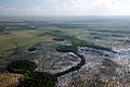
 Harney River, NPSPhoto (9250283794).jpg 2,048 × 1,536; 1.25 MB
-
 Hells Bay Aerial View (1), NPSPhoto (9247500709).jpg 2,048 × 1,536; 1.47 MB
-
 Hells Bay Aerial View (2), NPSPhoto (9250283074).jpg 2,048 × 1,536; 1.33 MB
-

-
 INDIAN SETTLEMENT IN EVERGLADES NATIONAL PARK - NARA - 544607.jpg 3,000 × 2,021; 998 KB
-
 Just E of SV Hwy41 Miccosukee, NPSPhoto, 2008 (9250152394).jpg 560 × 792; 253 KB
-
 Lane River, NPSPhoto (9247501763).jpg 3,008 × 2,000; 5.92 MB
-
 Lard Can Area, NPSPhoto (9250283036).jpg 2,048 × 1,536; 1.17 MB
-
 Levees, Dikes and Dams (10), NPSPhoto, R. Cammauf (9250147434).jpg 3,600 × 2,400; 11.89 MB
-
 Levees, Dikes and Dams (12), NPSPhoto, R. Cammauf (9250142702).jpg 3,504 × 2,336; 11.26 MB
-
 Levees, Dikes and Dams (14), NPSPhoto, R. Cammauf (9250141478).jpg 2,400 × 3,600; 5.05 MB
-
 Levees, Dikes and Dams (15), NPSPhoto, R. Cammauf (9247357637).jpg 3,140 × 2,512; 8.42 MB
-
 Levees, Dikes and Dams (16), NPSPhoto, R. Cammauf (9247357067).jpg 3,600 × 2,400; 6.85 MB
-
 Levees, Dikes and Dams (17), NPSPhoto, R. Cammauf (9250139668).jpg 3,140 × 2,512; 4.77 MB
-
 Levees, Dikes and Dams (19), NPSPhoto, R. Cammauf (9247354197).jpg 1,200 × 800; 134 KB
-
 Levees, Dikes and Dams (20), NPSPhoto, R. Cammauf (9247356437).jpg 3,600 × 2,400; 5.55 MB
-
 Levees, Dikes and Dams (3), NPSPhoto, R. Cammauf (9250151714).jpg 3,140 × 2,512; 4.6 MB
-
 Levees, Dikes and Dams (4), NPSPhoto, R. Cammauf (9247368675).jpg 3,140 × 2,512; 5.46 MB
-
 Levees, Dikes and Dams (5), NPSPhoto, R. Cammauf (9247368695).jpg 3,140 × 2,512; 8.07 MB
-
 Levees, Dikes and Dams (7), NPSPhoto, R. Cammauf (9247366697).jpg 3,600 × 2,400; 6.56 MB
-
 Levees, Dikes and Dams (9), NPSPhoto, R. Cammauf (9247366747).jpg 2,400 × 3,000; 7.91 MB
-
 Looking North at WCA3a from ENP, NPSPhoto, 2008 (9250138048).jpg 920 × 648; 308 KB
-
 Looking South from WCA3a at ENP, NPSPhoto, 2008 (9250137956).jpg 864 × 576; 264 KB
-
 Lopez River Area, NPSPhoto (9250284176).jpg 2,048 × 1,536; 1.17 MB
-
 Manatee in Taylor River, NPSPhoto (9257867440).jpg 3,008 × 2,000; 7.82 MB
-
 MudLakeCanal.png 1,145 × 877; 1.13 MB
-
 Nike Base Aerial, NPSPhoto, Rodney Cammauf (8720383287).jpg 3,600 × 2,400; 10.37 MB
-
 North Nest Key, Florida Bay (2), NPSPhoto (9247241295).jpg 2,248 × 1,435; 3.06 MB
-
 Pa-Hay-Okee Boardwalk (11), NPSPhoto (9255271007).jpg 3,600 × 2,400; 11.44 MB
-
 Rodgers Area, NPSPhoto (9250283012).jpg 2,048 × 1,536; 1.2 MB
-
 Shark Valley Tower Aerial, NPSPhoto (9101935480).jpg 821 × 553; 78 KB
-
 Stormwater Treatment Area in Northern Everglades.jpg 587 × 438; 231 KB
-
 Transition from Sawgrass to Coastal Habitat, NPSPhoto (9250299462).jpg 3,008 × 2,000; 5.7 MB
-
 West lake 1, NPSphoto (9258191658).jpg 3,600 × 2,400; 6.37 MB
-
 West lake 2, NPSphoto (9255413149).jpg 3,600 × 2,400; 6.57 MB
-
 West lake 3, NPSphoto (9255412895).jpg 3,600 × 2,400; 5.26 MB
-
 West lake boardwalk, NPSphoto (9255411617).jpg 3,600 × 2,400; 5.9 MB

.jpg)

,_NPSPhoto_(9247500923).jpg)
,_NPSPhoto_(9250283274).jpg)


.jpg)
,_NPSPhoto_(9247500709).jpg)
,_NPSPhoto_(9250283074).jpg)


.jpg)
.jpg)
.jpg)
,_NPSPhoto,_R._Cammauf_(9250147434).jpg)
,_NPSPhoto,_R._Cammauf_(9250142702).jpg)
,_NPSPhoto,_R._Cammauf_(9250141478).jpg)
,_NPSPhoto,_R._Cammauf_(9247357637).jpg)
,_NPSPhoto,_R._Cammauf_(9247357067).jpg)
,_NPSPhoto,_R._Cammauf_(9250139668).jpg)
,_NPSPhoto,_R._Cammauf_(9247354197).jpg)
,_NPSPhoto,_R._Cammauf_(9247356437).jpg)
,_NPSPhoto,_R._Cammauf_(9250151714).jpg)
,_NPSPhoto,_R._Cammauf_(9247368675).jpg)
,_NPSPhoto,_R._Cammauf_(9247368695).jpg)
,_NPSPhoto,_R._Cammauf_(9247366697).jpg)
,_NPSPhoto,_R._Cammauf_(9247366747).jpg)
.jpg)
.jpg)
.jpg)
.jpg)

.jpg)
,_NPSPhoto_(9247241295).jpg)
,_NPSPhoto_(9255271007).jpg)
.jpg)
.jpg)

.jpg)
.jpg)
.jpg)
.jpg)
.jpg)