Category:Aegean Sea maps
Jump to navigation
Jump to search
Subcategories
This category has the following 11 subcategories, out of 11 total.
Media in category "Aegean Sea maps"
The following 146 files are in this category, out of 146 total.
-
 Bellum mithridaticum 85aC.png 1,901 × 1,697; 2.91 MB
-
 Bellum mithridaticum 87-86aC.png 1,901 × 1,697; 3 MB
-
 2008-Dodecanese-earthquake-15-July-USGS.jpg 600 × 613; 65 KB
-
 Admiralty Chart No 2682 Kolpos Petalion to Nisos Nisiros, Published 1956.jpg 18,439 × 11,326; 36.42 MB
-
 Admiralty Chart No 2836a Grecian Archipelago Southern Sheet, Published 1963.jpg 16,421 × 11,274; 24.65 MB
-
 Aegean basemap.svg 576 × 612; 185 KB
-
 Aegean islands accession.svg 433 × 550; 165 KB
-
 Aegean islands demilitarisation-es.svg 433 × 550; 198 KB
-
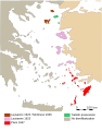 Aegean islands demilitarisation.svg 433 × 550; 166 KB
-
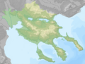
 Aegean Region.svg 540 × 461; 975 KB
-
 Aegean Sea 192 BC it.png 2,369 × 1,568; 449 KB
-
 Aegean Sea 192 BC-es.svg 1,349 × 890; 1.24 MB
-
 Aegean Sea 192 BC.png 2,334 × 1,533; 462 KB
-
 Aegean Sea and Anatolian Plates map-fr.png 552 × 291; 189 KB
-
 Aegean sea and Western Anatolia regions large topographic basemap.svg 4,001 × 2,600; 6.16 MB
-
 Aegean Sea in its region.svg 500 × 281; 4.83 MB
-
 Aegean Sea map bathymetry ar.svg 4,688 × 5,700; 5.18 MB
-
 Aegean Sea map bathymetry-es.png 2,500 × 3,040; 8.49 MB
-
 Aegean Sea map bathymetry-es.svg 3,750 × 4,560; 3.42 MB
-
 Aegean Sea map bathymetry-fi.svg 3,750 × 4,560; 3.52 MB
-
 Aegean Sea map bathymetry-fr.jpg 3,744 × 4,554; 4.22 MB
-
 Aegean Sea map bathymetry-fr.svg 3,750 × 4,560; 3.57 MB
-
 Aegean Sea map bathymetry-it.svg 3,750 × 4,560; 3.42 MB
-
 Aegean Sea map bathymetry-tr.svg 3,750 × 4,560; 3.6 MB
-
 Aegean Sea map bathymetry.svg 3,750 × 4,560; 3.54 MB
-
 Aegean Sea map hu.svg 540 × 599; 170 KB
-
 Aegean Sea map ku.png 1,480 × 1,642; 472 KB
-
 Aegean Sea map ku.svg 1,480 × 1,642; 633 KB
-
 Aegean Sea map Urdu.png 1,480 × 1,642; 487 KB
-
 Aegean Sea map-de.png 2,079 × 2,530; 979 KB
-
 Aegean Sea map-es.svg 3,750 × 4,560; 2.14 MB
-
 Aegean Sea map-fr.svg 3,750 × 4,560; 2.3 MB
-
 Aegean Sea map-it.svg 3,750 × 4,560; 2.14 MB
-
 Aegean Sea map.png 540 × 599; 170 KB
-
 Aegean Sea region Cropped.jpg 1,383 × 740; 260 KB
-
 Aegean Sea region. LOC 2006625576.jpg 7,142 × 6,358; 8.18 MB
-
 Aegean Sea with island groups labeled-es.svg 432 × 467; 336 KB
-
 Aegean Sea with island groups labeled.gif 350 × 465; 20 KB
-
 Aegean Sea.png 300 × 321; 59 KB
-
 Aegean strimonikos bay.JPG 1,082 × 891; 109 KB
-
 Aegean with legend EL.svg 553 × 600; 148 KB
-
 Aegean with legend EL2.svg 553 × 600; 148 KB
-
 Aegean with legends el.svg 432 × 467; 214 KB
-
 Aegean with legends it.svg 432 × 467; 173 KB
-
 Aegean with legends MK.svg 432 × 467; 320 KB
-
 Aegean with legends SV.svg 432 × 467; 177 KB
-
 Aegean with legends tr.svg 432 × 467; 172 KB
-
 Aegean with legends uk.svg 432 × 467; 180 KB
-
 Aegean with legends-es.svg 432 × 467; 256 KB
-
 Aegean with legends.svg 432 × 467; 173 KB
-
 Aegean-ar.png 2,367 × 3,503; 4.88 MB
-
 Aegean.jpg 2,366 × 3,497; 797 KB
-
 AegeanIslands.png 1,276 × 804; 19 KB
-
 AegeanSea map modified.png 535 × 535; 123 KB
-
 Ancient edremit gulf.jpg 870 × 448; 54 KB
-
 Argolic gulf.jpg 906 × 574; 109 KB
-
 Black sea Map-Masry.PNG 469 × 388; 41 KB
-
 Black Sea Straits rus.png 1,754 × 1,314; 90 KB
-
 Bodrum location.png 252 × 316; 31 KB
-
 Calcidica.PNG 883 × 687; 114 KB
-
 Chios topographic map-fr.svg 1,580 × 1,150; 1.35 MB
-
 Cyclades map-fr with bug.svg 512 × 603; 2.77 MB
-
 Despotate of Morea 1450 es.svg 1,303 × 1,214; 245 KB
-
 Despotate of Morea 1450 pt.svg 1,303 × 1,214; 87 KB
-
 Despotate of Morea 1450-ar.svg 1,303 × 1,214; 235 KB
-
 Despotate of Morea 1450-el.svg 1,303 × 1,214; 186 KB
-
 Despotate of Morea 1450-he.svg 1,303 × 1,214; 139 KB
-
 Despotate of Morea 1450-it zondertekst.svg 1,303 × 1,214; 205 KB
-
 Despotate of Morea 1450-nl.svg 1,303 × 1,214; 228 KB
-
 Despotate of Morea 1450-zh.svg 1,628 × 1,517; 111 KB
-
 Despotate of Morea 1450.svg 1,303 × 1,214; 208 KB
-
 Djezire-Isl.jpg 629 × 465; 84 KB
-
 Earthquake Greece 2008 06 08.jpg 407 × 470; 242 KB
-
 Egejsko more.svg 580 × 765; 210 KB
-
 Emirate of Crete Map.svg 1,498 × 1,011; 144 KB
-
 First Balkan war - liberated territories 1913.png 1,204 × 1,191; 666 KB
-
 Fourni de.png 1,000 × 849; 115 KB
-
 Fourni el.png 1,000 × 849; 133 KB
-
 Fourni ln.png 1,000 × 849; 69 KB
-
 Aegean Sea map-de.svg 3,750 × 4,560; 2.28 MB
-
 Greece (ancient) Attica (relief-cropped).png 640 × 578; 380 KB
-
 Greece (ancient) Chalcidice (relief-cropped).png 1,024 × 774; 615 KB
-
 Greece (ancient) Euboea (relief-cropped).png 1,024 × 796; 717 KB
-
 Greece (ancient) NorthAegean (relief-cropped).png 640 × 961; 462 KB
-
 Greece (ancient) SouthAegean (relief-cropped).png 1,024 × 843; 710 KB
-
 Greece (ancient) Thessaly (relief-cropped).png 640 × 336; 203 KB
-
 Greece large topographic basemap.svg 2,095 × 1,971; 13.21 MB
-
 Greece large topographic blank map.svg 2,095 × 1,971; 13.72 MB
-
 Greece North Aegean island map (ru).png 909 × 1,037; 190 KB
-
 Imbros Tenedos map location el.svg 725 × 674; 427 KB
-
 ImbrosTenedos 2-es.svg 725 × 674; 203 KB
-
 ImbrosTenedos 2.svg 725 × 674; 203 KB
-
 ImbrosTenedos HE.svg 725 × 674; 203 KB
-
 ImbrosTenedos ru.svg 722 × 671; 37 KB
-
 ImbrosTenedos-ar.png 770 × 715; 123 KB
-
 ImbrosTenedos.svg 722 × 671; 38 KB
-
 Imia delimitation 1932-it.svg 602 × 627; 98 KB
-
 Imia delimitation 1932-tr.svg 602 × 627; 101 KB
-
 Imia delimitation 1932.svg 602 × 627; 98 KB
-
 Imia region.svg 1,454 × 1,370; 80 KB
-
 Imia with legends el.svg 570 × 588; 86 KB
-
 Imia with legends tr.svg 570 × 588; 112 KB
-
 Imia with legends-es.svg 570 × 588; 87 KB
-
 Imia with legends-fr.svg 570 × 588; 92 KB
-
 Imia with legends.svg 570 × 588; 87 KB
-
 IslasEspóradas.svg 1,600 × 1,396; 1.96 MB
-
 Jonski ustanak-sh-Ionian-Revolt.svg 3,750 × 4,560; 3.79 MB
-
 Kolpos kavala.svg 681 × 441; 826 KB
-
 KOS.gif 319 × 357; 15 KB
-
 Locatie Egeische Zee.PNG 902 × 551; 33 KB
-
 Location Aegean Sea.png 640 × 326; 16 KB
-
 Map of the Aegean Sea.jpg 2,352 × 3,482; 1.73 MB
-
 Map of the Aegean Sea.svg 802 × 998; 20.45 MB
-
 Mapa del Mediterrani Oriental.png 750 × 551; 57 KB
-
 Mapa Guerra de Decelia.svg 1,849 × 2,000; 472 KB
-
 MapaTopográficoDeAsiaMenor-Caria.png 1,692 × 1,200; 475 KB
-
 MapaTopográficoDeAsiaMenor-Caria.svg 1,423 × 1,007; 7 MB
-
 MapaTopográficoDeAsiaMenor-Eólida.png 1,224 × 1,352; 416 KB
-
 MapaTopográficoDeAsiaMenor-Eólida.svg 787 × 1,093; 19.74 MB
-
 MapaTopográficoDeAsiaMenor-jonia.png 1,154 × 840; 220 KB
-
 MapaTopográficoDeAsiaMenor-jonia.svg 786 × 543; 10.53 MB
-
 Mar Egeo.png 600 × 488; 29 KB
-
 Mer Egée (carte).png 1,500 × 1,662; 470 KB
-
 Morze Egejskie.jpg 434 × 469; 45 KB
-
 Nordegeaj insuloj (turisma vidpunkto).gif 315 × 280; 10 KB
-
 North Aegean Periphery map2.png 235 × 202; 54 KB
-
 Regió de Grècia.PNG 685 × 599; 223 KB
-
 Rhodos topo.png 1,500 × 1,496; 1 MB
-
 RodasTopográfico.svg 1,048 × 595; 2.21 MB
-
 RodasTopográfico2.svg 1,048 × 669; 2.54 MB
-
 Roman-Syrian-War it.png 2,079 × 1,339; 475 KB
-
 Roman-Syrian-War-es.svg 1,125 × 770; 1.23 MB
-
 Roman-Syrian-War.png 2,079 × 1,339; 457 KB
-
 Saronic Gulf map-de.svg 1,490 × 1,280; 808 KB
-
 Saronic Gulf map-es.svg 1,490 × 1,280; 921 KB
-
 Saronic Gulf map-fr he.svg 1,490 × 1,280; 809 KB
-
 Saronic Gulf map-fr.svg 1,490 × 1,280; 808 KB
-
 Saronic Gulf map-hr.pdf 2,483 × 2,133; 2.02 MB
-
 Saronic Gulf map-hu.svg 1,490 × 1,280; 808 KB
-
 Saronic Gulf map-la.svg 1,490 × 1,280; 801 KB
-
 Sporades-HE.svg 735 × 793; 163 KB
-
 Transmap7.jpg 1,888 × 2,098; 898 KB
-
 TurkishGrayZoneInAegeanSea.svg 433 × 467; 331 KB
-
 TurkishGrayZoneIslands.svg 433 × 467; 379 KB
-
 Western Anatolia and Aegean topographic basemap.svg 1,410 × 1,585; 10.44 MB
-
 خريطة بحر إيجة قياس الأعماق Aegean Sea map bathymetry ar.pdf 7,812 × 9,500; 23.46 MB


_Attica_(relief-cropped).png)
_Chalcidice_(relief-cropped).png)
_Euboea_(relief-cropped).png)
_NorthAegean_(relief-cropped).png)
_SouthAegean_(relief-cropped).png)
_Thessaly_(relief-cropped).png)

.png)


.png)

.gif)


