Category:Maps of Psarà
Jump to navigation
Jump to search
Media in category "Maps of Psarà"
The following 12 files are in this category, out of 12 total.
-
 The burning of the Island of Psara in June 1824.jpg 4,640 × 3,480; 3.05 MB
-
 2010 Dimos Psaron.svg 1,082 × 757; 27 KB
-
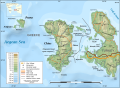
 2011 Dimos Psaron.png 1,000 × 1,477; 160 KB
-
 2019 Dimos Psaron.png 4,000 × 5,800; 299 KB
-
 Chios topographic map-de.svg 1,580 × 1,150; 1.35 MB
-
 Chios topographic map-en.svg 1,580 × 1,150; 1.4 MB
-
 Chios topographic map-es.svg 1,580 × 1,150; 1.35 MB
-
 Chios topographic map-fr.svg 1,580 × 1,150; 1.35 MB
-
 Chios topographic map-nb.svg 1,580 × 1,150; 1.41 MB
-
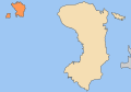
 Dimos Psaron.png 400 × 282; 19 KB
-
 Greece location map Psara.svg 1,003 × 825; 833 KB
-
 Massacre Psara 06-1824.png 451 × 550; 17 KB


