Category:Piri Reis, Kitab-ı Bahriye (Walters MS 658)
Jump to navigation
Jump to search
| Piri Reis: Book on Navigation
( |
||||||||||||||||||||||
|---|---|---|---|---|---|---|---|---|---|---|---|---|---|---|---|---|---|---|---|---|---|---|
| Author |
|
 | ||||||||||||||||||||
| Title |
Turkish: Kitab-ı Bahriye Book on Navigation |
|||||||||||||||||||||
| Subtitle | Walters manuscript W.658 | |||||||||||||||||||||
| Description |
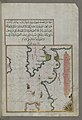
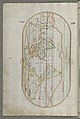
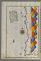
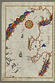
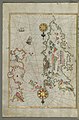
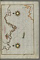
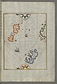
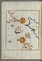
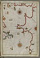
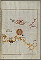
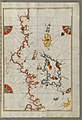
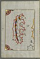
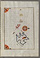
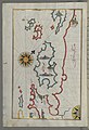
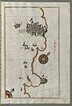
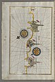
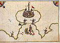
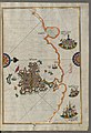
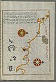
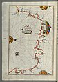
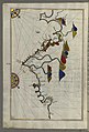
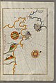
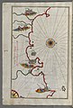
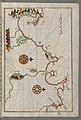
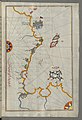
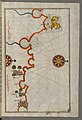
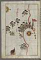
English: Originally composed in 932 AH/AD 1525 and dedicated to Sultan Süleyman I ("The Magnificent"), this great work by Piri Reis (d. 962 AH/AD 1555) on navigation was later revised and expanded. Walters manuscript W.658, made mostly in the late 11th century AH/AD 17th, is based on the later expanded version and has some 240 exquisitely executed maps and portolan charts. They include a world map (fol. 41a) with the outline of the Americas, as well as maps of coastlines (bays, capes, peninsulas), islands, mountains, and cities of the Mediterranean basin and the Black Sea. The work starts with the description of the coastline of Anatolia and the islands of the Aegean Sea, the Peloponnese peninsula, and the eastern and western coasts of the Adriatic Sea. It then proceeds to describe the western shores of Italy, southern France, Spain, North Africa, Palestine, Israel, Lebanon, Syria, western Anatolia, various islands north of Crete, the Sea of Marmara, Bosporus, and the Black Sea. It ends with a map of the shores of the Caspian Sea (fol. 374a). |
|||||||||||||||||||||
| Language | Turkish | |||||||||||||||||||||
| Publication date | This edition:turn of the 18/17th century | |||||||||||||||||||||
| Source |
Walters Art Museum: |
|||||||||||||||||||||

Subcategories
This category has only the following subcategory.
M
Media in category "Piri Reis, Kitab-ı Bahriye (Walters MS 658)"
The following 200 files are in this category, out of 278 total.
(previous page) (next page)-
 Piri Reis - Book on Navigation - Walters W658 - Closed Top View A.jpg 1,320 × 1,799; 3.6 MB
-
 Islamic - Binding from Book on Navigation - Walters W658binding - Top Interior.jpg 1,259 × 1,800; 3.34 MB
-
 Piri Reis - Illuminated Headpiece and Frame - Walters W6584B - Full Page.jpg 1,225 × 1,799; 2.79 MB
-
-
 Piri Reis - World Map in a Double Hemisphere - Walters W65840B - Full Page.jpg 1,215 × 1,800; 2.51 MB
-
 Piri Reis - Oval World Map - Walters W65841A - Full Page.jpg 1,208 × 1,800; 2.6 MB
-
-

-

-
 Piri Reis - Map of the Island of Lemnos - Walters W65847A - Full Page.jpg 1,187 × 1,800; 2.64 MB
-

-
 Piri Reis - Map of the Bay of Salonica - Walters W65851A - Full Page.jpg 1,194 × 1,799; 2.7 MB
-

-
 Piri Reis - Map of the Islands of Skyros and Euboea - Walters W65856A - Full Page.jpg 1,196 × 1,799; 2.84 MB
-
-

-

-
-

-
 Piri Reis - Map of Western Europe and North Africa - Walters W65864A - Full Page.jpg 1,199 × 1,800; 2.88 MB
-
-

-
-
 Piri Reis - Map of the the Island of Psara West of Chios - Walters W65874A - Full Page.jpg 1,191 × 1,799; 2.52 MB
-
-

-
 Piri Reis - Map of the Island of Samos - Walters W65879B - Full Page.jpg 1,223 × 1,799; 2.68 MB
-

-
-

-

-
 Piri Reis - Map of the Island of Patmos - Walters W65884B - Full Page.jpg 1,223 × 1,799; 2.74 MB
-
 Piri Reis - Map of the Island of Leros - Walters W65886A - Full Page.jpg 1,208 × 1,800; 2.62 MB
-
 Piri Reis - Map of the Island of Kalimnos - Walters W65888A - Full Page.jpg 1,213 × 1,800; 2.54 MB
-
-

-
 Piri Reis - Map of the Anatolian Coast Along the Kerme Bay - Walters W65892A - Full Page.jpg 1,213 × 1,799; 2.67 MB
-

-

-
 Piri Reis - Map of the Bay of Kerme East of Cos Island - Walters W65897B - Full Page.jpg 1,231 × 1,799; 2.83 MB
-
 Piri Reis - Map of Syme Island North-west of Rhodes Island - Walters W65899A - Full Page.jpg 1,208 × 1,799; 2.58 MB
-
-

-
 Piri Reis - Map of Rhodes Island - Walters W658103A - Full Page.jpg 1,231 × 1,799; 2.75 MB
-
 Piri Reis - Map of Chalkis Island Off Rhodes Island - Walters W658104A - Full Page.jpg 1,213 × 1,800; 2.61 MB
-

-

-

-

-

-
-
 Piri Reis - Map of the Island of Paros in the Aegean Sea - Walters W658112B - Full Page.jpg 1,222 × 1,799; 2.77 MB
-
 Piri Reis - Map of the Island of Syros in the Aegean Sea - Walters W658113B - Full Page.jpg 1,227 × 1,799; 2.59 MB
-

-
 Piri Reis - Map of Mykonos Island in the Aegean Sea - Walters W658116A - Full Page.jpg 1,225 × 1,799; 2.8 MB
-
 Piri Reis - Map of Tinos Island in the Aegean Sea - Walters W658117A - Full Page.jpg 1,227 × 1,800; 2.87 MB
-
-

-
 Piri Reis - Map of Argolikos Bay - Walters W658122B - Full Page.jpg 1,220 × 1,800; 2.65 MB
-

-

-

-
 Piri Reis - Map of Messiniakos Bay - Walters W658129A - Full Page.jpg 1,215 × 1,799; 2.93 MB
-

-

-
-
 Piri Reis - Map of Saronikos Bay - Walters W658133A - Full Page.jpg 1,228 × 1,800; 2.8 MB
-

-
 Piri Reis - Leaf from Book on Navigation - Walters W658134B - Full Page.jpg 1,242 × 1,799; 2.6 MB
-
 Piri Reis - Leaf from Book on Navigation - Walters W658135B - Full Page.jpg 1,205 × 1,754; 1.09 MB
-
 Piri Reis - Leaf from Book on Navigation - Walters W658136A - Full Page.jpg 1,201 × 1,760; 1.3 MB
-
-
 Piri Reis - Map of the Bay of Corinth - Walters W658137A - Full Page.jpg 1,236 × 1,800; 2.79 MB
-

-

-
-
 Piri Reis - Map of the Islands of Corfu and Paxi - Walters W658145B - Full Page.jpg 1,233 × 1,799; 2.74 MB
-

-

-

-
 Piri Reis - Map of the Island of Mljet Off Dubrovnik - Walters W658153A - Full Page.jpg 1,231 × 1,800; 2.68 MB
-

-
-

-

-

-

-

-
 Piri Reis - Map of the Island of Rab - Walters W658163A - Full Page.jpg 1,232 × 1,800; 2.56 MB
-
 Piri Reis - Map of Premuda Island West Off the Pag Island - Walters W658164A - Full Page.jpg 1,222 × 1,800; 2.65 MB
-
 Piri Reis - Map of the Islands of Pag and Rab - Walters W658165A - Full Page.jpg 1,230 × 1,799; 2.68 MB
-
 Piri Reis - Map of the Island of Krk - Walters W658166A - Full Page.jpg 1,270 × 1,799; 2.79 MB
-
 Piri Reis - Map of Cres, Lo?inj and Unije Islands - Walters W658168A - Full Page.jpg 1,253 × 1,800; 2.71 MB
-

-

-

-
 Piri Reis - Map of the Coast from Medulin as Far as Pula - Walters W658171A - Full Page.jpg 1,255 × 1,800; 2.55 MB
-
 Piri Reis - Map of the Coastline from Pula to Rovinj - Walters W658172B - Full Page.jpg 1,234 × 1,799; 2.61 MB
-
 Piri Reis - Map of the Coastline from Rovinj North - Walters W658173B - Full Page.jpg 1,265 × 1,799; 2.64 MB
-
-

-
-

-

-

-

-
 Piri Reis - Map of the Coastline from Muggia to Trieste - Walters W658181B - Full Page.jpg 1,238 × 1,800; 2.75 MB
-
 Piri Reis - Map of the Fortress of Trieste - Walters W658182B - Full Page.jpg 1,237 × 1,799; 2.87 MB
-

-
 Piri Reis - Leaf from Book on Navigation - Walters W658185A - Full Page.jpg 1,265 × 1,799; 2.65 MB
-
 Piri Reis - Map of the Eastern Part of the City of Venice - Walters W658185B - Full Page.jpg 1,242 × 1,799; 3.21 MB
-
 Piri Reis - Map of the Western Part of the City of Venice - Walters W658186A - Full Page.jpg 1,280 × 1,800; 3.04 MB
-
 Piri Reis - Leaf from Book on Navigation - Walters W658186B - Full Page.jpg 1,228 × 1,799; 2.7 MB
-

-

-

-

-

-

-
-

-

-

-

-

-

-

-

-

-
-

-
-
 Brindisi by Piri Reis.jpg 801 × 574; 164 KB
-
 Piri Reis - Map of the Port of Brindisi - Walters W658205A - Full Page.jpg 1,799 × 1,240; 2.94 MB
-

-
-

-

-

-

-

-

-
 Piri Reis - Leaf from Book on Navigation - Walters W658220A - Full Page.jpg 1,265 × 1,799; 2.45 MB
-

-
 Piri Reis - Map of the Island of Sicily - Walters W658221A - Full Page.jpg 1,231 × 1,799; 2.67 MB
-
 Piri Reis - Leaf from Book on Navigation - Walters W658221B - Full Page.jpg 1,240 × 1,800; 2.73 MB
-
 Piri Reis - Map of the Island of Malta - Walters W658222B - Full Page.jpg 1,263 × 1,799; 2.76 MB
-
-
 Piri Reis - Map of the Island of Sardinia - Walters W658226B - Full Page.jpg 1,235 × 1,799; 2.78 MB
-
 Corsica by Piri Reis.jpg 557 × 806; 200 KB
-
 Piri Reis - Map of the Island of Corsica - Walters W658229A - Full Page.jpg 1,223 × 1,799; 2.8 MB
-
 Piri Reis - Map of the Island of Minorca - Walters W658230B - Full Page.jpg 1,255 × 1,799; 2.73 MB
-
 Piri Reis - Map of the Islands of Mojorca and Minorca - Walters W658233A - Full Page.jpg 1,214 × 1,799; 2.54 MB
-

-

-
-

-
 Piri Reis - Oval Map of the World - Walters W65823B - Full Page.jpg 1,220 × 1,799; 2.55 MB
-
-

-
 Piri Reis - Leaf from Book on Navigation - Walters W658245A - Full Page.jpg 1,270 × 1,799; 2.75 MB
-
-
 Piri Reis - Leaf from Book on Navigation - Walters W658246B - Full Page.jpg 1,219 × 1,800; 2.54 MB
-
-
 Piri Reis - Western Hemisphere Within a Windrose - Walters W65824B - Full Page.jpg 1,223 × 1,800; 949 KB
-

-
 Piri Reis - Map of the French Coast Around Marseille - Walters W658253A - Full Page.jpg 1,224 × 1,800; 2.65 MB
-
 Piri Reis - Map of the Coast Around Narbonne - Walters W658255A - Full Page.jpg 1,256 × 1,800; 2.88 MB
-

-

-

-
 Piri Reis - Leaf from Book on Navigation - Walters W658261B - Full Page.jpg 1,212 × 1,799; 2.64 MB
-
-
 Piri Reis - Leaf from Book on Navigation - Walters W658263B - Full Page.jpg 1,217 × 1,800; 2.63 MB
-
 Piri Reis - Leaf from Book on Navigation - Walters W658264A - Full Page.jpg 1,255 × 1,800; 2.54 MB
-
-
 Piri Reis - Leaf from Book on Navigation - Walters W658265B - Full Page.jpg 1,217 × 1,800; 2.6 MB
-
-

-
-

-
 Piri Reis - Map of the Algerian Coast around Algiers - Walters W658270B - Full Page.jpg 1,222 × 1,800; 2.66 MB
-

-
-

-

-

-

-
-
 Piri Reis - Map of the Coast of Tripoli - Walters W658286B - Full Page.jpg 1,227 × 1,799; 2.72 MB
-
 Piri Reis - Leaf from Book on Navigation - Walters W658288A - Full Page.jpg 1,220 × 1,799; 2.64 MB
-
-
 Piri Reis - Leaf from Book on Navigation - Walters W658289B - Full Page.jpg 1,239 × 1,799; 2.58 MB
-

-
 Piri Reis - Map of the Libyan Coast as Far as Benghazi - Walters W658293A - Full Page.jpg 1,214 × 1,799; 2.67 MB
-

-

-
 Piri Reis - Map of the Libyan Coast as Far as Salum - Walters W658296B - Full Page.jpg 1,792 × 1,205; 2.79 MB
-
 Piri Reis - Map of the Egyptian Coast From Salum East - Walters W658297B - Full Page.jpg 1,799 × 1,192; 2.73 MB
-


_Off_the_Coast_of_Anatolia_-_Walters_W65843A_-_Full_Page.jpg)


_with_the_City_of_Athens_-_Walters_W658121A_-_Full_Page.jpg)


_-_Walters_W658194A_-_Full_Page.jpg)


.jpg)


&filefrom=300A%0APiri+Reis+-+Map+of+the+Coast+of+Alexandria+Showing+a+Portion+of+the+Town+Itself+-+Walters+W658300A+-+Full+Page.jpg#mw-category-media)