Category:20th-century maps of Java
Jump to navigation
Jump to search
Subcategories
This category has the following 5 subcategories, out of 5 total.
- 1900s maps of Java (16 F)
- 1910s maps of Java (17 F)
- 1920s maps of Java (12 F)
- 1930s maps of Java (11 F)
- 1940s maps of Java (10 F)
Media in category "20th-century maps of Java"
The following 5 files are in this category, out of 5 total.
-
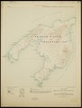
 Doeri Ketapang.jpg 748 × 357; 295 KB
-
 Jave - Map.jpg 796 × 563; 75 KB
-
 Admiralty Chart No 3311 Anchorages on the North Coast of Java, Published 1902.jpg 16,182 × 10,908; 24.32 MB
-
 Java 150.000, KK ATL 275 3.pdf 2,522 × 3,337, 704 pages; 2.18 GB
-
 Kaart van de stadsgemeente Malang K 08994 Java (stadsplattegronden A tm M).tif 9,814 × 10,149; 284.99 MB


