Category:1940s maps of Java
Jump to navigation
Jump to search
Media in category "1940s maps of Java"
The following 10 files are in this category, out of 10 total.
-
 Java & Madura 150.000, KK 049-04-01053-12-10.pdf 2,593 × 3,606, 454 pages; 1.66 GB
-
 Sf bandjardawa pada peta tahun 1942.jpg 1,500 × 1,500; 814 KB
-
 1943 Japanese WWII map of Batavia.jpg 1,600 × 1,096; 508 KB
-

-
 Admiralty Chart No 1066 Java Sea, Published 1943.jpg 16,397 × 11,254; 39.63 MB
-
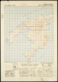
 Txu-pclmaps-oclc-6596455-ponorogo.jpg 3,734 × 4,565; 6.39 MB
-
 AAF cloth chart-Philippine series LOC 87691254-8.jpg 11,855 × 6,529; 11.38 MB
-
 Java and Madoera irrigation and forestry - OSS - btv1b53196968t.jpg 11,526 × 4,096; 4.04 MB
-

-


