Category:1910s maps of Java
Jump to navigation
Jump to search
Media in category "1910s maps of Java"
The following 17 files are in this category, out of 17 total.
-
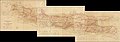
 Java - btv1b53061606c.jpg 6,581 × 2,907; 2.36 MB
-
 Location of the Aceh Monument on the 'Plan of Batavia' (1910).jpg 879 × 681; 252 KB
-
 EB1911 Java map.jpg 1,069 × 425; 309 KB
-
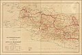
 Topographische kaart der afdeelingen Pasoeroean.jpg 6,940 × 8,159; 8.7 MB
-
 Samarang - Joana Stoomtram Maatschappij overzichtskaart.tif 6,254 × 3,680; 65.87 MB
-

-
 Semarang–Cheribon Stoomtram Maatschappij overzichtskaart.tif 7,350 × 4,024; 84.65 MB
-
 Batavia (side detail in a 1914 map of Dutch Indonesia).jpg 440 × 442; 36 KB
-
 Overzichtskaart van de lijnen der Kediri-stoomtrammaatschappij.tif 6,176 × 9,304; 164.41 MB
-

-
 Automobielkaart van de Java Motor Club van Java en Madeoera - merged.jpg 51,864 × 18,051; 133.97 MB
-
 Automobielkaart van de Java Motor Club van Java en Madeoera - Sheet 1.jpg 19,902 × 13,399; 47.49 MB
-
 Automobielkaart van de Java Motor Club van Java en Madeoera - Sheet 2.jpg 21,286 × 13,312; 49.2 MB
-
 Automobielkaart van de Java Motor Club van Java en Madeoera - Sheet 3.jpg 19,741 × 13,338; 50.12 MB
-
 Dutch Colonial Maps - NIGM.jpg 581 × 509; 401 KB
-
 Semarang in 1919.png 730 × 1,163; 1.74 MB
-
 Map of Batavia (Baedeker, 1914).jpg 1,784 × 1,815; 1.39 MB

.jpg)


.jpg)


.jpg)