Category:2018 maps of India
Jump to navigation
Jump to search
| ← 2010 2011 2012 2013 2014 2015 2017 2018 2019 → |
English: 2018 maps made in India or from India or showing history of India
Media in category "2018 maps of India"
The following 11 files are in this category, out of 11 total.
-
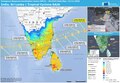
 2018 Kerala Floods Red Alert Districts.png 3,445 × 5,020; 402 KB
-
 7th Legislative Assembly of Mizoram.svg 360 × 185; 3 KB
-
 ECDM 20180504 India Dust-storm.pdf 2,479 × 1,754; 1.34 MB
-
 ECDM 20180820 Kerala Floods.pdf 1,625 × 1,125; 476 KB
-
 ECDM 20180921 India Monsoon Floods.pdf 1,625 × 1,125; 799 KB
-
 ECDM 20181012 Kerala Floods UPDATE.pdf 1,625 × 1,125; 545 KB
-
 ECDM 20181113 TC GAJA.pdf 1,625 × 1,125; 533 KB
-
 India monsoon imerg 13-20 august 2018.jpg 1,280 × 720; 1 MB
-
 Kerala - Cumulative rainfall by district 2018.png 983 × 1,235; 307 KB
-
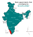 Kerala Flood Relief States.svg 1,594 × 1,772; 310 KB
-
 কেরল বন্যা ত্রাণকার্যে অবদান রাখা রাজ্যসমূহ.svg 1,594 × 1,772; 581 KB


