Category:2014 maps of India
Jump to navigation
Jump to search
English: 2014 maps made in India or from India or showing history of India
Media in category "2014 maps of India"
The following 28 files are in this category, out of 28 total.
-
 CPI(M) candidates in Indian general election, 2014.png 837 × 822; 52 KB
-
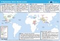
 ECDM 20140502 World Events.pdf 1,625 × 1,125; 495 KB
-
 ECDM 20140630 World Events.pdf 1,625 × 1,125; 387 KB
-
 ECDM 20140728 World Events.pdf 1,625 × 1,125; 748 KB
-
 ECDM 20140819 World Events.pdf 1,625 × 1,125; 377 KB
-
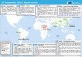
 ECDM 20140905 Pakistan India Floods.pdf 1,625 × 1,125; 847 KB
-
 ECDM 20140908 Asia Floods.pdf 1,625 × 1,125; 721 KB
-
 ECDM 20140909 World Events.pdf 1,625 × 1,125; 389 KB
-
 ECDM 20140923 World Events.pdf 1,625 × 1,125; 322 KB
-
 ECDM 20140924 World Events.pdf 1,625 × 1,125; 718 KB
-
 ECDM 20140925 India Floods.pdf 1,625 × 1,125; 850 KB
-
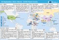
 ECDM 20141009 Asia TCs.pdf 1,625 × 1,125; 884 KB
-
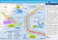
 ECDM 20141010 TCs.pdf 1,625 × 1,125; 603 KB
-
 ECDM 20141013 TCs.pdf 1,625 × 1,125; 703 KB
-
 ECDM 20141028 NILOFAR HANNA.pdf 1,625 × 1,125; 405 KB
-
 ECDM 20141030 Asia Events.pdf 1,625 × 1,125; 675 KB
-
 Indian General Election 2014 by alliance.svg 1,300 × 1,488; 5.02 MB
-
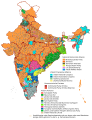
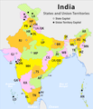 IndiaStatesByRTOcodes.png 1,487 × 1,735; 310 KB
-
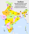 Indien Verwaltungsgliederung.png 1,487 × 1,735; 314 KB
-
 Indische Parlamentswahl 2014 Parteien.png 1,593 × 2,039; 837 KB
-
 Indische Parlamentswahl 2014 Parteien.svg 1,380 × 1,700; 4.86 MB
-
 Map birth place of Writers of Guru Granth Sahib.jpg 1,536 × 1,856; 410 KB
-
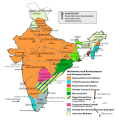
 Mehrheiten nach Bundesstaaten Indien 2014.png 3,382 × 3,522; 953 KB
-
 Mehrheiten nach Bundesstaaten Indien 2014.svg 867 × 891; 1.12 MB
-
 Regierungsparteien Indien 2014-04 de.svg 1,613 × 1,814; 1.01 MB
-
 South Indian territories 2014 de.svg 676 × 749; 279 KB
-
 South Indian territories 2014-fr.svg 672 × 746; 290 KB
-
 Wahlergebnisse Indien 2014.svg 1,346 × 1,749; 8.14 MB
_candidates_in_Indian_general_election,_2014.png)


