Category:2018 United States House of Representatives election maps of Oregon
Jump to navigation
Jump to search
States of the United States: Alabama · Alaska · Arizona · Arkansas · California · Colorado · Florida · Indiana · Iowa · Kansas · Kentucky · Massachusetts · Michigan · New Jersey · New Mexico · Ohio · Oklahoma · Oregon · Pennsylvania · South Carolina · Utah · West Virginia · Wisconsin
Media in category "2018 United States House of Representatives election maps of Oregon"
The following 7 files are in this category, out of 7 total.
-
 2018 OR-01 Election by County.svg 850 × 1,000; 34 KB
-
 2018 OR-02 Election by County.svg 850 × 650; 389 KB
-
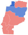
 2018 OR-03 Election by County.svg 850 × 550; 24 KB
-
 2018 OR-04 Election by County.svg 850 × 1,050; 145 KB
-
 2018 OR-05 Election by County.svg 850 × 700; 96 KB
-
 Oregon 2018 House.png 6,900 × 4,132; 326 KB
-
 Oregon Congressional Election Results 2018 and 2020.svg 810 × 608; 46 KB


