Category:2010s maps of New Zealand
Jump to navigation
Jump to search
Countries of Oceania: Australia · Fiji · Kiribati · New Zealand · Papua New Guinea
Other areas: Hawaii – Partly: Indonesia
Other areas: Hawaii – Partly: Indonesia

Subcategories
This category has the following 4 subcategories, out of 4 total.
- 2013 maps of New Zealand (6 F)
- 2014 maps of New Zealand (3 F)
- 2015 maps of New Zealand (3 F)
- 2019 maps of New Zealand (1 F)
Media in category "2010s maps of New Zealand"
The following 2 files are in this category, out of 2 total.
-
 2011 general election provisional electorates (partial).svg 778 × 778; 1,012 KB
-
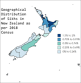 Geographical Distribution of Sikhs in New Zealand as per 2018 Census.png 2,353 × 2,412; 809 KB
.svg)
