Category:2010s maps of China
Jump to navigation
Jump to search
Subcategories
This category has the following 8 subcategories, out of 8 total.
- 2010 maps of China (1 F)
- 2011 maps of China (3 F)
- 2012 maps of China (4 F)
- 2013 maps of China (16 F)
- 2014 maps of China (31 F)
- 2017 maps of China (15 F)
- 2018 maps of China (11 F)
- 2019 maps of China (15 F)
Media in category "2010s maps of China"
The following 13 files are in this category, out of 13 total.
-
 1 km-grid river network density in China.jpeg 1,052 × 749; 82 KB
-
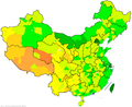
 2010 China HDI.png 900 × 794; 153 KB
-
 Reversed Map of South Asia.gif 2,000 × 2,156; 2.18 MB
-
 Map of Wuhua County.svg 512 × 688; 177 KB
-
 2016 HDI of prefecture level cities in China.png 2,677 × 2,179; 445 KB
-
 2017nian Zhongguo Renlei Fazhan Zhishu.png 900 × 794; 151 KB
-
 2018 China HDI (Global Data Lab).png 900 × 794; 166 KB
-
 2019 China HDI (Global Data Lab).png 900 × 794; 157 KB
-
 2021 China HDI (Global Data Lab).png 900 × 794; 166 KB
-
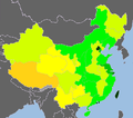
 Administrative divisions of China by HDI (2017).svg 512 × 427; 122 KB
-
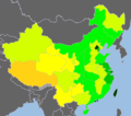
 Administrative divisions of China by HDI (2019).svg 512 × 427; 115 KB
-
 Agricultural plastic greenhouses in China.jpeg 1,072 × 1,423; 270 KB
-


.png)
.png)
.png)
.svg)
.svg)

