Category:2010s maps of Finland
Jump to navigation
Jump to search
Subcategories
This category has the following 3 subcategories, out of 3 total.
- 2018 maps of Finland (1 F)
Media in category "2010s maps of Finland"
The following 5 files are in this category, out of 5 total.
-
 Suomen väestöntiheys vuonna 2016.svg 2,208 × 3,456; 374 KB
-
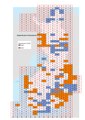 Digitaaliset Maastokartat 50 000 2018-2019.pdf 1,754 × 2,481; 7.54 MB
-
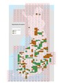 Digitaaliset Peruskartat 2018-2019.pdf 1,754 × 2,481; 7.55 MB
-
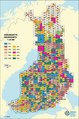
 Maastokartta 50 000 1.1.2018.pdf 1,114 × 1,679; 4.31 MB
-
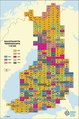
 Peruskartta 25 000 kattavuus 1.1.2018.pdf 1,114 × 1,679; 6.19 MB
