Category:19th-century maps of North Holland
Jump to navigation
Jump to search
Provinces of the Netherlands: Drenthe · Friesland · Gelderland · Groningen · North Brabant · North Holland · Overijssel · South Holland · Zeeland
Subcategories
This category has the following 3 subcategories, out of 3 total.
Media in category "19th-century maps of North Holland"
The following 5 files are in this category, out of 5 total.
-
 Karte von Groningen und Ostfriesland.jpg 10,054 × 5,264; 17.99 MB
-
 Gemeente Amsterdam Kaart in 1872 J. Kuyper.jpg 2,433 × 2,161; 4.74 MB
-
 Bussum, Gemeenteatlas van Nederland.jpg 2,170 × 1,862; 819 KB
-
 Naarden, Gemeenteatlas van Nederland.jpg 2,394 × 2,068; 1.2 MB
-
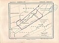 Nibbixwoud, Gemeenteatlas van Nederland.jpg 1,467 × 1,081; 506 KB


