Category:19th-century maps of North Brabant
Jump to navigation
Jump to search
Provinces of the Netherlands: Drenthe · Friesland · Gelderland · Groningen · North Brabant · North Holland · Overijssel · South Holland · Zeeland
Subcategories
This category has only the following subcategory.
Media in category "19th-century maps of North Brabant"
The following 7 files are in this category, out of 7 total.
-
 Kaart Baardwijkse Overlaat.jpg 958 × 721; 187 KB
-
 Nieuwe etappe-kaart van het Koningrijk der Nederlanden (...) - 1848 0.jpg 3,466 × 2,458; 3.41 MB
-
 1850TopMilK51 1rdBoxtel cutBelversven.jpg 394 × 439; 51 KB
-
 1864 Verdelingskaart overlay met kleuren.jpg 661 × 692; 156 KB
-
 S-hertogenbosch gemeente 1866.jpg 1,272 × 1,617; 798 KB
-
 S-hertogenbosch stad 1866.gif 1,800 × 1,549; 424 KB
-
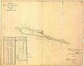 Station Deurne 1866 Hulpkaart 35 DNE00 F.jpg 6,709 × 5,264; 1.11 MB

_-_1848_0.jpg)


