
Category:1990 United States Senate election maps
Media in category "1990 United States Senate election maps"
The following 48 files are in this category, out of 48 total.
-
 1990 MA Senate.png 2,400 × 1,492; 116 KB
-

-

-

-

-

-

-
-
 1990 United States Senate election in Iowa results map by county.svg 810 × 532; 31 KB
-

-

-

-

-

-
 1990 United States Senate Election in Massachusetts by Municipality.svg 810 × 502; 182 KB
-

-
 1990 United States Senate election in Massachusetts results map by municipality.svg 2,100 × 1,300; 1.57 MB
-

-

-

-

-

-

-

-

-

-
 1990 United States Senate election in Oklahoma results map by congressional district.svg 3,784 × 1,923; 531 KB
-

-
 1990 United States Senate election in Oklahoma results map by precinct.svg 3,784 × 1,923; 7.15 MB
-
 1990 United States Senate election in Oklahoma results map by state house district.svg 3,784 × 1,923; 1.43 MB
-
 1990 United States Senate election in Oklahoma results map by state senate district.svg 3,784 × 1,923; 1.11 MB
-

-

-

-

-

-
 1990 United States Senate election in Texas results map by county.svg 810 × 769; 104 KB
-

-

-
-
 1990 United States Senate special election in Hawaii results map by county.svg 1,052 × 614; 2.12 MB
-

-
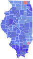
 90ILSenateCounties.PNG 336 × 599; 48 KB
-
 90NJSenateCounties.PNG 316 × 598; 38 KB
-
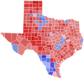
 90TXSenateCounties.PNG 599 × 583; 27 KB
-
 KY-USA 1990 Senate Results by County 2-color.svg 6,770 × 2,916; 132 KB
-
 Massachusetts United States Senate Republican primary results by municipality, 1990.svg 2,100 × 1,300; 1.56 MB
-
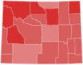
 NC Senate Election County Results 1990.PNG 512 × 384; 31 KB


