Category:1950 United States Senate election maps
Jump to navigation
Jump to search
Media in category "1950 United States Senate election maps"
The following 33 files are in this category, out of 33 total.
-
1926 United States Senate election in Iowa results map by county.svg 285 × 191; 58 KB
-
1950 United States Senate election in Indiana results map by county.svg 744 × 744; 208 KB
-
1950 United States Senate election in Iowa results map by county.svg 810 × 532; 23 KB
-
1950 United States Senate election in Nevada results map by county.svg 800 × 1,182; 9 KB
-
1950 United States Senate election in New York results map by county.svg 744 × 577; 297 KB
-
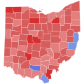
1950 United States Senate election in Ohio results map by county.svg 810 × 810; 39 KB
-
1950 United States Senate election in Utah results map by county.svg 810 × 810; 29 KB
-
1950 United States Senate elections results map.svg 959 × 593; 59 KB
-
Oregon 1950 US Senator.svg 806 × 601; 105 KB
-
Pennsylvania Senate Election Results by County, 1950.png 2,000 × 1,166; 233 KB


