Category:1952 United States Senate election maps
Jump to navigation
Jump to search
Media in category "1952 United States Senate election maps"
The following 31 files are in this category, out of 31 total.
-
 1952 Florida U.S. Senate.png 992 × 955; 311 KB
-

-

-
-

-
 1952 United States Senate Election in Massachusetts by Town.svg 810 × 502; 182 KB
-
 1952 United States Senate election in Massachusetts results map by municipality.svg 2,100 × 1,300; 1.56 MB
-

-

-

-
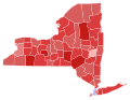 1952 United States Senate election in New York results map by county.svg 744 × 577; 297 KB
-
 1952 United States Senate election in Ohio results map by county.svg 810 × 810; 40 KB
-
 1952 United States Senate Election in Pennsylvania by County.svg 810 × 471; 50 KB
-

-

-

-
 1952 United States Senate Election in West Virginia by County.svg 512 × 486; 12 KB
-

-

-
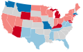 1952 United States Senate elections results map.svg 959 × 593; 58 KB
-

-

-
-

-

-
 Arizona Senate Election Results by County, 1952.png 2,000 × 2,332; 218 KB
-
 Arizona Senatorial Election Results by County, 1952.svg 277 × 323; 15 KB
-
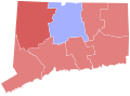
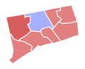 Connecticut Senate Election Results by County, 1952.png 2,000 × 1,628; 112 KB
-
 Massachusetts Senate Election Results by County, 1952.png 2,000 × 1,174; 114 KB
-
 North Dakota Senate Election Results by County, 1952.png 2,000 × 1,194; 187 KB
-
 Pennsylvania Senate Election Results by County, 1952.png 2,000 × 1,166; 233 KB


