Category:1970s maps of Spain
Jump to navigation
Jump to search
Subcategories
This category has the following 6 subcategories, out of 6 total.
- 1974 maps of Spain (2 F)
- 1975 maps of Spain (32 F)
- 1976 maps of Spain (28 F)
- 1978 maps of Spain (29 F)
Media in category "1970s maps of Spain"
The following 3 files are in this category, out of 3 total.
-
 Morocco-Western Sahara map-ar.jpg 3,140 × 2,278; 986 KB
-
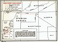 Morocco-Western Sahara map.jpg 1,005 × 729; 171 KB
-
 SpainElectionMapCongress1979.png 1,705 × 2,372; 56 KB


