Category:1970s maps of Denmark
Jump to navigation
Jump to search
Subcategories
This category has the following 3 subcategories, out of 3 total.
- 1974 maps of Denmark (4 F)
.
Media in category "1970s maps of Denmark"
The following 2 files are in this category, out of 2 total.
-
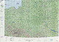 Operational Navigation Chart E-3, 6th edition.jpg 9,254 × 6,671; 20.94 MB
-
 Operational Navigation Chart D-2, 7th edition.jpg 9,254 × 6,633; 17.41 MB

