Category:1948 maps
Appearance
| ← · 1940 · 1941 · 1942 · 1943 · 1944 · 1945 · 1946 · 1947 · 1948 · 1949 · → |
Deutsch: Karten mit Bezug zum Jahr 1948
English: Maps related to the year 1948
Español: Mapas relativos al año 1948
Français : Cartes concernant l’an 1948
Русский: Карты 1948 года
Subcategories
This category has the following 8 subcategories, out of 8 total.
Media in category "1948 maps"
The following 120 files are in this category, out of 120 total.
-
1948 M.T.A. Boston map.jpg 1,261 × 2,100; 765 KB
-
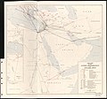
Airlines of the Eastern Mediterranean and adjacent areas - As of October, 1947 LOC 2013593021.tif 8,183 × 7,626; 178.54 MB
-
Amman (FL147449296 0777978).jpg 15,704 × 12,002; 190.55 MB
-
Antarctica - DPLA - 6cb7b65cf90690876aa604f84a481e2c.jpg 2,370 × 3,330; 974 KB
-
Ayahs' Home King Edward's Road, Hackney on 1948 Ordnance Survey map.jpg 3,387 × 2,932; 1.65 MB
-
Croatia-Ethnic-1948.png 1,000 × 990; 465 KB
-
Eretz Israel fue es y sera siempra nuestra (FL42785271 2637221).jpg 8,174 × 8,102; 86.54 MB
-
French Service géographique de l'armée, Cheikh Meskine (FL78830602 3801680).jpg 15,108 × 11,332; 197.56 MB
-
French Service géographique de l'armée, Deir Abu Sa'id (FL78830718 3801988).jpg 15,272 × 11,930; 202.15 MB
-
French Service géographique de l'armée, Deraa (FL78830668 3801978).jpg 15,248 × 11,785; 197.95 MB
-
French Service géographique de l'armée, Hermon. (Rachaiya-Sud) (FL79296624 3802276).jpg 14,020 × 19,339; 300.31 MB
-
French Service géographique de l'armée, Husn (FL78830711 3801991).jpg 15,230 × 11,972; 209.33 MB
-
French Service géographique de l'armée, Irbid (FL78830616 3801969).jpg 15,626 × 11,866; 209.61 MB
-
French Service géographique de l'armée, Kafer El Ma (FL78830519 3801632).jpg 15,194 × 11,344; 197.13 MB
-
French Service géographique de l'armée, Mafraq (FL78830673 3801994).jpg 15,222 × 11,548; 197.06 MB
-
French Service géographique de l'armée, Rosh Pinna (FL79322124 3802964).jpg 15,450 × 12,050; 206.34 MB
-
French Service géographique de l'armée, Tiberias - Fiq (FL79647183 3801562).jpg 15,365 × 11,532; 201.36 MB
-
French Service géographique de l'armée, Um Qeis (FL78830597 3801692).jpg 15,102 × 11,486; 211.13 MB
-
Great Britain army 517 Field Survey Company, Hawara (FL83894910 4072836).jpg 14,998 × 17,890; 238.78 MB
-
Great Britain army 517 Field Survey Company, Kafer Hoûné (FL83895366 4072850).jpg 18,594 × 14,488; 270.01 MB
-
Great Britain army 517 Field Survey Company, Kfaïr ez Zaïte (FL83895375 4072864).jpg 18,126 × 14,358; 252.55 MB
-
Great Britain army 517 Field Survey Company, Samar (FL83894915 4072827).jpg 14,646 × 17,932; 252.73 MB
-
Great Britain army 517 Field Survey Company, Sarafannd (FL83895351 4072868).jpg 18,614 × 14,210; 252.15 MB
-
Great Britain army 517 Field Survey Company, Som (FL83894880 4072823).jpg 14,794 × 18,256; 254.25 MB
-
Great Britain army 517 Field Survey Company, Um Qeis (FL83894868 4072670).jpg 14,875 × 17,940; 266.93 MB
-
IDF Combat Engineering Corps, ישראל-דרום, צילום אויר 01-Mount-Sodom (FL165786323 2634410).jpg 11,898 × 12,846; 168.57 MB
-
IDF Combat Engineering Corps, ישראל-דרום, צילום אויר 02 (FL165786335 2634410).jpg 11,780 × 13,460; 197.91 MB
-
IDF Combat Engineering Corps, ישראל-דרום, צילום אויר 03 (FL165786338 2634410).jpg 11,764 × 13,458; 198.64 MB
-
IDF Combat Engineering Corps, ישראל-דרום, צילום אויר 04 (FL165786340 2634410).jpg 11,930 × 14,214; 189.23 MB
-
IDF Combat Engineering Corps, ישראל-דרום, צילום אויר 05-Arad (FL165786347 2634410).jpg 11,903 × 13,210; 189.49 MB
-
IDF Combat Engineering Corps, ישראל-דרום, צילום אויר 06-Beersheba (FL165786350 2634410).jpg 15,163 × 13,019; 287.39 MB
-
Iraq Railways (FL155322852 2524969).jpg 10,535 × 12,738; 135.29 MB
-
Israel Defense Forces, Palestine (FL25570566 2640328).jpg 14,634 × 24,236; 440.19 MB
-
Israel Defense Forces, חוף אילת (FL147408702 2660316).jpg 14,503 × 11,272; 170.71 MB
-
Israel Defense Forces, ירושלים 01-north--west (FL25570810 2642504).jpg 19,024 × 21,614; 508.04 MB
-
Israel Defense Forces, ירושלים 02-north--east (FL25570813 2642504).jpg 19,231 × 22,032; 525.62 MB
-
Israel Defense Forces, ירושלים 03-south--west (FL25570814 2642504).jpg 18,921 × 21,620; 536.39 MB
-
Israel Defense Forces, ירושלים 04-south--east (FL25570817 2642504).jpg 19,200 × 21,942; 531.68 MB
-
Jerusalem au temps de Jesus 01 (FL199420739 1125363).jpg 6,894 × 4,035; 29.04 MB
-
Jerusalem au temps de Jesus 02 (FL199420740 1125363).jpg 6,975 × 4,079; 32.92 MB
-
Jerusalem au temps de Jesus 03-Map (FL199420741 1125363).jpg 5,008 × 6,731; 42.22 MB
-
Kfar Etzion Educational Center, נתיב הלה (FL42754464 2367909).jpg 7,837 × 5,087; 52.18 MB
-
Koh-i-noor map 1948.jpg 6,000 × 3,136; 5.14 MB
-
Map of Guangzhou 1948 (2).jpg 1,128 × 813; 366 KB
-
Map of Guangzhou 1948.jpg 1,128 × 772; 365 KB
-
Nan Yang Qun Dao xin di tu = Map of East Indies LOC 2014589787.jpg 12,516 × 9,042; 22.11 MB
-
Nan Yang Qun Dao xin di tu = Map of East Indies LOC 2014589787.tif 12,516 × 9,042; 323.78 MB
-
Naoua (FL78830524 3801506).jpg 15,559 × 11,960; 205.91 MB
-
Pictorial Advertising Map of the Americas, 1948.jpg 4,000 × 5,281; 3.51 MB
-
Plan de la ville de Rennes en 1948.jpg 11,382 × 8,755; 9.28 MB
-
States of Maryland and Delaware - base map LOC map52000759.tif 10,400 × 6,368; 189.48 MB
-
Survey of Egypt, Palestine - South 00-index (FL28953974 2698205).jpg 4,176 × 4,425; 3.05 MB
-
Survey of Egypt, Palestine - South 01-7--4 (FL28953979 2698205).jpg 17,915 × 16,162; 353.35 MB
-
Survey of Egypt, Palestine - South 02-7--5 (FL28953983 2698205).jpg 18,293 × 16,422; 349.58 MB
-
Survey of Egypt, Palestine - South 04-9--5 (FL28953992 2698205).jpg 22,457 × 17,846; 475.13 MB
-
Survey of Egypt, Palestine - South 05-9--7-sh-nuran (FL28953998 2698205).jpg 22,179 × 13,077; 354.87 MB
-
Survey of Egypt, Palestine - South 06-11--4 (FL28954002 2698205).jpg 23,494 × 18,085; 510.04 MB
-
Survey of Egypt, Palestine - South 08-11--7-beersheba (FL28954011 2698205).jpg 23,471 × 12,120; 334.02 MB
-
Survey of Egypt, Palestine - South 09-13--4 (FL28954014 2698205).jpg 22,852 × 18,213; 491.1 MB
-
Survey of Egypt, Palestine - South 12-13--8-dhahiriya (FL28954030 2698205).jpg 22,543 × 16,068; 438.47 MB
-
Survey of Egypt, Palestine - South 15-15--7 (FL28954040 2698205).jpg 24,019 × 18,224; 504.58 MB
-
Survey of Egypt, Palestine - South 16-15--8-yatta (FL28954046 2698205).jpg 23,750 × 17,896; 501.84 MB
-
Survey of Israel, א-טירה (FL25571582 3840073).jpg 14,102 × 16,652; 317.86 MB
-
Survey of Israel, אל-עמר (FL147409006 2694741).jpg 16,260 × 11,654; 211.36 MB
-
Survey of Israel, הר לצן (FL147392006 2367442).jpg 16,436 × 11,590; 210.78 MB
-
Survey of Israel, ודי אל ג'יב (FL154452964 2367440).jpg 16,246 × 11,638; 241.93 MB
-
Survey of Israel, עוג'א (FL154452983 2367441).jpg 16,234 × 11,567; 231.98 MB
-
Survey of Israel, קקון (FL25571596 3840086).jpg 14,180 × 16,700; 315.04 MB
-
Survey of Palestine, Beersheba (FL60507295 3809591).jpg 16,492 × 12,590; 234.91 MB
-
Survey of Palestine, Gaza (FL60505109 3809041).jpg 16,708 × 13,010; 234.32 MB
-
Survey of Palestine, Gaza (FL60505114 3809039).jpg 17,106 × 13,190; 241.64 MB
-
Survey of Palestine, Jaffa Tel Aviv (FL54739389 3808570).jpg 16,273 × 12,446; 273.5 MB
-
Survey of Palestine, Jebel Usdum (FL60507500 3809640).jpg 17,096 × 13,194; 256.56 MB
-
Survey of Palestine, Jerusalem (FL60505067 3808989).jpg 14,758 × 13,192; 221.01 MB
-
Survey of Palestine, Metulla (FL54735300 3808344).jpg 16,442 × 12,464; 307.53 MB
-
Survey of Palestine, Nablus (FL60504954 3808669).jpg 14,532 × 13,152; 222.62 MB
-
Survey of Palestine, Nazareth (FL54739363 3808534).jpg 15,130 × 11,306; 250.34 MB
-
Survey of Palestine, Palestine (FL27965281 2651424).jpg 11,504 × 21,670; 342.3 MB
-
Survey of Palestine, Palestine road map (FL27964813 2556464).jpg 12,735 × 15,202; 227.46 MB
-
Survey of Palestine, Ramle (FL60918688 3808962).jpg 17,086 × 13,154; 247.36 MB
-
Survey of Palestine, Safad (FL54735341 3808471).jpg 15,102 × 11,320; 253.13 MB
-
Survey of Palestine, Zikhron Ya'aqov (FL54739332 3808524).jpg 13,262 × 11,963; 206.63 MB
-
Topographic map of the Grand Canyon National Park Arizona . LOC 98687188.jpg 12,009 × 13,640; 10.49 MB
-
Topographic map of the Grand Canyon National Park Arizona . LOC 98687188.tif 12,009 × 13,640; 468.64 MB
-
Topographic map of the Grand Canyon National Park Arizona . LOC 98687189.jpg 12,198 × 13,675; 29.21 MB
-
Topographic map of the Grand Canyon National Park Arizona . LOC 98687189.tif 12,198 × 13,675; 477.24 MB
-
Tour de France 1948.png 600 × 600; 272 KB
-
Union of Soviet Socialist Republics (USSR) - DPLA - 6ca05c5cf1a4decca87a271c2917d6c8.jpg 5,280 × 4,056; 2.37 MB
-
War, McDowell Co., West Virginia LOC 98681102.jpg 6,838 × 8,109; 5.03 MB
-
War, McDowell Co., West Virginia LOC 98681102.tif 6,838 × 8,109; 158.64 MB
-
Wystawa Ziem Odzyskanych Wrocław - mapa.jpg 4,735 × 4,507; 4.89 MB
-
Карта СРСР. Товсте. 1948 (M-35-112).jpg 2,343 × 2,528; 1.78 MB
-
ארץ ישראל (FL39695822 2642726).jpg 8,562 × 11,193; 142.06 MB
-
בית-ג'מל (FL79965983 2698435).jpg 10,924 × 13,097; 153.26 MB
-
המערכה בארץ-ישראל (FL46962007 3430617).jpg 8,256 × 11,753; 133.22 MB
-
חולה 01-hula (FL25569805 2369841).jpg 15,132 × 15,637; 330.22 MB
-
חולה 02-kuneitra (FL25569806 2369841).jpg 17,198 × 15,334; 362.56 MB
-
מפת תל-אביב (FL63911481 2367484).jpg 13,214 × 9,734; 145.88 MB
-
מקורות המים באבן אבייגילה (סיני) (FL147558458 3249827).jpg 2,211 × 2,762; 4.77 MB
-
מקורות המים באל-עריש (FL147558331 3249819).jpg 2,321 × 3,021; 5.68 MB
-
מקורות המים בחסנה (סיני) (FL147558467 3249839).jpg 2,164 × 2,593; 4.37 MB
-
מקורות המים בנכל (סיני) (FL147558435 3249831).jpg 2,165 × 2,976; 5.05 MB
-
מקורות המים עוג'ה אל חפיר (סיני) (FL154452943 3249844).jpg 2,156 × 2,732; 4.49 MB
-
סדור של הספקת מים באיסמליה (FL147558449 3249824).jpg 3,065 × 2,397; 5.94 MB
-
קו מסילת ברזל קנטרה -רפה תחנת רכבת אל עריש 01 (FL147558321 3249789).jpg 4,088 × 2,168; 7.14 MB
-
קו מסילת ברזל קנטרה -רפה תחנת רכבת אל עריש 02-Text-page (FL147558328 3249789).jpg 1,922 × 2,983; 4.5 MB
-
קו מסילת ברזל קנטרה -רפה תחנת רכבת ביר אל אבד (FL147558418 3249793).jpg 4,042 × 2,161; 6.69 MB
-
קו מסילת ברזל קנטרה -רפה תחנת רכבת מזר (FL147558399 3249791).jpg 4,120 × 1,791; 6.15 MB
-
קו מסילת ברזל קנטרה -רפה תחנת רכבת רומנה (FL147558369 3249804).jpg 5,051 × 2,118; 8.29 MB
-
קו מסילת ברזל קנטרה -רפה תחנת רכבת רפה (FL147558375 3249806).jpg 4,072 × 3,005; 9.56 MB
-
תכנית אספקת מים של ברכות אל-עריש (FL147558428 3249823).jpg 3,165 × 2,379; 6.52 MB


