Category:1945 maps
Jump to navigation
Jump to search
English: Maps of events in 1945.
| ← · 1940 · 1941 · 1942 · 1943 · 1944 · 1945 · 1946 · 1947 · 1948 · 1949 · → |
Deutsch: Karten mit Bezug zum Jahr 1945
English: Maps related to the year 1945
Español: Mapas relativos al año 1945
Français : Cartes concernant l’an 1945
Русский: Карты 1945 года
Subcategories
This category has the following 9 subcategories, out of 9 total.
Media in category "1945 maps"
The following 146 files are in this category, out of 146 total.
-
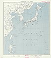
1945 Approaches to Japan (30249095403).jpg 6,336 × 7,289; 4.16 MB
-
1945 Korea Administrative Divisions (30252754834).jpg 7,271 × 3,928; 3.26 MB
-
1945 map of Runwell.png 313 × 342; 211 KB
-
1945 Ordance Survey Map of St Cross, South Elmham.JPG 345 × 335; 51 KB
-
1945 Pacific Japanese Control (30249115263).jpg 4,209 × 3,168; 1.4 MB
-
1945 Taegu (30249115013).jpg 3,152 × 3,543; 1.27 MB
-
1945.02.12. Plan der Zerstörungen Nürnbergs.jpg 4,081 × 3,561; 10.8 MB
-
1945年美军绘制福州地图.jpg 4,447 × 5,678; 6.21 MB
-
20th Century Boundary Map of Palgrave.PNG 205 × 252; 147 KB
-
20th Century map of Brent Eleigh.PNG 337 × 233; 182 KB
-
20th Century Map of Darenth.png 754 × 484; 912 KB
-
20th century map of Deenethorpe.PNG 552 × 430; 470 KB
-
20th Century map of Easton.PNG 552 × 339; 344 KB
-
20th Century map of Kelshall.PNG 412 × 356; 308 KB
-
20th Century map of Leaveland, Kent.png 331 × 288; 212 KB
-
20th Century Ordnance Survey map of Hill, Gloucestershire.JPG 899 × 530; 116 KB
-
20th Century Ordnance Survey Map of Hill, Gloucestershire.JPG 404 × 260; 30 KB
-
A 20th century map of Fakenham Magna.png 661 × 495; 753 KB
-
Army Road Network 7 February 1945 - NARA - 100385007.jpg 8,700 × 6,673; 6.16 MB
-
Battles and campaigns - World War II, European and African theater LOC 2011593048.jpg 11,750 × 9,776; 21.42 MB
-
Battles and campaigns - World War II, European and African theater LOC 2011593048.tif 11,750 × 9,776; 328.64 MB
-
Belstead historic map.png 325 × 240; 147 KB
-
Borneo coastal terrain LOC 2014585446.jpg 3,888 × 4,482; 2.34 MB
-
Borneo coastal terrain LOC 2014585446.tif 3,888 × 4,482; 49.86 MB
-
Borneo soil trafficability LOC 2014585447.jpg 3,328 × 3,926; 1.79 MB
-
Brandeston.png 525 × 388; 527 KB
-
Burmarsh, Kent - Map Dating 1945.png 432 × 320; 247 KB
-
Břevnov 1945.jpg 1,457 × 777; 206 KB
-
Cairo West - Lydda.Strip no. 10 (FL36012312 3898109).jpg 19,461 × 7,765; 207.8 MB
-
Canton Map 1945.png 6,788 × 5,305; 69.82 MB
-
Deutsche Militärkarte Schweiz-Norditalien.png 5,000 × 5,000; 52.73 MB
-
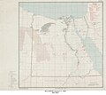
Egypt Principal Mineral Ore Deposits (1945) - DPLA - 755202cdd7140a1cd56d308117712f18.jpg 6,301 × 5,632; 3.85 MB
-
French Service géographique de l'armée, Abou Kémâl (FL155910495 4084049).jpg 14,434 × 17,965; 253.27 MB
-
French Service géographique de l'armée, Afula (FL79322221 3802962).jpg 18,372 × 13,553; 298.93 MB
-
French Service géographique de l'armée, Boûara (FL155909815 4084043).jpg 14,356 × 16,788; 277.2 MB
-
French Service géographique de l'armée, Carmel East (FL79322205 3802819).jpg 16,530 × 12,914; 255.91 MB
-
French Service géographique de l'armée, Deïr ez Zor (FL155910109 4084044).jpg 14,484 × 18,021; 249.29 MB
-
French Service géographique de l'armée, Jenin (FL79320137 3802783).jpg 18,360 × 13,546; 281.14 MB
-
French Service géographique de l'armée, Mount Tabor (FL79322135 3802826).jpg 16,578 × 12,984; 243.62 MB
-
French Service géographique de l'armée, Qamichlîyé -Sinjar (FL155909781 4084138).jpg 13,674 × 19,946; 287.96 MB
-
French Service géographique de l'armée, ÂNA (FL155908986 4084060).jpg 14,110 × 17,973; 252.36 MB
-
Geobotanical map of soils Palestine (FL27965576 2654966).jpg 14,421 × 24,306; 436.85 MB
-
Great Britain army 512 Field Survey Company, Bethlehem and Beit Jala (FL31740130 2714135).jpg 13,228 × 17,480; 366.04 MB
-
Great Britain army 517 Field Survey Company, Al Majdal (FL10519987 2714129).jpg 6,685 × 6,739; 71.01 MB
-
Great Britain army 517 Field Survey Company, Beisan (FL10519978 2714101).jpg 6,873 × 8,352; 94.97 MB
-
Great Britain army 517 Field Survey Company, Ein et Turaba (FL27977842 3807308).jpg 14,805 × 11,772; 214.7 MB
-
Great Britain army 517 Field Survey Company, Guide map of Haifa (FL28026045 3662640).jpg 10,866 × 11,575; 146.83 MB
-
Great Britain army 517 Field Survey Company, Hadar (FL10521059 2714143).jpg 6,410 × 7,231; 71.53 MB
-
Great Britain army 517 Field Survey Company, Hadera (FL10521638 2714150).jpg 6,260 × 7,275; 76.76 MB
-
Great Britain army 517 Field Survey Company, Hebron (FL10521048 2714138).jpg 6,633 × 8,071; 93.05 MB
-
Great Britain army 517 Field Survey Company, Jenin (FL10519984 2714127).jpg 6,756 × 7,251; 78.71 MB
-
Great Britain army 517 Field Survey Company, Nablus (FL10521045 2714137).jpg 6,800 × 7,646; 86.98 MB
-
Great Britain army 517 Field Survey Company, Natanya (FL10519996 2714134).jpg 6,688 × 6,760; 82.24 MB
-
Great Britain army 517 Field Survey Company, Ramalla and Al Bira (FL10521042 2714136).jpg 6,804 × 8,179; 93.61 MB
-
Great Britain army 517 Field Survey Company, Tiberias (FL10521077 2714145).jpg 6,720 × 6,745; 72.24 MB
-
Great Britain army 517 Field Survey Company, Tulkarm (FL10521635 2714149).jpg 6,794 × 8,030; 95.33 MB
-
Great Britain Army, Kh. Umm El Baqar (FL28026293 3804960).jpg 11,840 × 13,263; 161.96 MB
-
Great Britain Army, Lachish (FL28026308 3804990).jpg 11,533 × 13,998; 200.97 MB
-
Great Britain Army, Qabalan (FL27977813 3807093).jpg 11,639 × 14,561; 204.99 MB
-
Great Britain Army, Salfit (FL27975737 3805142).jpg 11,586 × 14,282; 180.72 MB
-
Great Britain Army, Tell el Muleiha (FL28026303 3804969).jpg 11,474 × 14,120; 200.91 MB
-
Great Britain Army, Tell es Safi (FL28026313 3805023).jpg 11,814 × 14,702; 196.35 MB
-
Great Britain Army, Zikrin (FL28026318 3805004).jpg 12,134 × 14,638; 187.67 MB
-
GREAT HENNY MAP.PNG 406 × 249; 228 KB
-
Hannington Location on a Ordnance Survey map.png 416 × 241; 185 KB
-
Henstead Historical map.png 349 × 145; 123 KB
-
Hessett.png 250 × 237; 141 KB
-
Historic map of Radwinter.png 499 × 325; 327 KB
-
Historic Map of Winwick, Cambridgeshire.JPG 488 × 399; 42 KB
-
Historical map image of Poughill.png 502 × 305; 345 KB
-
Historical map insert.PNG 274 × 237; 142 KB
-
Historical Map of Newborough, 1945.png 746 × 492; 687 KB
-
Historical map of Parham.png 369 × 295; 281 KB
-
Historical map of St pinnock.png 693 × 544; 961 KB
-
Hunton.png 493 × 524; 642 KB
-
Indochina Banner.jpg 6,818 × 975; 592 KB
-
Indochine-297-neuf-e1586846505597.jpg 368 × 250; 47 KB
-
Japan and Korea 1945 сut.png 2,355 × 953; 4 MB
-
Kita Kyūshū kōshahōtai haibi yōzu. LOC 2013586001.jpg 12,526 × 9,310; 29.71 MB
-
Kümmerly und Frey, Das Heilige land 01-map (FL27965554 2654889).jpg 9,379 × 13,797; 197.9 MB
-
Kümmerly und Frey, Das Heilige land 02-verso (FL27965556 2654889).jpg 13,473 × 9,099; 173.4 MB
-
Latin America pictorial, 1945.jpg 6,566 × 5,712; 5.8 MB
-
Lydda - H3 - Habbaniya (FL36012373 3898103).jpg 27,411 × 7,951; 339.44 MB
-
Map image of Great Livermere.PNG 1,082 × 656; 1.65 MB
-
Map of Knodishall from the 20th Century.png 446 × 579; 646 KB
-
Map of Nash in the 1940s.png 1,073 × 731; 1.63 MB
-
Marholm in 1945.png 257 × 251; 135 KB
-
Minneapolis MN Map 1945.jpg 776 × 1,168; 1.19 MB
-
North Lopham historical map.PNG 584 × 360; 448 KB
-
O.S.S. Theaters of Operation - DPLA - 250c488c52e01121915458ef83e1b2b5.jpg 12,512 × 9,000; 5.13 MB
-
Okinawa airfields 1945.jpg 785 × 600; 104 KB
-
Operations Chart - Action Report Iheya-Aguni Operation.jpg 7,266 × 6,338; 6.33 MB
-
Ordance Survey Map of East Langton.PNG 388 × 301; 272 KB
-
Ordnance Survey Map displaying the area of Hartley.PNG 364 × 334; 306 KB
-
Ordnance Survey Map of Roudham and Larling 20th century.JPG 680 × 318; 73 KB
-
Ordnance Survey Map of Roxwell 20th Century.PNG 208 × 164; 72 KB
-
Ordnance Survey Map of Ullesthorpe and the surrounding area.PNG 478 × 312; 292 KB
-
Ordnance survey map of Ullesthorpe.PNG 238 × 137; 69 KB
-
Ordnance Survey map of Ullesthorpe.PNG 508 × 338; 337 KB
-
Ordnance Survey Map of Ullesthorpe.PNG 484 × 306; 293 KB
-
Ostravská operace.gif 1,000 × 1,266; 100 KB
-
Palaestina tempore Jesu Christi (FL36566149 3913278).jpg 10,250 × 14,737; 240.96 MB
-
Palestine (FL36381661 2688125).jpg 7,752 × 11,820; 125.19 MB
-
Palestine (FL45611954 3951927).jpg 1,743 × 2,410; 2 MB
-
Palestine 01-Palestine (FL196625077 1125297).jpg 1,743 × 2,410; 4.19 MB
-
Palestine 02 (FL196625078 1125297).jpg 2,420 × 1,729; 3.71 MB
-
Palestine Arab Refugee Office map, showing Jewish-owned Land 31 March 1945.jpg 5,784 × 8,344; 11.53 MB
-
Political divisions of Malaya Selangor - btv1b531969285.jpg 7,840 × 9,412; 4.93 MB
-
Rockbeare, Historic Map of the 20th Century.jpg 918 × 464; 116 KB
-
Rockford map extract.png 268 × 323; 209 KB
-
Situation Map 1 November 1944 Düren - Aachen - Luxembourg - NARA - 100384789.jpg 6,624 × 8,738; 6.71 MB
-
Snippet of twinstead.png 569 × 334; 438 KB
-
Stanfield map.PNG 539 × 321; 368 KB
-
Stapleford Map.PNG 345 × 503; 418 KB
-
Survey of Palestine, Beit Jibrin (FL28026330 3805047).jpg 11,796 × 13,379; 213.12 MB
-
Survey of Palestine, Central Judæa (FL32697819 2367934).jpg 13,923 × 14,957; 311.87 MB
-
Survey of Palestine, Dead Sea (FL60505868 3809558).jpg 15,736 × 12,498; 219.13 MB
-
Survey of Palestine, Ed Dawayima (FL28026335 3805042).jpg 11,727 × 13,596; 210.03 MB
-
Survey of Palestine, Gaza (FL60505093 3809019).jpg 17,760 × 13,550; 260.68 MB
-
Survey of Palestine, Gaza (FL60918674 3809024).jpg 16,170 × 13,216; 229.71 MB
-
Survey of Palestine, Hebron (FL60505887 3809544).jpg 17,704 × 13,496; 270.49 MB
-
Survey of Palestine, Hebron west (FL27975720 3805121).jpg 11,870 × 14,297; 184.42 MB
-
Survey of Palestine, Jaffa - Tel Aviv (FL17237341 2369391).jpg 3,640 × 5,432; 30.41 MB
-
Survey of Palestine, Jaffa Tel Aviv (FL54739380 3808561).jpg 14,319 × 11,871; 241.1 MB
-
Survey of Palestine, Jebel Usdum (FL60507491 3809638).jpg 16,512 × 13,480; 245.69 MB
-
Survey of Palestine, Jerusalem 01-north-west (FL27974429 2762665).jpg 10,748 × 15,472; 222.06 MB
-
Survey of Palestine, Jerusalem 02-north-east (FL27974430 2762665).jpg 14,764 × 17,126; 358.48 MB
-
Survey of Palestine, Jerusalem 03-south-west (FL27974431 2762665).jpg 11,220 × 14,835; 235.16 MB
-
Survey of Palestine, Jerusalem 04-south-east (FL27974432 2762665).jpg 14,291 × 13,819; 266.27 MB
-
Survey of Palestine, Jerusalem. The Old City 01-map (FL32681151 2366991).jpg 14,557 × 17,885; 362.6 MB
-
Survey of Palestine, Jerusalem. The Old City 02-cover (FL32681153 2366991).jpg 2,775 × 5,071; 13.99 MB
-
Survey of Palestine, Ramle (FL60505017 3808956).jpg 16,236 × 13,310; 247.99 MB
-
Survey of Palestine, Yibna (FL60504961 3808707).jpg 15,786 × 12,886; 208.95 MB
-
Terschelling - DPLA - 57e727c687eec5ee01b9f5592bf22a82.JPG 17,984 × 13,369; 11.54 MB
-
Triumphal Map of the 36th Infantry Division Campaigns in France, Germany, Austria.jpg 16,066 × 9,675; 29.83 MB
-
Union of Socialist Republics - DPLA - d04955c04489c018d432fb388e9545a1 (page 1).jpg 15,216 × 11,155; 21.19 MB
-
Union of Socialist Republics - DPLA - d04955c04489c018d432fb388e9545a1 (page 2).jpg 14,979 × 11,159; 21.47 MB
-
Карта Кавказского государственного заповедника, 1945 г.jpg 5,814 × 4,613; 5.42 MB
-
ארץ ישראל בימי השופטים (FL45602924 3938319).jpg 1,884 × 1,359; 1.45 MB
-
ירושלים בימי חזקיהו. (FL45602874 3938322).jpg 949 × 1,387; 612 KB
-
ירושלים בימי נחמיה. תקון החומה (FL45602915 3938327).jpg 927 × 1,387; 683 KB
-
كشور شاهنشاهي ايران وهسايگان آن (FL155948176 3443968).jpg 19,583 × 13,722; 308.32 MB
-
中華民國三十四年福州市區詳圖.jpg 3,629 × 4,685; 8.32 MB


