Category:1950 maps
Jump to navigation
Jump to search
| ← · 1950 · 1951 · 1952 · 1953 · 1954 · 1955 · 1956 · 1957 · 1958 · 1959 · → |
Deutsch: Karten mit Bezug zum Jahr 1950
English: Maps related to the year 1950
Español: Mapas relativos al año 1950
Français : Cartes concernant l’an 1950
Русский: Карты 1950 года
Subcategories
This category has the following 11 subcategories, out of 11 total.
Media in category "1950 maps"
The following 46 files are in this category, out of 46 total.
-
 0529121005168j0jg5b4jylwj5snftmefj.jpg 418 × 389; 22 KB
-
 052912100531u4znhzkqf4qzc.jpg 561 × 730; 71 KB
-
 1950 M.T.A. Boston map.jpg 5,398 × 8,928; 87.06 MB
-
 Akershus amt nr 105- Instrument Approach Chart ICAO, 1950.jpg 2,474 × 3,208; 1.2 MB
-
 Battle for Korea, 1950.jpg 639 × 1,274; 315 KB
-
 Messtischblatt 4509 Bochum 193x.jpg 10,336 × 7,960; 15.75 MB
-

-
 Czechoslovakia - DPLA - 5d463bc6cbfd3391b2ae3d58fb6a0797.jpg 4,664 × 3,946; 1.82 MB
-
 Czechoslovakia - DPLA - d2c3a5afef121ad359036a3462ff15a9.jpg 4,648 × 3,952; 1.83 MB
-

-
 Great Smoky Mountains National Park and vicinity. LOC 99446153.jpg 10,664 × 8,510; 17.04 MB
-
 HolyokeWaterPowerMap circa 1950.jpg 5,844 × 4,400; 20.69 MB
-
 Island and anchorages in the Southern Ocean - Maquarie Island - 1950 nautical chart.jpg 5,000 × 7,328; 17.12 MB
-
 Israel (FL147408385 3369819).jpg 2,986 × 3,944; 11.65 MB
-
 Korea, 1950.jpg 639 × 1,294; 308 KB
-
 Mammoth Cave National Park, Kentucky LOC 79691611.jpg 12,811 × 7,167; 13.82 MB
-
 Mammoth Cave National Park, Kentucky LOC 79691611.tif 12,811 × 7,167; 262.69 MB
-
 Maryland and Delaware shaded relief. LOC 76695238.jpg 10,409 × 6,779; 8.4 MB
-
 Maryland and Delaware shaded relief. LOC 76695238.tif 10,409 × 6,779; 201.88 MB
-
 Maryland State Highway Map - 1950.pdf 6,085 × 2,814, 2 pages; 13.09 MB
-
 Next objectives for the Soviets, 1950.jpg 973 × 549; 219 KB
-
 North Korean Supply Pattern - DPLA - 2792564d66ba9a1b9bfb73cbf4b3ece3.jpg 7,931 × 5,755; 4.99 MB
-
 Number of reported smallpox cases, OWID.svg 850 × 600; 140 KB
-

-
 States of Maryland and Delaware - base map with highways and shaded relief LOC map52000758.jpg 10,232 × 6,600; 7.79 MB
-
 States of Maryland and Delaware - base map with highways and shaded relief LOC map52000758.tif 10,232 × 6,600; 193.21 MB
-
 Survey of Israel, Israel (FL37465294 2366881).jpg 11,392 × 14,779; 206.21 MB
-
 Survey of Israel, Israel (FL44250466 2367744).jpg 9,844 × 23,226; 348.5 MB
-
 Survey of Israel, Israel (FL44254733 2367798).jpg 9,974 × 23,046; 348.46 MB
-
 Survey of Israel, Israel guide map 01 (FL155340665 3585533).jpg 10,259 × 14,796; 170.46 MB
-
 Survey of Israel, Israel guide map 02 (FL155340666 3585533).jpg 14,764 × 10,268; 166.03 MB
-
 Survey of Israel, Motor map (FL44254723 2367912).jpg 11,100 × 15,258; 236.07 MB
-
 Survey of Israel, Tel-Aviv (FL25553465 2367009).jpg 18,776 × 20,508; 518.86 MB
-
 Survey of Israel, Tourist motor map (FL155729540 3793747).jpg 10,004 × 14,446; 176.7 MB
-
 Survey of Israel, ג'מסין אל ערבי, ג'רישה. נפת יפו (FL62986114 4094803).jpg 12,602 × 13,500; 171.62 MB
-
 Survey of Israel, ישראל (FL147391529 2367198).jpg 11,791 × 14,535; 159.54 MB
-
 Survey of Israel, ישראל (FL147392241 2367944).jpg 10,218 × 14,818; 165.53 MB
-
 Survey of Israel, ישראל (FL147555966 2369343).jpg 3,217 × 5,663; 19.35 MB
-
 Survey of Israel, ישראל. גליון דרומי (FL147558654 3938334).jpg 3,470 × 5,445; 17.03 MB
-
 Survey of Israel, סקיה, תל ליטוינסקי. נפת יפו (FL62985922 4094774).jpg 14,960 × 17,760; 261.85 MB
-
 Surveys Departmen of Israel, Es Salihiya (FL50290437 4052606).jpg 19,299 × 15,546; 389.4 MB
-
 Surveys Departmen of Israel, Metulla (FL50290432 4052604).jpg 18,690 × 15,739; 378.88 MB
-
 View of Judge and Clerk Islands from 1950 nautical chart (cropped).jpg 1,841 × 733; 187 KB
-
 Washington, D.C., as seen by new Air Force horizon to horizon camera. LOC 87693353.jpg 2,783 × 6,014; 2.06 MB
-
 Washington, D.C., as seen by new Air Force horizon to horizon camera. LOC 87693353.tif 2,783 × 6,014; 47.89 MB
-
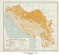 Yugoslavia Agricultural Land Use - DPLA - 4a3f31778d1ef95afe91d843e3e07211.jpg 5,351 × 5,002; 4.05 MB


.svg)


,_Germany_administrative_boundaries_(FL167468818_2569413).jpg)


.jpg)


.jpg)
.jpg)
.jpg)
.jpg)
.jpg)
.jpg)
.jpg)
.jpg)
.jpg)
.jpg)
.jpg)
.jpg)
.jpg)
.jpg)
.jpg)
.jpg)


.jpg)