Category:1930s maps of Belarus
Jump to navigation
Jump to search
Media in category "1930s maps of Belarus"
The following 22 files are in this category, out of 22 total.
-
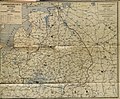
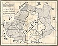 Biełaruś. Беларусь (1930).jpg 2,406 × 1,899; 3.41 MB
-
 Biełaruś. Беларусь (1931).jpg 727 × 1,027; 115 KB
-
 Alieksandrova (1934 map).png 923 × 573; 1.21 MB
-
 Biełaruś. Беларусь (1934).jpg 1,975 × 1,494; 605 KB
-
 Biełaruś. Беларусь (1935).jpg 1,258 × 1,647; 270 KB
-
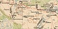
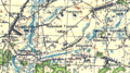
 Аравічы на карце генштаба РККА Беларусі і Літвы. 1935 г.jpg 624 × 321; 55 KB
-
 Вялікі Бор на карце генштаба РККА Беларусі і Літвы. 1935 г.jpg 624 × 289; 40 KB
-
 Гарошкаў на карце генштаба РККА Беларусі і Літвы. 1935 г.jpg 624 × 300; 49 KB
-
 Грушнае на мапе РККА Беларусі і Літвы 1935 г.jpg 624 × 275; 81 KB
-
 Карчовае на карце генштаба РККА. 1935 г.jpg 624 × 349; 52 KB
-
 Мархлеўск на карце Генштаба РККА Беларусі і Літвы. 1935 г.jpg 624 × 370; 52 KB
-

-

-
 Настольле на мапе гэнштабу РККА Беларусі і Літвы. 1935 г.jpg 623 × 282; 46 KB
-
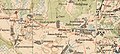
 Нова-Аляксееўка (Цюцькі) на мапе РККА Беларусі і Літвы. 1935 г.jpg 1,600 × 707; 561 KB
-
 Пасёлак Дэлістаў на карце генштаба РККА Беларусі і Літвы 1935 г.png 624 × 290; 446 KB
-

-
 Стралічаў на карце генштаба РККК Беларусі і Літвы. 1935 г.jpg 624 × 359; 47 KB
-
 Храпкаў на карце генштаба РККА Беларусі і Літвы. 1935 г.jpg 624 × 314; 45 KB
-
-
 Biełaruś. Беларусь (1939) (2).jpg 2,048 × 1,691; 764 KB
-
 Biełaruś. Беларусь (1939).jpg 960 × 743; 187 KB
.jpg)
.jpg)
.png)
.jpg)
.jpg)


_%D0%BD%D0%B0_%D0%BC%D0%B0%D0%BF%D0%B5_%D0%A0%D0%9A%D0%9A%D0%90_%D0%91%D0%B5%D0%BB%D0%B0%D1%80%D1%83%D1%81%D1%96_%D1%96_%D0%9B%D1%96%D1%82%D0%B2%D1%8B._1935_%D0%B3.jpg)


_(2).jpg)
.jpg)