Category:1914 maps of Illinois
Jump to navigation
Jump to search
States of the United States: California · Hawaii · Idaho · Illinois · Iowa · Kentucky · Louisiana · Massachusetts · Michigan · Minnesota · Missouri · Montana · Nevada · New York · North Dakota · Oklahoma · Pennsylvania · South Dakota · Texas · Washington · West Virginia · Wisconsin · Wyoming – Washington, D.C.
| ← 1910 1911 1912 1913 1914 1915 1916 1917 1918 1919 → |
Subcategories
This category has the following 20 subcategories, out of 20 total.
C
S
Media in category "1914 maps of Illinois"
The following 38 files are in this category, out of 38 total.
-
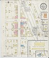 Sanborn Fire Insurance Map from Ashton, Lee County, Illinois. LOC sanborn01712 001.jpg 6,450 × 7,650; 4.01 MB
-
 Sanborn Fire Insurance Map from Ashton, Lee County, Illinois. LOC sanborn01712 001.tif 6,450 × 7,650; 141.17 MB
-
-
 Sanborn Fire Insurance Map from Buckley, Iroquois County, Illinois. LOC sanborn01752 003-1.tif 6,450 × 7,650; 141.17 MB
-

-
 Sanborn Fire Insurance Map from Buckley, Iroquois County, Illinois. LOC sanborn01752 003-2.tif 6,450 × 7,650; 141.17 MB
-

-
 Sanborn Fire Insurance Map from Oblong, Crawford County, Illinois. LOC sanborn02061 001-1.tif 6,450 × 7,650; 141.17 MB
-

-
 Sanborn Fire Insurance Map from Oblong, Crawford County, Illinois. LOC sanborn02061 001-2.tif 6,450 × 7,650; 141.17 MB
-

-
 Sanborn Fire Insurance Map from Broadlands, Champaign County, Illinois. LOC sanborn01749 001.tif 6,450 × 7,650; 141.17 MB
-
 Sanborn Fire Insurance Map from Carlock, McLean County, Illinois. LOC sanborn01766 001.jpg 6,450 × 7,650; 4.03 MB
-
 Sanborn Fire Insurance Map from Carlock, McLean County, Illinois. LOC sanborn01766 001.tif 6,450 × 7,650; 141.17 MB
-

-
 Sanborn Fire Insurance Map from Deer Creek, Tazewell County, Illinois. LOC sanborn01821 001.tif 6,450 × 7,650; 141.17 MB
-
 Sanborn Fire Insurance Map from Dongola, Union County, Illinois. LOC sanborn01828 001.jpg 6,450 × 7,650; 4.06 MB
-
 Sanborn Fire Insurance Map from Dongola, Union County, Illinois. LOC sanborn01828 001.tif 6,450 × 7,650; 141.17 MB
-

-
 Sanborn Fire Insurance Map from Hopedale, Tazewell County, Illinois. LOC sanborn01931 001.tif 6,450 × 7,650; 141.17 MB
-

-
 Sanborn Fire Insurance Map from Industry, Mcdonough County, Illinois. LOC sanborn01936 001.tif 6,450 × 7,650; 141.17 MB
-
 Sanborn Fire Insurance Map from Lostant, La Salle County, Illinois. LOC sanborn01982 001.jpg 6,450 × 7,650; 3.81 MB
-
 Sanborn Fire Insurance Map from Lostant, La Salle County, Illinois. LOC sanborn01982 001.tif 6,450 × 7,650; 141.17 MB
-
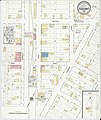
 Sanborn Fire Insurance Map from Manhattan, Will County, Illinois. LOC sanborn01991 001.jpg 6,450 × 7,650; 3.99 MB
-
 Sanborn Fire Insurance Map from Manhattan, Will County, Illinois. LOC sanborn01991 001.tif 6,450 × 7,650; 141.17 MB
-
 Sanborn Fire Insurance Map from Mclean, McLean County, Illinois. LOC sanborn01987 002.jpg 6,450 × 7,650; 4.07 MB
-
 Sanborn Fire Insurance Map from Mclean, McLean County, Illinois. LOC sanborn01987 002.tif 6,450 × 7,650; 141.17 MB
-
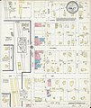
 Sanborn Fire Insurance Map from Middletown, Logan County, Illinois. LOC sanborn02010 001.jpg 6,450 × 7,650; 4.08 MB
-
 Sanborn Fire Insurance Map from Middletown, Logan County, Illinois. LOC sanborn02010 001.tif 6,450 × 7,650; 141.17 MB
-

-
 Sanborn Fire Insurance Map from New Berlin, Sangamon County, Illinois. LOC sanborn02045 001.tif 6,450 × 7,650; 141.17 MB
-
 Sanborn Fire Insurance Map from Ogden, Champaign County, Illinois. LOC sanborn02065 001.jpg 6,450 × 7,650; 4.27 MB
-
 Sanborn Fire Insurance Map from Ogden, Champaign County, Illinois. LOC sanborn02065 001.tif 6,450 × 7,650; 141.17 MB
-
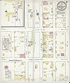
 Sanborn Fire Insurance Map from Sibley, Ford County, Illinois. LOC sanborn02155 003.jpg 6,450 × 7,650; 3.93 MB
-
 Sanborn Fire Insurance Map from Sibley, Ford County, Illinois. LOC sanborn02155 003.tif 6,450 × 7,650; 141.17 MB
-
-
 Sanborn Fire Insurance Map from Vergennes, Jackson County, Illinois. LOC sanborn02198 002.tif 6,450 × 7,650; 141.17 MB


