Category:1911 maps of Illinois
Jump to navigation
Jump to search
States of the United States: California · Connecticut · Delaware · Idaho · Illinois · Iowa · Kansas · Louisiana · Massachusetts · Michigan · Minnesota · Missouri · New York · Ohio · Oklahoma · Pennsylvania · South Carolina · South Dakota · Texas · Utah · Virginia · West Virginia · Wisconsin · Wyoming – Washington, D.C.
| ← 1910 1911 1912 1913 1914 1915 1916 1917 1918 1919 → |
Subcategories
This category has the following 5 subcategories, out of 5 total.
S
Media in category "1911 maps of Illinois"
The following 15 files are in this category, out of 15 total.
-

-

-
 Sanborn Fire Insurance Map from Fisher, Champaign County, Illinois. LOC sanborn01867 003-1.tif 6,450 × 7,650; 141.17 MB
-

-
 Sanborn Fire Insurance Map from Fisher, Champaign County, Illinois. LOC sanborn01867 003-2.tif 6,450 × 7,650; 141.17 MB
-

-
 Sanborn Fire Insurance Map from Mansfield, Piatt County, Illinois. LOC sanborn01993 003-1.tif 6,450 × 7,650; 141.17 MB
-

-
 Sanborn Fire Insurance Map from Mansfield, Piatt County, Illinois. LOC sanborn01993 003-2.tif 6,450 × 7,650; 141.17 MB
-
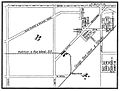
 Midlothian and Blue Island Railroad Sanford Club Grounds.jpg 1,434 × 926; 249 KB
-
 Midlothian and Blue Island Railroad Sanford.jpg 2,596 × 912; 291 KB
-
 Midlothian and Blue Island Railroad Sanforda.jpg 1,216 × 924; 253 KB
-

-

-
 United Breweries 1911.jpg 1,211 × 903; 229 KB


