Category:1914 maps of Massachusetts
Jump to navigation
Jump to search
States of the United States: California · Hawaii · Idaho · Illinois · Iowa · Kentucky · Louisiana · Massachusetts · Michigan · Minnesota · Missouri · Montana · Nevada · New York · North Dakota · Oklahoma · Pennsylvania · South Dakota · Texas · Washington · West Virginia · Wisconsin · Wyoming – Washington, D.C.
| ← 1910 1911 1912 1913 1914 1915 1916 1917 → |
Media in category "1914 maps of Massachusetts"
The following 9 files are in this category, out of 9 total.
-

-
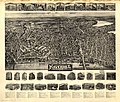 Aero view of Haverhill, Massachusetts 1914. LOC gm72003284.jpg 9,776 × 8,320; 18.1 MB
-
 Aero view of Haverhill, Massachusetts 1914. LOC gm72003284.tif 9,776 × 8,320; 232.71 MB
-
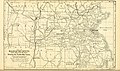
 Annual report of the Massachusetts State Forest Commission (1914) (14775418431).jpg 3,154 × 1,856; 1.23 MB
-

-
 Map of Boston Massachusetts (1914) NSRW.jpg 725 × 699; 215 KB
-

-
-
 Old Boston taverns and tavern clubs (1917) (14577007188).jpg 3,232 × 2,260; 693 KB


_(14775418431).jpg)
.jpg)
_NSRW.jpg)
.jpg)
.jpg)
_(14577007188).jpg)